Property Record
150 Jeffords, Dexter, MI 48130
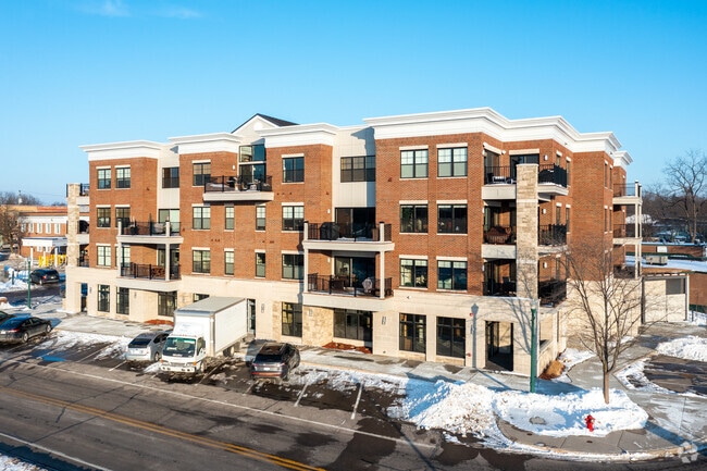
This Property Is For Sale
NEARBY LISTINGS FOR SALE OR LEASE
-
-
View all Dexter listings for sale on LoopNet.com
Property Detail
150 Jeffords
08-06-212-021
150 Jeffords Condominium
Condominium
NEW CONDOMINIUM M.D. L5263 P659 UNIT 21, 150 JEFFORDS CONDOMINIUM SPLIT ON 08/09/2018 FROM 08-08-06-210-059;
X
Washtenaw
26161C0209E
Michigan
2025
North Washtenaw County
2025
Detroit
454002
Ann Arbor, MI
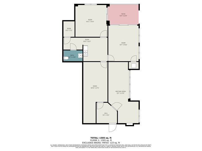
1,629 SF
DEMOGRAPHICS near 150 Jeffords
1 mile
3 mile
5 mile
2024 Total Population
3,859
9,777
24,591
2029 Population
3,857
9,700
24,322
Pop Growth 2024-2029
(0.05%)
(0.79%)
(1.09%)
Average Age
42
42
42
2024 Total Households
1,519
3,691
9,221
HH Growth 2024-2029
(0.20%)
(0.92%)
(1.17%)
Median Household Inc
$92,849
$111,687
$118,186
Avg Household Size
2.50
2.60
2.60
2024 Avg HH Vehicles
2.00
2.00
2.00
Median Home Value
$381,792
$396,127
$417,057
Median Year Built
1992
1992
1992
Nearby Places
Map Layers
Map Styles
 Street
 Aerial
Transit
 Traffic
 Biking
Places
Listings with unknown addresses are not visible on the map
- Restaurants
- Banks
- Shops
- Fitness
- Groceries
PUBLIC TRANSPORTATION
COMMUTER RAIL
Drive
Walk
Distance
18 min
9.1 mi
AIRPORT
Detroit Metro Wayne County
Drive
Walk
Distance
Detroit Metro Wayne County
48 min
37.5 mi
Freight Ports
Drive
Walk
Distance
88 min
68.9 mi
Nearby Properties
Address
Land Use
TOTAL SIZE
Lot Size
Zoning
Address
Land Use
TOTAL SIZE
Lot Size
Zoning
460,082 SF
42.24 AC
RD
Address
Land Use
TOTAL SIZE
Lot Size
Zoning
27,416 SF
14.78 AC
VR
Address
Land Use
TOTAL SIZE
Lot Size
Zoning
443,838 SF
47.01 AC
I-1
Address
Land Use
TOTAL SIZE
Lot Size
Zoning
24.06 AC
R-3
Address
Land Use
TOTAL SIZE
Lot Size
Zoning
2,913 SF
25.61 AC
C-3
Address
Land Use
TOTAL SIZE
Lot Size
Zoning
61,760 SF
18.06 AC
II
Address
Land Use
TOTAL SIZE
Lot Size
Zoning
2,525 SF
28.42 AC
IRP
Address
Land Use
TOTAL SIZE
Lot Size
Zoning
52,990 SF
20.49 AC
I-1
Address
Land Use
TOTAL SIZE
Lot Size
Zoning
Address
Land Use
TOTAL SIZE
Lot Size
Zoning
13.36 AC
R-3
Address
Land Use
TOTAL SIZE
Lot Size
Zoning
Address
Land Use
TOTAL SIZE
Lot Size
Zoning
49,707 SF
4.50 AC
C-1
Address
Land Use
TOTAL SIZE
Lot Size
Zoning
31,970 SF
8.34 AC
C-1
Address
Land Use
TOTAL SIZE
Lot Size
Zoning
88,590 SF
9.80 AC
RD
Address
Land Use
TOTAL SIZE
Lot Size
Zoning
11.82 AC
SEVERAL
Address
Land Use
TOTAL SIZE
Lot Size
Zoning
150,000 SF
18.24 AC
I-1
Address
Land Use
TOTAL SIZE
Lot Size
Zoning
68,000 SF
11.61 AC
RD
Address
Land Use
TOTAL SIZE
Lot Size
Zoning
70,200 SF
8.06 AC
IRP
Address
Land Use
TOTAL SIZE
Lot Size
Zoning
84,460 SF
IFT PARCEL
Address
Land Use
TOTAL SIZE
Lot Size
Zoning
67,262 SF
9.05 AC
C-1
Address
Land Use
TOTAL SIZE
Lot Size
Zoning
4,788 SF
14.35 AC
SEVERAL
Address
Land Use
TOTAL SIZE
Lot Size
Zoning
43,293 SF
2.20 AC
RD
Address
Land Use
TOTAL SIZE
Lot Size
Zoning
15,444 SF
3.28 AC
PB
Address
Land Use
TOTAL SIZE
Lot Size
Zoning
576 SF
IFT PARCEL
Address
Land Use
TOTAL SIZE
Lot Size
Zoning
21,870 SF
0.46 AC
VILLAGE
Address
Land Use
TOTAL SIZE
Lot Size
Zoning
18,000 SF
6.68 AC
PUD
Address
Land Use
TOTAL SIZE
Lot Size
Zoning
10,530 SF
2 AC
PB
Address
Land Use
TOTAL SIZE
Lot Size
Zoning
73,803 SF
3.70 AC
RD
Address
Land Use
TOTAL SIZE
Lot Size
Zoning
7,890 SF
1.20 AC
VR
Address
Land Use
TOTAL SIZE
Lot Size
Zoning
21,312 SF
1.99 AC
PUD
The World's #1 Commercial Real Estate Marketplace
Connect with us
© 2026 CoStar Group
The information above has been obtained from sources believed reliable. While we do not doubt its accuracy we have not verified it and make no guarantee, warranty or representation about it. It is your responsibility to independently confirm its accuracy and completeness. Any projections, opinions, assumptions, or estimates used are for example only and do not represent the current or future performance of the property. The value of this transaction to you depends on tax and other factors which should be evaluated by your tax, financial, and legal advisors. You and your advisors should conduct a careful, independent investigation of the property to determine to your satisfaction the suitability of the property for your needs.