Property Record
100 Laishley Ct, Punta Gorda, FL 33950


NEARBY LISTINGS FOR SALE OR LEASE
Property Detail
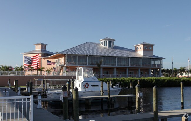
100 Laishley Ct
Punta Gorda, FL
Punta Gorda Harbor
412306326003
PUNTA GORDA HARBOR LT D2 .46 AC. M/L A PORTION OF PARCEL D DESC AS: COMM AT INTXN OF N ROW RETTA ESPLANADE AND W ROW NESBIT ST TH N ALG W ROW 464.34 FT SW 32.68 FT FOR POB TH SW 106.40 FT SE 52 FT NE 6 FT SE 8 FT SW 55.98 FT NW 8 FT NE 6 FT NW 52 FT
Structuresonleasedland
Charlotte
AE
Florida
12015C0233G
d2
2023
0.46 AC
2025
Charlotte County
010302
Southwest Florida
39,253 SF
DEMOGRAPHICS near 100 Laishley Ct
1 Mile
3 Mile
5 Mile
2024 Total Population
2,352
28,746
74,423
2029 Population
2,851
34,693
89,365
Pop Growth 2024-2029
+ 21.22%
+ 20.69%
+ 20.08%
Average Age
51
57
54
2024 Total Households
1,151
14,497
35,160
HH Growth 2024-2029
+ 21.46%
+ 20.89%
+ 20.43%
Median Household Inc
$48,615
$57,043
$55,923
Avg Household Size
2.00
1.90
2.00
2024 Avg HH Vehicles
2.00
2.00
2.00
Median Home Value
$312,621
$344,601
$257,524
Median Year Built
1985
1988
1987
Nearby Places
Map Layers
Map Styles
 Street
 Aerial
- Restaurants
- Banks
- Shops
- Fitness
- Groceries
PUBLIC TRANSPORTATION
AIRPORT
Punta Gorda
DRIVE
WALK
Distance
Punta Gorda
11 min
4.7 mi
Freight Ports
Port Manatee
DRIVE
WALK
Distance
Port Manatee
86 min
72.7 mi
SALE & LEASE HISTORY
LISTING DATE
SALE/LEASE

May 04, 2022
For Sale
Nearby Properties
Address
Land Use
TOTAL SIZE
Lot Size
Zoning
Address
Land Use
TOTAL SIZE
Lot Size
Zoning
333,027 SF
9.79 AC
CHRW
Address
Land Use
TOTAL SIZE
Lot Size
Zoning
349,844 SF
78.47 AC
P
Address
Land Use
TOTAL SIZE
Lot Size
Zoning
77,154 SF
10.30 AC
CC
Address
Land Use
TOTAL SIZE
Lot Size
Zoning
161,439 SF
171 AC
RE1
Address
Land Use
TOTAL SIZE
Lot Size
Zoning
172,298 SF
37.42 AC
OMI
Address
Land Use
TOTAL SIZE
Lot Size
Zoning
789,392 SF
31.39 AC
RMF15
Address
Land Use
TOTAL SIZE
Lot Size
Zoning
47,443 SF
7.94 AC
CC
Address
Land Use
TOTAL SIZE
Lot Size
Zoning
114,417 SF
4.36 AC
GM-15
Address
Land Use
TOTAL SIZE
Lot Size
Zoning
15,253 SF
13.27 AC
P
Address
Land Use
TOTAL SIZE
Lot Size
Zoning
208,560 SF
36.69 AC
PD-GM
Address
Land Use
TOTAL SIZE
Lot Size
Zoning
134,308 SF
16 AC
RSF3.5
Address
Land Use
TOTAL SIZE
Lot Size
Zoning
40,430 SF
5.63 AC
RMF12
Address
Land Use
TOTAL SIZE
Lot Size
Zoning
6,313 SF
15.49 AC
P
Address
Land Use
TOTAL SIZE
Lot Size
Zoning
73,095 SF
5 AC
NC
Address
Land Use
TOTAL SIZE
Lot Size
Zoning
44,185 SF
1.22 AC
CC
Address
Land Use
TOTAL SIZE
Lot Size
Zoning
128,594 SF
25.54 AC
PD
Address
Land Use
TOTAL SIZE
Lot Size
Zoning
25,356 SF
1.40 AC
CC
Address
Land Use
TOTAL SIZE
Lot Size
Zoning
70,518 SF
2.08 AC
PD
Address
Land Use
TOTAL SIZE
Lot Size
Zoning
82,379 SF
0.88 AC
CC
Address
Land Use
TOTAL SIZE
Lot Size
Zoning
12,159 SF
0.56 AC
CC
Address
Land Use
TOTAL SIZE
Lot Size
Zoning
24,880 SF
84.50 AC
PKR
Address
Land Use
TOTAL SIZE
Lot Size
Zoning
1,296 SF
14.46 AC
CG
Address
Land Use
TOTAL SIZE
Lot Size
Zoning
43,755 SF
8.19 AC
CC
Address
Land Use
TOTAL SIZE
Lot Size
Zoning
30,472 SF
3.19 AC
NR-10
Address
Land Use
TOTAL SIZE
Lot Size
Zoning
81,167 SF
5.63 AC
CG
Address
Land Use
TOTAL SIZE
Lot Size
Zoning
30,940 SF
0.42 AC
NC
Address
Land Use
TOTAL SIZE
Lot Size
Zoning
448 SF
16.37 AC
PD
Address
Land Use
TOTAL SIZE
Lot Size
Zoning
68,492 SF
6.38 AC
HC
Address
Land Use
TOTAL SIZE
Lot Size
Zoning
82,865 SF
19.74 AC
RMF12
Address
Land Use
TOTAL SIZE
Lot Size
Zoning
43,914 SF
4.06 AC
HC
The World's #1 Commercial Real Estate Marketplace
Connect with us
© 2025 CoStar Group
The information above has been obtained from sources believed reliable. While we do not doubt its accuracy we have not verified it and make no guarantee, warranty or representation about it. It is your responsibility to independently confirm its accuracy and completeness. Any projections, opinions, assumptions, or estimates used are for example only and do not represent the current or future performance of the property. The value of this transaction to you depends on tax and other factors which should be evaluated by your tax, financial, and legal advisors. You and your advisors should conduct a careful, independent investigation of the property to determine to your satisfaction the suitability of the property for your needs.