Property Record
150 Main St, Emerson, NJ 07630
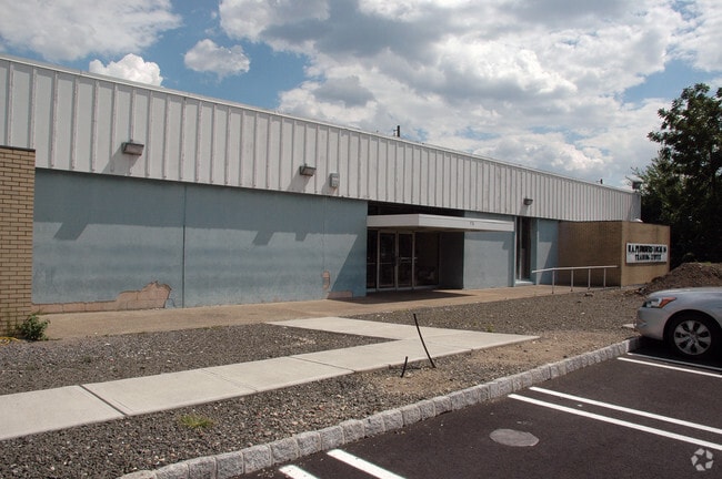


Property Detail
150 Main St
14-00335-0000-00013
BERGEN
Governmentalpublicusegeneral
New Jersey
R75
1.4
AE The base floodplain where base flood elevations are provided. AE Zones are now used on new format FIRMs instead of A1-A30 Zones.
1.60 AC
2024
Route 46 Corridor
2025
Northern New Jersey
012001
New York-Jersey City-White Plains, NY-NJ
NEARBY LISTINGS FOR SALE OR LEASE
DEMOGRAPHICS near 150 Main St
1 mile
3 mile
5 mile
2025 Total Population
30,057
270,491
623,161
2030 Population
29,813
274,514
634,076
Pop Growth 2025-2030
(0.81%)
+ 1.49%
+ 1.75%
Average Age
41
40
40
2025 Total Households
11,303
97,941
219,835
HH Growth 2025-2030
(0.80%)
+ 1.61%
+ 1.83%
Median Household Inc
$83,308
$83,472
$90,297
Avg Household Size
2.60
2.70
2.70
2025 Avg HH Vehicles
2.00
2.00
2.00
Median Home Value
$490,035
$471,918
$493,333
Median Year Built
1957
1956
1954
Nearby Places
Map Layers
Map Styles
 Street
 Aerial
Layers
 Traffic
 Biking
Places
Listings with unknown addresses are not visible on the map
- Restaurants
- Banks
- Shops
- Fitness
- Groceries
PUBLIC TRANSPORTATION
COMMUTER RAIL
Emerson (Pascack Valley Line - NJ Transit Commuter Rail (NJ Transit))
Drive
Walk
Distance
Emerson (Pascack Valley Line - NJ Transit Commuter Rail (NJ Transit))
2 min
13 min
0.7 mi
Westwood (Pascack Valley Line - NJ Transit Commuter Rail (NJ Transit))
Drive
Walk
Distance
Westwood (Pascack Valley Line - NJ Transit Commuter Rail (NJ Transit))
4 min
1.9 mi
AIRPORT
LaGuardia
Drive
Walk
Distance
LaGuardia
38 min
22.7 mi
Newark Liberty International
Drive
Walk
Distance
Newark Liberty International
33 min
25.4 mi
Westchester County
Drive
Walk
Distance
Westchester County
45 min
29.2 mi
Freight Ports
NY - Red Hook Container Terminal
Drive
Walk
Distance
NY - Red Hook Container Terminal
47 min
26.6 mi
Nearby Properties
Address
Land Use
TOTAL SIZE
Lot Size
Zoning
Address
Land Use
TOTAL SIZE
Lot Size
Zoning
62.88 AC
R100
Address
Land Use
TOTAL SIZE
Lot Size
Zoning
19.96 AC
HSO
Address
Land Use
TOTAL SIZE
Lot Size
Zoning
8.78 AC
HSO
Address
Land Use
TOTAL SIZE
Lot Size
Zoning
59 AC
AA
Address
Land Use
TOTAL SIZE
Lot Size
Zoning
185,878 SF
33.44 AC
B
Address
Land Use
TOTAL SIZE
Lot Size
Zoning
23,572 SF
98.75 AC
CR
Address
Land Use
TOTAL SIZE
Lot Size
Zoning
9.20 AC
OR
Address
Land Use
TOTAL SIZE
Lot Size
Zoning
47,623 SF
88.60 AC
B
Address
Land Use
TOTAL SIZE
Lot Size
Zoning
192,486 SF
11.82 AC
BL
Address
Land Use
TOTAL SIZE
Lot Size
Zoning
82.73 AC
Address
Land Use
TOTAL SIZE
Lot Size
Zoning
21.74 AC
SC
Address
Land Use
TOTAL SIZE
Lot Size
Zoning
82,969 SF
9.99 AC
R1
Address
Land Use
TOTAL SIZE
Lot Size
Zoning
Address
Land Use
TOTAL SIZE
Lot Size
Zoning
0.78 AC
B
Address
Land Use
TOTAL SIZE
Lot Size
Zoning
57,890 SF
26.61 AC
R100
Address
Land Use
TOTAL SIZE
Lot Size
Zoning
8.72 AC
A
Address
Land Use
TOTAL SIZE
Lot Size
Zoning
38.86 AC
R100
Address
Land Use
TOTAL SIZE
Lot Size
Zoning
15.20 AC
A
Address
Land Use
TOTAL SIZE
Lot Size
Zoning
1,620 SF
37.22 AC
R225
Address
Land Use
TOTAL SIZE
Lot Size
Zoning
9.44 AC
RESA
Address
Land Use
TOTAL SIZE
Lot Size
Zoning
3.33 AC
R3
Address
Land Use
TOTAL SIZE
Lot Size
Zoning
55,192 SF
5.14 AC
Address
Land Use
TOTAL SIZE
Lot Size
Zoning
36.37 AC
R4
Address
Land Use
TOTAL SIZE
Lot Size
Zoning
5.37 AC
B2
Address
Land Use
TOTAL SIZE
Lot Size
Zoning
15,065 SF
9.30 AC
RC
Address
Land Use
TOTAL SIZE
Lot Size
Zoning
31,892 SF
15.55 AC
R100
Address
Land Use
TOTAL SIZE
Lot Size
Zoning
34,971 SF
11.35 AC
R75
Address
Land Use
TOTAL SIZE
Lot Size
Zoning
62,728 SF
14.49 AC
RA15
Address
Land Use
TOTAL SIZE
Lot Size
Zoning
5.17 AC
B2
Address
Land Use
TOTAL SIZE
Lot Size
Zoning
4 AC
HSO
The World's #1 Commercial Real Estate Marketplace
Connect with us
© 2026 CoStar Group
The information above has been obtained from sources believed reliable. While we do not doubt its accuracy we have not verified it and make no guarantee, warranty or representation about it. It is your responsibility to independently confirm its accuracy and completeness. Any projections, opinions, assumptions, or estimates used are for example only and do not represent the current or future performance of the property. The value of this transaction to you depends on tax and other factors which should be evaluated by your tax, financial, and legal advisors. You and your advisors should conduct a careful, independent investigation of the property to determine to your satisfaction the suitability of the property for your needs.