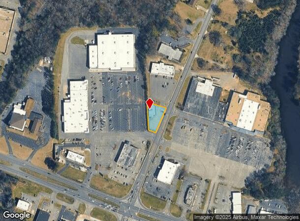
Property Record
150 N Airport Rd, Jasper, AL 35504


NEARBY LISTINGS FOR SALE OR LEASE
Property Detail
150 N Airport Rd
17-02-03-3-000-056-0010
PO SWSW 3-14-7 COM @ NE COR W 215.50 TO W ROW AIRPORT RD SW 921.28 TO POB CONT SW 177.92 NWLY 48 NLY 183.35 SELY 124.05 TO
Realpropertynec
Walker
X
Alabama
01127C0307E
0.40 AC
2025
Walker County
2024
Birmingham
020302
Birmingham-Hoover, AL
10,562 SF
DEMOGRAPHICS near 150 N Airport Rd
1 Mile
3 Mile
5 Mile
2024 Total Population
2,902
14,138
20,743
2029 Population
2,809
13,813
20,290
Pop Growth 2024-2029
(3.20%)
(2.30%)
(2.18%)
Average Age
42
42
42
2024 Total Households
1,258
5,544
8,172
HH Growth 2024-2029
(3.10%)
(2.25%)
(2.12%)
Median Household Inc
$55,565
$48,101
$50,923
Avg Household Size
2.20
2.40
2.40
2024 Avg HH Vehicles
2.00
2.00
2.00
Median Home Value
$182,864
$181,431
$173,396
Median Year Built
1976
1977
1980
Nearby Places
Map Layers
Map Styles
 Street
 Aerial
- Restaurants
- Banks
- Shops
- Fitness
- Groceries
SALE & LEASE HISTORY
LISTING DATE
SALE/LEASE

Sep 25, 2016
For Lease
Mar 20, 2017
For Sale
Mar 06, 2017
For Lease
Nearby Properties
Address
Land Use
TOTAL SIZE
Lot Size
Zoning
Address
Land Use
TOTAL SIZE
Lot Size
Zoning
258,084 SF
49 AC
O
Address
Land Use
TOTAL SIZE
Lot Size
Zoning
146,360 SF
51 AC
O
Address
Land Use
TOTAL SIZE
Lot Size
Zoning
86,928 SF
19 AC
OT
Address
Land Use
TOTAL SIZE
Lot Size
Zoning
55,188 SF
4.80 AC
OT
Address
Land Use
TOTAL SIZE
Lot Size
Zoning
42,149 SF
2 AC
O
Address
Land Use
TOTAL SIZE
Lot Size
Zoning
8,932 SF
7.50 AC
CO
Address
Land Use
TOTAL SIZE
Lot Size
Zoning
60,200 SF
5.60 AC
OT
Address
Land Use
TOTAL SIZE
Lot Size
Zoning
846 SF
11 AC
SF
Address
Land Use
TOTAL SIZE
Lot Size
Zoning
44,601 SF
3.80 AC
OT
Address
Land Use
TOTAL SIZE
Lot Size
Zoning
38,770 SF
180 AC
CO
Address
Land Use
TOTAL SIZE
Lot Size
Zoning
33,863 SF
2.50 AC
S
Address
Land Use
TOTAL SIZE
Lot Size
Zoning
26,446 SF
43 AC
CO
Address
Land Use
TOTAL SIZE
Lot Size
Zoning
37,813 SF
2 AC
O
Address
Land Use
TOTAL SIZE
Lot Size
Zoning
5,640 SF
19 AC
O
Address
Land Use
TOTAL SIZE
Lot Size
Zoning
4,830 SF
6.10 AC
OT
Address
Land Use
TOTAL SIZE
Lot Size
Zoning
30,981 SF
3.90 AC
S
Address
Land Use
TOTAL SIZE
Lot Size
Zoning
100 SF
20 AC
OT
Address
Land Use
TOTAL SIZE
Lot Size
Zoning
81,668 SF
9.80 AC
O
The World's #1 Commercial Real Estate Marketplace
Connect with us
© 2025 CoStar Group
The information above has been obtained from sources believed reliable. While we do not doubt its accuracy we have not verified it and make no guarantee, warranty or representation about it. It is your responsibility to independently confirm its accuracy and completeness. Any projections, opinions, assumptions, or estimates used are for example only and do not represent the current or future performance of the property. The value of this transaction to you depends on tax and other factors which should be evaluated by your tax, financial, and legal advisors. You and your advisors should conduct a careful, independent investigation of the property to determine to your satisfaction the suitability of the property for your needs.