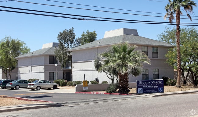
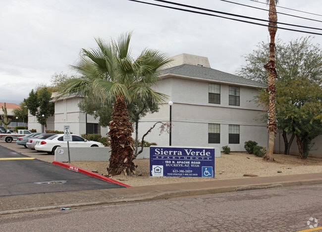
Property Record
150 N Apache Rd, Buckeye, AZ 85326

Property Detail
150 N Apache Rd
400-16-007
PT NE4 NE4 AKA LOT 1 DAF COM SW COR SD LOT TH E 980.06F TH N 3D 13M E 33.05F TH CONT N 03D 13M E 432.84F TO TPOB TH CONT N 3D 13M E 268.78F TH S 86D 47M E 349.71F TH S 3D 13M W 249.79F TH W 350. 19F TO TPOB
Apartment
Maricopa
MR
Arizona
C and X Area of minimal flood hazard, usually depicted on FIRMs as above the 500-year flood level.
1
2025
2.08 AC
2025
West Valley
050702
Phoenix
32,204 SF
Phoenix-Mesa-Chandler, AZ
NEARBY LISTINGS FOR SALE OR LEASE
-
-
View all Buckeye listings for sale on LoopNet.com
DEMOGRAPHICS near 150 N Apache Rd
1 mile
3 mile
5 mile
2024 Total Population
6,147
30,573
55,393
2029 Population
6,426
32,569
58,770
Pop Growth 2024-2029
+ 4.54%
+ 6.53%
+ 6.10%
Average Age
37
34
35
2024 Total Households
2,048
9,091
16,555
HH Growth 2024-2029
+ 4.44%
+ 6.57%
+ 6.17%
Median Household Inc
$64,419
$86,622
$90,117
Avg Household Size
3.00
3.30
3.30
2024 Avg HH Vehicles
2.00
2.00
2.00
Median Home Value
$312,750
$360,937
$371,927
Median Year Built
1988
2007
2007
Nearby Places
Map Layers
Map Styles
 Street
 Aerial
Transit
 Traffic
 Biking
Places
Listings with unknown addresses are not visible on the map
- Restaurants
- Banks
- Shops
- Fitness
- Groceries
Nearby Properties
Address
Land Use
TOTAL SIZE
Lot Size
Zoning
Address
Land Use
TOTAL SIZE
Lot Size
Zoning
2,310,631 SF
215.58 AC
Address
Land Use
TOTAL SIZE
Lot Size
Zoning
1,207,360 SF
67.69 AC
Address
Land Use
TOTAL SIZE
Lot Size
Zoning
13.35 AC
Address
Land Use
TOTAL SIZE
Lot Size
Zoning
1,834,456 SF
142.44 AC
C-G
Address
Land Use
TOTAL SIZE
Lot Size
Zoning
11.14 AC
Address
Land Use
TOTAL SIZE
Lot Size
Zoning
3,494 SF
6.20 AC
GC
Address
Land Use
TOTAL SIZE
Lot Size
Zoning
510,427 SF
64.69 AC
GC
Address
Land Use
TOTAL SIZE
Lot Size
Zoning
290,752 SF
21.32 AC
SU
Address
Land Use
TOTAL SIZE
Lot Size
Zoning
174.17 AC
Address
Land Use
TOTAL SIZE
Lot Size
Zoning
93,337 SF
15.37 AC
PC
Address
Land Use
TOTAL SIZE
Lot Size
Zoning
78,774 SF
7.57 AC
PUD
Address
Land Use
TOTAL SIZE
Lot Size
Zoning
122,714 SF
12.27 AC
C-C
Address
Land Use
TOTAL SIZE
Lot Size
Zoning
68,255 SF
3.16 AC
PUD
Address
Land Use
TOTAL SIZE
Lot Size
Zoning
85,712 SF
15.18 AC
PR
Address
Land Use
TOTAL SIZE
Lot Size
Zoning
228,652 SF
136.91 AC
SU
Address
Land Use
TOTAL SIZE
Lot Size
Zoning
8,144 SF
39.69 AC
R-43
Address
Land Use
TOTAL SIZE
Lot Size
Zoning
60,201 SF
14.10 AC
PUD
Address
Land Use
TOTAL SIZE
Lot Size
Zoning
125,120 SF
8.49 AC
SU
Address
Land Use
TOTAL SIZE
Lot Size
Zoning
181,308 SF
20.19 AC
C-G
Address
Land Use
TOTAL SIZE
Lot Size
Zoning
20,248 SF
23.16 AC
SU
Address
Land Use
TOTAL SIZE
Lot Size
Zoning
3.10 AC
Address
Land Use
TOTAL SIZE
Lot Size
Zoning
178,939 SF
13.98 AC
CC
Address
Land Use
TOTAL SIZE
Lot Size
Zoning
150,139 SF
20.48 AC
C-G
Address
Land Use
TOTAL SIZE
Lot Size
Zoning
136,836 SF
8.85 AC
R-R
Address
Land Use
TOTAL SIZE
Lot Size
Zoning
53.11 AC
C-G
Address
Land Use
TOTAL SIZE
Lot Size
Zoning
40,859 SF
6.92 AC
PUD
Address
Land Use
TOTAL SIZE
Lot Size
Zoning
Address
Land Use
TOTAL SIZE
Lot Size
Zoning
24,119 SF
5.13 AC
CC
Address
Land Use
TOTAL SIZE
Lot Size
Zoning
108,952 SF
32.46 AC
I-2
Address
Land Use
TOTAL SIZE
Lot Size
Zoning
32,567 SF
7.38 AC
PR
The World's #1 Commercial Real Estate Marketplace
Connect with us
© 2026 CoStar Group
The information above has been obtained from sources believed reliable. While we do not doubt its accuracy we have not verified it and make no guarantee, warranty or representation about it. It is your responsibility to independently confirm its accuracy and completeness. Any projections, opinions, assumptions, or estimates used are for example only and do not represent the current or future performance of the property. The value of this transaction to you depends on tax and other factors which should be evaluated by your tax, financial, and legal advisors. You and your advisors should conduct a careful, independent investigation of the property to determine to your satisfaction the suitability of the property for your needs.