Property Record
150 N Kamehameha Hwy, Wahiawa, HI 96786

NEARBY LISTINGS FOR SALE OR LEASE
Property Detail
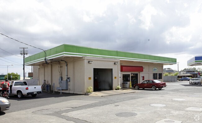
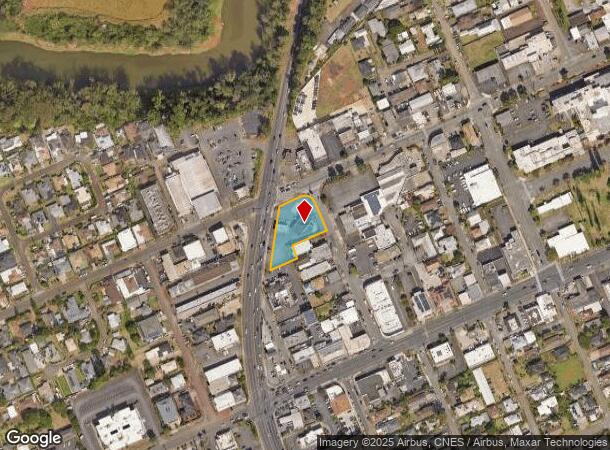
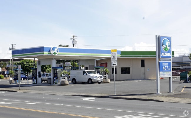
150 N Kamehameha Hwy
Urban Honolulu, HI
Texaco Gas Station
1-7-4-004-022-0000
LOTS 4 5600 SF, 8 7000 SF MAP 2; 5-A 5407 SF MAP 7; 3-A 3950 SF; 2-B 262 SF; 7-A 3112 SF & 9-A 4620 SF MAP 4 LCAPP 77
Commercialnec
Honolulu
D
Hawaii
15003C0210F
4
2024
0.69 AC
2025
Central Oahu
009301
Hawaii
1,768 SF
DEMOGRAPHICS near 150 N Kamehameha Hwy
1 Mile
3 Mile
5 Mile
2024 Total Population
14,441
66,807
90,501
2029 Population
14,171
65,378
87,722
Pop Growth 2024-2029
(1.87%)
(2.14%)
(3.07%)
Average Age
39
35
37
2024 Total Households
4,358
20,822
28,193
HH Growth 2024-2029
(2.39%)
(2.65%)
(3.73%)
Median Household Inc
$67,254
$85,708
$92,644
Avg Household Size
2.90
3.00
3.00
2024 Avg HH Vehicles
2.00
2.00
2.00
Median Home Value
$665,574
$673,016
$710,424
Median Year Built
1969
1989
1983
Nearby Places
- Restaurants
- Banks
- Shops
- Fitness
- Groceries
PUBLIC TRANSPORTATION
AIRPORT
Daniel K Inouye International
DRIVE
WALK
Distance
Daniel K Inouye International
26 min
17.2 mi
Freight Ports
Honolulu Harbor, Oahu
DRIVE
WALK
Distance
Honolulu Harbor, Oahu
35 min
21.4 mi
Nearby Properties
Address
Land Use
TOTAL SIZE
Lot Size
Zoning
Address
Land Use
TOTAL SIZE
Lot Size
Zoning
129,731 SF
8.45 AC
B-2
Address
Land Use
TOTAL SIZE
Lot Size
Zoning
8.16 AC
I-2
Address
Land Use
TOTAL SIZE
Lot Size
Zoning
684.89 AC
F-1
Address
Land Use
TOTAL SIZE
Lot Size
Zoning
132,900 SF
3.52 AC
IMX-1
Address
Land Use
TOTAL SIZE
Lot Size
Zoning
70,807 SF
4.31 AC
B-2
Address
Land Use
TOTAL SIZE
Lot Size
Zoning
7.51 AC
B-2
Address
Land Use
TOTAL SIZE
Lot Size
Zoning
56,029 SF
3.37 AC
IMX-1
Address
Land Use
TOTAL SIZE
Lot Size
Zoning
37,541 SF
4.21 AC
B-1
Address
Land Use
TOTAL SIZE
Lot Size
Zoning
1,247.70 AC
AG-1
Address
Land Use
TOTAL SIZE
Lot Size
Zoning
106,550 SF
3.64 AC
IMX-1
Address
Land Use
TOTAL SIZE
Lot Size
Zoning
111,722 SF
2.97 AC
IMX-1
Address
Land Use
TOTAL SIZE
Lot Size
Zoning
3.65 AC
IMX-1
Address
Land Use
TOTAL SIZE
Lot Size
Zoning
263.30 AC
AG-1
Address
Land Use
TOTAL SIZE
Lot Size
Zoning
77,207 SF
3.64 AC
IMX-1
Address
Land Use
TOTAL SIZE
Lot Size
Zoning
71,141 SF
4.32 AC
IMX-1
Address
Land Use
TOTAL SIZE
Lot Size
Zoning
2,495 SF
2.30 AC
B-2
Address
Land Use
TOTAL SIZE
Lot Size
Zoning
24,292 SF
17.93 AC
AG-2
Address
Land Use
TOTAL SIZE
Lot Size
Zoning
42,886 SF
1.78 AC
B-2
Address
Land Use
TOTAL SIZE
Lot Size
Zoning
42,886 SF
1.52 AC
B-2
Address
Land Use
TOTAL SIZE
Lot Size
Zoning
42,886 SF
1.72 AC
B-2
Address
Land Use
TOTAL SIZE
Lot Size
Zoning
52,005 SF
4 AC
IMX-1
Address
Land Use
TOTAL SIZE
Lot Size
Zoning
42,886 SF
1.32 AC
B-2
Address
Land Use
TOTAL SIZE
Lot Size
Zoning
67,524 SF
4 AC
IMX-1
Address
Land Use
TOTAL SIZE
Lot Size
Zoning
55,440 SF
3.22 AC
B-2
Address
Land Use
TOTAL SIZE
Lot Size
Zoning
186.16 AC
AG-1
Address
Land Use
TOTAL SIZE
Lot Size
Zoning
31,021 SF
5 AC
IMX-1
Address
Land Use
TOTAL SIZE
Lot Size
Zoning
25,038 SF
1.94 AC
B-2
Address
Land Use
TOTAL SIZE
Lot Size
Zoning
39,124 SF
3.48 AC
IMX-1
Address
Land Use
TOTAL SIZE
Lot Size
Zoning
18.96 AC
IMX-1
Address
Land Use
TOTAL SIZE
Lot Size
Zoning
22,704 SF
1.93 AC
B-1
The World's #1 Commercial Real Estate Marketplace
Connect with us
© 2025 CoStar Group
The information above has been obtained from sources believed reliable. While we do not doubt its accuracy we have not verified it and make no guarantee, warranty or representation about it. It is your responsibility to independently confirm its accuracy and completeness. Any projections, opinions, assumptions, or estimates used are for example only and do not represent the current or future performance of the property. The value of this transaction to you depends on tax and other factors which should be evaluated by your tax, financial, and legal advisors. You and your advisors should conduct a careful, independent investigation of the property to determine to your satisfaction the suitability of the property for your needs.