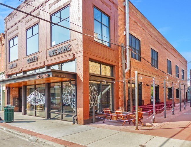
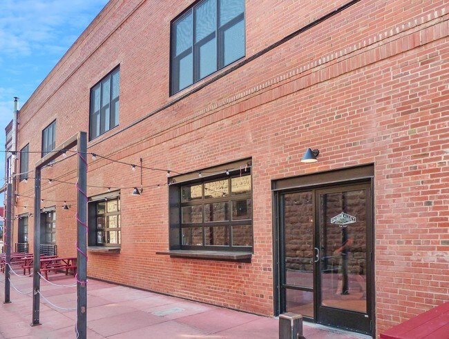
Property Record
150 N Main St, Sheridan, WY 82801
NEARBY LISTINGS FOR SALE OR LEASE
Property Detail
150 N Main St
Sheridan, WY
Original Town Now City Of Sheridan
03-5684-27-4-01-001-25
SHERIDAN ORIGINAL TOWN BLOCK 2 LOT 9 & N6' LOT 10 (TOTAL SQ FT = 4,875.00)
Bartavern
Sheridan
X
Wyoming
56033C0762E
9,10
2025
0.11 AC
2025
I-25 Corridor/Casper
000300
Other Market Areas
9,887 SF
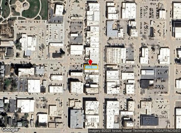
DEMOGRAPHICS near 150 N Main St
1 Mile
3 Mile
5 Mile
2024 Total Population
8,828
21,952
24,217
2029 Population
9,704
24,097
26,579
Pop Growth 2024-2029
+ 9.92%
+ 9.77%
+ 9.75%
Average Age
41
42
42
2024 Total Households
4,283
9,792
10,633
HH Growth 2024-2029
+ 9.97%
+ 9.90%
+ 9.87%
Median Household Inc
$48,812
$55,831
$57,255
Avg Household Size
2.00
2.10
2.20
2024 Avg HH Vehicles
2.00
2.00
2.00
Median Home Value
$245,454
$275,942
$283,702
Median Year Built
1960
1978
1979
Nearby Places
Map Layers
Map Styles
 Street
 Aerial
- Restaurants
- Banks
- Shops
- Fitness
- Groceries
SALE & LEASE HISTORY
LISTING DATE
SALE/LEASE

Aug 22, 2018
For Lease
Nearby Properties
Address
Land Use
TOTAL SIZE
Lot Size
Zoning
Address
Land Use
TOTAL SIZE
Lot Size
Zoning
104,640 SF
9.10 AC
A
Address
Land Use
TOTAL SIZE
Lot Size
Zoning
69,902 SF
9.53 AC
Address
Land Use
TOTAL SIZE
Lot Size
Zoning
183,642 SF
22.36 AC
A
Address
Land Use
TOTAL SIZE
Lot Size
Zoning
40,118 SF
7.42 AC
Address
Land Use
TOTAL SIZE
Lot Size
Zoning
28,896 SF
1.76 AC
Address
Land Use
TOTAL SIZE
Lot Size
Zoning
107,748 SF
10.27 AC
Address
Land Use
TOTAL SIZE
Lot Size
Zoning
12,366 SF
10.62 AC
Address
Land Use
TOTAL SIZE
Lot Size
Zoning
22,305 SF
0.77 AC
Address
Land Use
TOTAL SIZE
Lot Size
Zoning
40,217 SF
2 AC
Address
Land Use
TOTAL SIZE
Lot Size
Zoning
54,648 SF
0.65 AC
Address
Land Use
TOTAL SIZE
Lot Size
Zoning
33,574 SF
4.60 AC
Address
Land Use
TOTAL SIZE
Lot Size
Zoning
54,212 SF
4.73 AC
Address
Land Use
TOTAL SIZE
Lot Size
Zoning
142,233 SF
7.69 AC
Address
Land Use
TOTAL SIZE
Lot Size
Zoning
38,730 SF
1.44 AC
Address
Land Use
TOTAL SIZE
Lot Size
Zoning
21,836 SF
10.04 AC
Address
Land Use
TOTAL SIZE
Lot Size
Zoning
51,280 SF
3.34 AC
Address
Land Use
TOTAL SIZE
Lot Size
Zoning
40,804 SF
5 AC
UR
Address
Land Use
TOTAL SIZE
Lot Size
Zoning
38,242 SF
9.50 AC
A
Address
Land Use
TOTAL SIZE
Lot Size
Zoning
47,043 SF
0.38 AC
Address
Land Use
TOTAL SIZE
Lot Size
Zoning
39,400 SF
0.43 AC
Address
Land Use
TOTAL SIZE
Lot Size
Zoning
45,051 SF
3.54 AC
Address
Land Use
TOTAL SIZE
Lot Size
Zoning
40,164 SF
2.81 AC
UR
Address
Land Use
TOTAL SIZE
Lot Size
Zoning
11,004 SF
3.74 AC
Address
Land Use
TOTAL SIZE
Lot Size
Zoning
35,119 SF
1.62 AC
Address
Land Use
TOTAL SIZE
Lot Size
Zoning
49.35 AC
UR
Address
Land Use
TOTAL SIZE
Lot Size
Zoning
8,882 SF
2.55 AC
Address
Land Use
TOTAL SIZE
Lot Size
Zoning
93,570 SF
2.45 AC
Address
Land Use
TOTAL SIZE
Lot Size
Zoning
24,520 SF
8.62 AC
Address
Land Use
TOTAL SIZE
Lot Size
Zoning
5,784 SF
17.29 AC
Address
Land Use
TOTAL SIZE
Lot Size
Zoning
65,394 SF
3.22 AC
The World's #1 Commercial Real Estate Marketplace
Connect with us
© 2026 CoStar Group
The information above has been obtained from sources believed reliable. While we do not doubt its accuracy we have not verified it and make no guarantee, warranty or representation about it. It is your responsibility to independently confirm its accuracy and completeness. Any projections, opinions, assumptions, or estimates used are for example only and do not represent the current or future performance of the property. The value of this transaction to you depends on tax and other factors which should be evaluated by your tax, financial, and legal advisors. You and your advisors should conduct a careful, independent investigation of the property to determine to your satisfaction the suitability of the property for your needs.