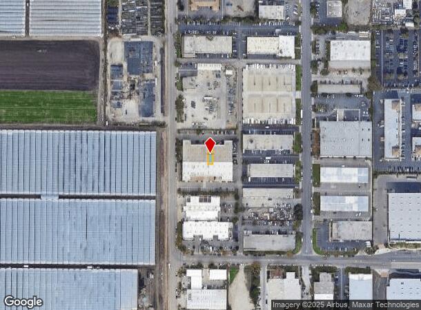
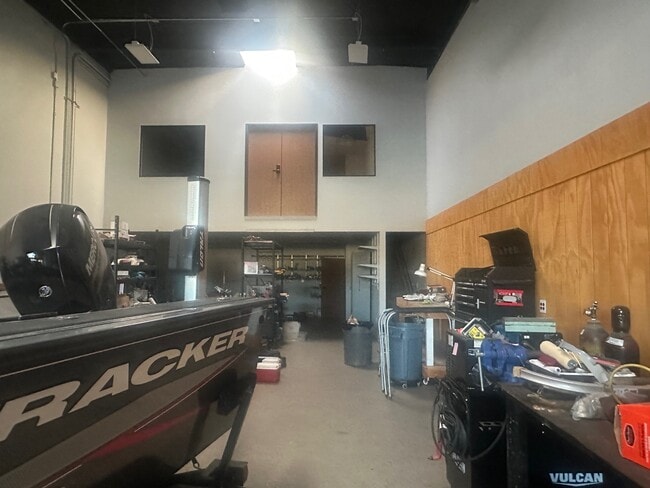
Property Record
150 Wood Rd, Camarillo, CA 93010
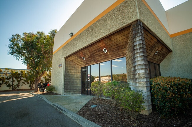

This Property Is For Sale
NEARBY LISTINGS FOR SALE OR LEASE
Property Detail
150 Wood Rd
230-0-141-125
3802
Industrialcondominium
TRACT: 380200 REF: 95 MR 37 CONDO PLAN: -5
X
Ventura
06111C0928E
California
2024
2 AC
2025
Central Ventura
005602
Los Angeles
2,444 SF
Oxnard-Thousand Oaks-Ventura, CA
DEMOGRAPHICS near 150 Wood Rd
1 Mile
3 Mile
5 Mile
2024 Total Population
2,041
28,474
127,168
2029 Population
2,034
28,020
124,843
Pop Growth 2024-2029
(0.34%)
(1.59%)
(1.83%)
Average Age
41
41
38
2024 Total Households
842
10,321
38,105
HH Growth 2024-2029
(0.48%)
(1.59%)
(1.90%)
Median Household Inc
$116,319
$102,208
$96,341
Avg Household Size
2.40
2.70
3.20
2024 Avg HH Vehicles
2.00
2.00
2.00
Median Home Value
$924,622
$817,974
$694,137
Median Year Built
2006
1978
1979
Nearby Places
- Restaurants
- Banks
- Shops
- Fitness
- Groceries
PUBLIC TRANSPORTATION
COMMUTER RAIL
Camarillo (Ventura County Line - Southern California Regional Rail Authority (Metrolink))
DRIVE
WALK
Distance
Camarillo (Ventura County Line - Southern California Regional Rail Authority (Metrolink))
7 min
4.5 mi
DRIVE
WALK
Distance
11 min
7.4 mi
Freight Ports
The Port of Hueneme
DRIVE
WALK
Distance
The Port of Hueneme
19 min
10.9 mi
Nearby Properties
Address
Land Use
TOTAL SIZE
Lot Size
Zoning
Address
Land Use
TOTAL SIZE
Lot Size
Zoning
135,631 SF
74.32 AC
Address
Land Use
TOTAL SIZE
Lot Size
Zoning
25.09 AC
Address
Land Use
TOTAL SIZE
Lot Size
Zoning
159.70 AC
Address
Land Use
TOTAL SIZE
Lot Size
Zoning
31.75 AC
Address
Land Use
TOTAL SIZE
Lot Size
Zoning
19,288 SF
24.55 AC
CPD
Address
Land Use
TOTAL SIZE
Lot Size
Zoning
10.59 AC
Address
Land Use
TOTAL SIZE
Lot Size
Zoning
72,165 SF
24.05 AC
L-M
Address
Land Use
TOTAL SIZE
Lot Size
Zoning
33,261 SF
36.25 AC
Address
Land Use
TOTAL SIZE
Lot Size
Zoning
Address
Land Use
TOTAL SIZE
Lot Size
Zoning
150,320 SF
6.22 AC
Address
Land Use
TOTAL SIZE
Lot Size
Zoning
123,752 SF
5.98 AC
RPD
Address
Land Use
TOTAL SIZE
Lot Size
Zoning
30,800 SF
32.79 AC
M-1-
Address
Land Use
TOTAL SIZE
Lot Size
Zoning
15.59 AC
Address
Land Use
TOTAL SIZE
Lot Size
Zoning
8,398 SF
45.88 AC
M1PD
Address
Land Use
TOTAL SIZE
Lot Size
Zoning
70,392 SF
19.97 AC
4
Address
Land Use
TOTAL SIZE
Lot Size
Zoning
13,833 SF
13.91 AC
Address
Land Use
TOTAL SIZE
Lot Size
Zoning
84,518 SF
4.71 AC
RPD
Address
Land Use
TOTAL SIZE
Lot Size
Zoning
390 SF
39.49 AC
Address
Land Use
TOTAL SIZE
Lot Size
Zoning
88,224 SF
7.40 AC
Address
Land Use
TOTAL SIZE
Lot Size
Zoning
60,511 SF
2.95 AC
RPD30
Address
Land Use
TOTAL SIZE
Lot Size
Zoning
66,715 SF
4.07 AC
Address
Land Use
TOTAL SIZE
Lot Size
Zoning
3.08 AC
Address
Land Use
TOTAL SIZE
Lot Size
Zoning
44,806 SF
17.71 AC
Address
Land Use
TOTAL SIZE
Lot Size
Zoning
339.53 AC
Address
Land Use
TOTAL SIZE
Lot Size
Zoning
117,030 SF
17.35 AC
M1PD
Address
Land Use
TOTAL SIZE
Lot Size
Zoning
Address
Land Use
TOTAL SIZE
Lot Size
Zoning
66,315 SF
2.37 AC
CPD
Address
Land Use
TOTAL SIZE
Lot Size
Zoning
97,392 SF
5.35 AC
ML
Address
Land Use
TOTAL SIZE
Lot Size
Zoning
1,728 SF
7.11 AC
MIPD
Address
Land Use
TOTAL SIZE
Lot Size
Zoning
44,456 SF
11.64 AC
The World's #1 Commercial Real Estate Marketplace
Connect with us
© 2025 CoStar Group
The information above has been obtained from sources believed reliable. While we do not doubt its accuracy we have not verified it and make no guarantee, warranty or representation about it. It is your responsibility to independently confirm its accuracy and completeness. Any projections, opinions, assumptions, or estimates used are for example only and do not represent the current or future performance of the property. The value of this transaction to you depends on tax and other factors which should be evaluated by your tax, financial, and legal advisors. You and your advisors should conduct a careful, independent investigation of the property to determine to your satisfaction the suitability of the property for your needs.