Property Record
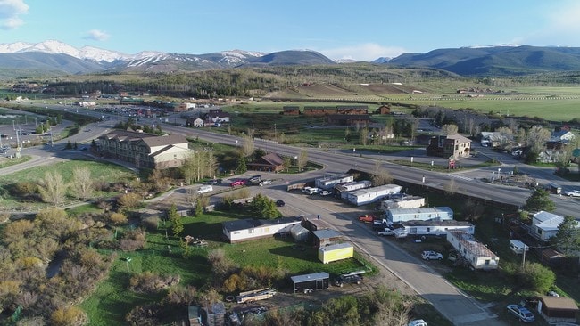
150 N Zerex St, Fraser, CO 80442

Property Detail
150 N Zerex St
Other Market Areas
SUBD: CLAYTON SUB RESUB TR B&C LOT: 4
R028936
GRAND
Mobilehomepark
Colorado
B and X Area of moderate flood hazard, usually the area between the limits of the 100-year and 500-year floods.
4
2025
0.80 AC
2025
Colorado Ski Area
000204
NEARBY LISTINGS FOR SALE OR LEASE
DEMOGRAPHICS near 150 N Zerex St
1 mile
3 mile
5 mile
2025 Total Population
1,493
4,715
5,675
2030 Population
1,508
5,096
6,045
Pop Growth 2025-2030
+ 1.00%
+ 8.08%
+ 6.52%
Average Age
41
42
42
2025 Total Households
687
2,241
2,683
HH Growth 2025-2030
+ 0.29%
+ 7.90%
+ 6.45%
Median Household Inc
$83,073
$88,055
$87,371
Avg Household Size
2.00
2.00
2.00
2025 Avg HH Vehicles
2.00
2.00
2.00
Median Home Value
$564,516
$591,335
$635,742
Median Year Built
1992
1997
1997
Nearby Places
Map Layers
Map Styles
 Street
 Aerial
Transit
 Traffic
 Biking
Places
Listings with unknown addresses are not visible on the map
- Restaurants
- Banks
- Shops
- Fitness
- Groceries
PUBLIC TRANSPORTATION
COMMUTER RAIL
Drive
Walk
Distance
1 min
6 min
0.3 mi
Drive
Walk
Distance
13 min
5.8 mi
SALE & LEASE HISTORY
LISTING DATE
SALE/LEASE

Sep 11, 2020
For Sale
Sep 11, 2018
For Sale
Nearby Properties
Address
Land Use
TOTAL SIZE
Lot Size
Zoning
Address
Land Use
TOTAL SIZE
Lot Size
Zoning
672 SF
390.12 AC
Address
Land Use
TOTAL SIZE
Lot Size
Zoning
27,426 SF
2.04 AC
50
Address
Land Use
TOTAL SIZE
Lot Size
Zoning
27,034 SF
4.22 AC
Address
Land Use
TOTAL SIZE
Lot Size
Zoning
46,426 SF
4.92 AC
Address
Land Use
TOTAL SIZE
Lot Size
Zoning
48,259 SF
5.49 AC
1
Address
Land Use
TOTAL SIZE
Lot Size
Zoning
34,773 SF
2.69 AC
46
Address
Land Use
TOTAL SIZE
Lot Size
Zoning
10,790 SF
0.60 AC
Address
Land Use
TOTAL SIZE
Lot Size
Zoning
15,054 SF
35.16 AC
Address
Land Use
TOTAL SIZE
Lot Size
Zoning
21,486 SF
2.29 AC
51
Address
Land Use
TOTAL SIZE
Lot Size
Zoning
36,325 SF
1.72 AC
Address
Land Use
TOTAL SIZE
Lot Size
Zoning
3.08 AC
48
Address
Land Use
TOTAL SIZE
Lot Size
Zoning
142,474 SF
2.77 AC
48
Address
Land Use
TOTAL SIZE
Lot Size
Zoning
23,276 SF
2.05 AC
48
Address
Land Use
TOTAL SIZE
Lot Size
Zoning
18,578 SF
0.83 AC
48
Address
Land Use
TOTAL SIZE
Lot Size
Zoning
2,800 SF
3 AC
Address
Land Use
TOTAL SIZE
Lot Size
Zoning
14,620 SF
0.84 AC
Address
Land Use
TOTAL SIZE
Lot Size
Zoning
7,840 SF
1.76 AC
48
Address
Land Use
TOTAL SIZE
Lot Size
Zoning
6,898 SF
5.65 AC
43
Address
Land Use
TOTAL SIZE
Lot Size
Zoning
3,503 SF
37.90 AC
Address
Land Use
TOTAL SIZE
Lot Size
Zoning
4,411 SF
0.28 AC
Address
Land Use
TOTAL SIZE
Lot Size
Zoning
21,540 SF
1.28 AC
1
Address
Land Use
TOTAL SIZE
Lot Size
Zoning
7,274 SF
266.65 AC
Address
Land Use
TOTAL SIZE
Lot Size
Zoning
8,706 SF
1.14 AC
Address
Land Use
TOTAL SIZE
Lot Size
Zoning
0.47 AC
Address
Land Use
TOTAL SIZE
Lot Size
Zoning
20,305 SF
2.77 AC
51
Address
Land Use
TOTAL SIZE
Lot Size
Zoning
9,566 SF
0.62 AC
1
Address
Land Use
TOTAL SIZE
Lot Size
Zoning
7,710 SF
0.97 AC
Address
Land Use
TOTAL SIZE
Lot Size
Zoning
7,286 SF
0.15 AC
Address
Land Use
TOTAL SIZE
Lot Size
Zoning
12,270 SF
0.44 AC
48
The World's #1 Commercial Real Estate Marketplace
Connect with us
© 2026 CoStar Group
The information above has been obtained from sources believed reliable. While we do not doubt its accuracy we have not verified it and make no guarantee, warranty or representation about it. It is your responsibility to independently confirm its accuracy and completeness. Any projections, opinions, assumptions, or estimates used are for example only and do not represent the current or future performance of the property. The value of this transaction to you depends on tax and other factors which should be evaluated by your tax, financial, and legal advisors. You and your advisors should conduct a careful, independent investigation of the property to determine to your satisfaction the suitability of the property for your needs.