Property Record
150 Ne 20Th St, Newport, OR 97365
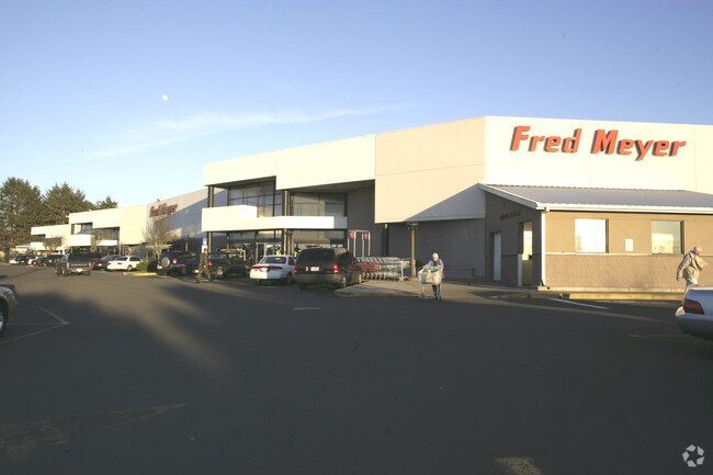
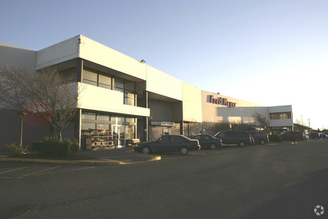
Property Detail
150 Ne 20Th St
R342790
TWNSHP 11, RNG 11, ACRES 5.17, DOC200717223
Commercialnec
Lincoln
C-1
Oregon
B and X Area of moderate flood hazard, usually the area between the limits of the 100-year and 500-year floods.
2.39 AC
2025
Oregon West Area
2025
Other Market Areas
950900
Newport, OR
NEARBY LISTINGS FOR SALE OR LEASE
DEMOGRAPHICS near 150 Ne 20Th St
1 mile
3 mile
5 mile
2025 Total Population
4,610
10,689
11,809
2030 Population
4,561
10,679
11,811
Pop Growth 2025-2030
(1.06%)
(0.09%)
+ 0.02%
Average Age
44
45
46
2025 Total Households
1,991
4,705
5,213
HH Growth 2025-2030
(1.05%)
(0.30%)
(0.13%)
Median Household Inc
$58,452
$59,953
$61,949
Avg Household Size
2.20
2.20
2.20
2025 Avg HH Vehicles
2.00
2.00
2.00
Median Home Value
$449,578
$454,040
$468,157
Median Year Built
1975
1979
1979
Nearby Places
Map Layers
Map Styles
 Street
 Aerial
Layers
 Traffic
 Biking
Places
Listings with unknown addresses are not visible on the map
- Restaurants
- Banks
- Shops
- Fitness
- Groceries
SALE & LEASE HISTORY
LISTING DATE
SALE/LEASE

Jan 18, 2022
For Lease
Nearby Properties
Address
Land Use
TOTAL SIZE
Lot Size
Zoning
Address
Land Use
TOTAL SIZE
Lot Size
Zoning
96,993 SF
0.28 AC
P-1
Address
Land Use
TOTAL SIZE
Lot Size
Zoning
8,960 SF
13.60 AC
W-1
Address
Land Use
TOTAL SIZE
Lot Size
Zoning
4.27 AC
W2, C2
Address
Land Use
TOTAL SIZE
Lot Size
Zoning
143,594 SF
2.55 AC
P-1
Address
Land Use
TOTAL SIZE
Lot Size
Zoning
4,028 SF
59.13 AC
W1-W2
Address
Land Use
TOTAL SIZE
Lot Size
Zoning
14.35 AC
W-2
Address
Land Use
TOTAL SIZE
Lot Size
Zoning
2.71 AC
P-1
Address
Land Use
TOTAL SIZE
Lot Size
Zoning
32.90 AC
W-2
Address
Land Use
TOTAL SIZE
Lot Size
Zoning
89,850 SF
4.32 AC
R-3,P-1
Address
Land Use
TOTAL SIZE
Lot Size
Zoning
3.12 AC
W-2
Address
Land Use
TOTAL SIZE
Lot Size
Zoning
62.90 AC
P-2
Address
Land Use
TOTAL SIZE
Lot Size
Zoning
33.88 AC
P-2
Address
Land Use
TOTAL SIZE
Lot Size
Zoning
76,352 SF
5.60 AC
P-1
Address
Land Use
TOTAL SIZE
Lot Size
Zoning
99,374 SF
5.39 AC
C-1
Address
Land Use
TOTAL SIZE
Lot Size
Zoning
51,539 SF
6.25 AC
P-1
Address
Land Use
TOTAL SIZE
Lot Size
Zoning
886 SF
10.38 AC
W-2
Address
Land Use
TOTAL SIZE
Lot Size
Zoning
107,559 SF
7.37 AC
C-1
Address
Land Use
TOTAL SIZE
Lot Size
Zoning
67,028 SF
4.13 AC
P-1
Address
Land Use
TOTAL SIZE
Lot Size
Zoning
1.44 AC
W-2
Address
Land Use
TOTAL SIZE
Lot Size
Zoning
8.15 AC
R-4
Address
Land Use
TOTAL SIZE
Lot Size
Zoning
121,069 SF
5.17 AC
C-1
Address
Land Use
TOTAL SIZE
Lot Size
Zoning
107,978 SF
9.29 AC
C-1
Address
Land Use
TOTAL SIZE
Lot Size
Zoning
2.81 AC
W-2
Address
Land Use
TOTAL SIZE
Lot Size
Zoning
73,670 SF
1.52 AC
C-2
Address
Land Use
TOTAL SIZE
Lot Size
Zoning
900 SF
10.94 AC
R-4
Address
Land Use
TOTAL SIZE
Lot Size
Zoning
58,563 SF
3.03 AC
C-2
Address
Land Use
TOTAL SIZE
Lot Size
Zoning
24,302 SF
1.38 AC
P-1
Address
Land Use
TOTAL SIZE
Lot Size
Zoning
18,756 SF
1.75 AC
C-1
Address
Land Use
TOTAL SIZE
Lot Size
Zoning
30,000 SF
1.49 AC
W-2
Address
Land Use
TOTAL SIZE
Lot Size
Zoning
30,000 SF
1.30 AC
W-2
The World's #1 Commercial Real Estate Marketplace
Connect with us
© 2026 CoStar Group
The information above has been obtained from sources believed reliable. While we do not doubt its accuracy we have not verified it and make no guarantee, warranty or representation about it. It is your responsibility to independently confirm its accuracy and completeness. Any projections, opinions, assumptions, or estimates used are for example only and do not represent the current or future performance of the property. The value of this transaction to you depends on tax and other factors which should be evaluated by your tax, financial, and legal advisors. You and your advisors should conduct a careful, independent investigation of the property to determine to your satisfaction the suitability of the property for your needs.