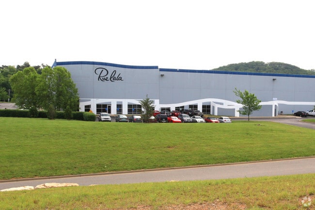
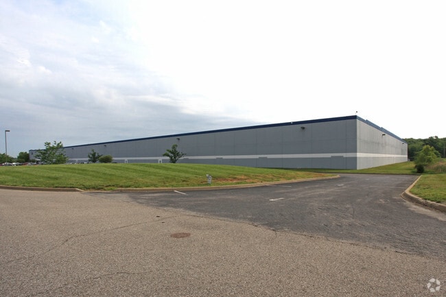
Property Record
150 Omicron Ct, Shepherdsville, KY 40165

Property Detail
150 Omicron Ct
Louisville/Jefferson County, KY-IN
LT 10A CEDAR GROVE BUSINESS PARK
430244
Bullitt
Commercialnec
Kentucky
B and X Area of moderate flood hazard, usually the area between the limits of the 100-year and 500-year floods.
10a
2025
25.85 AC
2025
Bullitt County
021103
Louisville
NEARBY LISTINGS FOR SALE OR LEASE
DEMOGRAPHICS near 150 Omicron Ct
1 mile
3 mile
5 mile
2025 Total Population
181
7,874
26,786
2030 Population
188
8,121
27,810
Pop Growth 2025-2030
+ 3.87%
+ 3.14%
+ 3.82%
Average Age
45
43
40
2025 Total Households
67
3,064
10,161
HH Growth 2025-2030
+ 2.99%
+ 3.07%
+ 3.80%
Median Household Inc
$88,281
$69,609
$69,106
Avg Household Size
2.70
2.50
2.60
2025 Avg HH Vehicles
3.00
2.00
2.00
Median Home Value
$346,153
$260,515
$256,450
Median Year Built
1995
1987
1992
Nearby Places
Map Layers
Map Styles
 Street
 Aerial
Layers
 Traffic
 Biking
Places
Listings with unknown addresses are not visible on the map
- Restaurants
- Banks
- Shops
- Fitness
- Groceries
PUBLIC TRANSPORTATION
AIRPORT
Louisville Muhammad Ali International
Drive
Walk
Distance
Louisville Muhammad Ali International
27 min
18.2 mi
Freight Ports
Port of Toledo
Drive
Walk
Distance
Port of Toledo
379 min
325.3 mi
Nearby Properties
Address
Land Use
TOTAL SIZE
Lot Size
Zoning
Address
Land Use
TOTAL SIZE
Lot Size
Zoning
Address
Land Use
TOTAL SIZE
Lot Size
Zoning
936,000 SF
51.74 AC
Address
Land Use
TOTAL SIZE
Lot Size
Zoning
Address
Land Use
TOTAL SIZE
Lot Size
Zoning
Address
Land Use
TOTAL SIZE
Lot Size
Zoning
Address
Land Use
TOTAL SIZE
Lot Size
Zoning
29.43 AC
Address
Land Use
TOTAL SIZE
Lot Size
Zoning
Address
Land Use
TOTAL SIZE
Lot Size
Zoning
38.03 AC
Address
Land Use
TOTAL SIZE
Lot Size
Zoning
52.61 AC
Address
Land Use
TOTAL SIZE
Lot Size
Zoning
Address
Land Use
TOTAL SIZE
Lot Size
Zoning
38.20 AC
Address
Land Use
TOTAL SIZE
Lot Size
Zoning
59.47 AC
Address
Land Use
TOTAL SIZE
Lot Size
Zoning
2,608 SF
287 AC
Address
Land Use
TOTAL SIZE
Lot Size
Zoning
32.26 AC
Address
Land Use
TOTAL SIZE
Lot Size
Zoning
Address
Land Use
TOTAL SIZE
Lot Size
Zoning
33.96 AC
Address
Land Use
TOTAL SIZE
Lot Size
Zoning
Address
Land Use
TOTAL SIZE
Lot Size
Zoning
Address
Land Use
TOTAL SIZE
Lot Size
Zoning
29.46 AC
Address
Land Use
TOTAL SIZE
Lot Size
Zoning
42.39 AC
Address
Land Use
TOTAL SIZE
Lot Size
Zoning
2,468 SF
165 AC
Address
Land Use
TOTAL SIZE
Lot Size
Zoning
Address
Land Use
TOTAL SIZE
Lot Size
Zoning
Address
Land Use
TOTAL SIZE
Lot Size
Zoning
Address
Land Use
TOTAL SIZE
Lot Size
Zoning
40.82 AC
Address
Land Use
TOTAL SIZE
Lot Size
Zoning
20.96 AC
Address
Land Use
TOTAL SIZE
Lot Size
Zoning
Address
Land Use
TOTAL SIZE
Lot Size
Zoning
27.78 AC
Address
Land Use
TOTAL SIZE
Lot Size
Zoning
The World's #1 Commercial Real Estate Marketplace
Connect with us
© 2026 CoStar Group
The information above has been obtained from sources believed reliable. While we do not doubt its accuracy we have not verified it and make no guarantee, warranty or representation about it. It is your responsibility to independently confirm its accuracy and completeness. Any projections, opinions, assumptions, or estimates used are for example only and do not represent the current or future performance of the property. The value of this transaction to you depends on tax and other factors which should be evaluated by your tax, financial, and legal advisors. You and your advisors should conduct a careful, independent investigation of the property to determine to your satisfaction the suitability of the property for your needs.