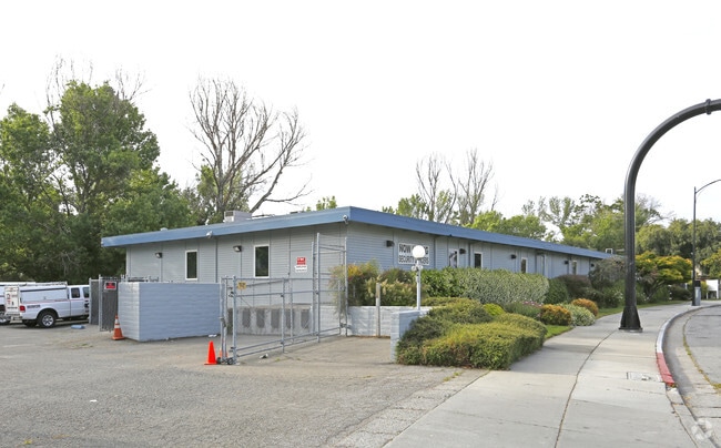
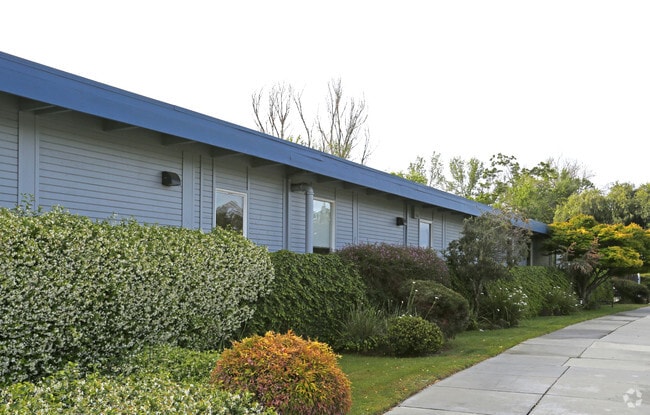
Property Record
150 S Barack Obama Blvd, San Jose, CA 95110

NEARBY LISTINGS FOR SALE OR LEASE
Property Detail
150 S Barack Obama Blvd
259-48-071
Los Coches Rho
Financialbuilding
Santa Clara
D
California
06085C0234H
0.65 AC
2024
Downtown San Jose
2025
South Bay/San Jose
500300
San Jose-Sunnyvale-Santa Clara, CA
12,000 SF
DEMOGRAPHICS near 150 S Barack Obama Blvd
1 Mile
3 Mile
5 Mile
2024 Total Population
36,137
230,090
642,925
2029 Population
35,523
222,437
618,660
Pop Growth 2024-2029
(1.70%)
(3.33%)
(3.77%)
Average Age
38
38
39
2024 Total Households
15,587
84,133
216,363
HH Growth 2024-2029
(1.73%)
(3.41%)
(3.88%)
Median Household Inc
$124,531
$105,684
$113,614
Avg Household Size
2.20
2.50
2.80
2024 Avg HH Vehicles
2.00
2.00
2.00
Median Home Value
$998,233
$1,051,629
$1,039,444
Median Year Built
2000
1972
1972
Nearby Places
- Restaurants
- Banks
- Shops
- Fitness
- Groceries
PUBLIC TRANSPORTATION
TRANSIT/SUBWAY
San Fernando Station (Mountain View - Winchester Line - VTA, Old Ironsides - Winchester - VTA, Old Ironsides - Winchester Modified-S - VTA)
DRIVE
WALK
Distance
San Fernando Station (Mountain View - Winchester Line - VTA, Old Ironsides - Winchester - VTA, Old Ironsides - Winchester Modified-S - VTA)
1 min
4 min
0.2 mi
San Jose Diridon Station (Mountain View - Winchester Line - VTA, Old Ironsides - Winchester - VTA, Old Ironsides - Winchester Modified-S - VTA)
DRIVE
WALK
Distance
San Jose Diridon Station (Mountain View - Winchester Line - VTA, Old Ironsides - Winchester - VTA, Old Ironsides - Winchester Modified-S - VTA)
2 min
7 min
0.4 mi
Children's Discovery Museum Station (Alum Rock - Santa Teresa Line - VTA, Baypointe - Santa Teresa - VTA, Baypointe - Santa Teresa Modified-S - VTA)
DRIVE
WALK
Distance
Children's Discovery Museum Station (Alum Rock - Santa Teresa Line - VTA, Baypointe - Santa Teresa - VTA, Baypointe - Santa Teresa Modified-S - VTA)
1 min
11 min
0.6 mi
Convention Center Station (Baypointe - Santa Teresa - VTA, Baypointe - Santa Teresa Modified-S - VTA, Old Ironsides - Winchester - VTA, Old Ironsides - Winchester Modified-S - VTA)
DRIVE
WALK
Distance
Convention Center Station (Baypointe - Santa Teresa - VTA, Baypointe - Santa Teresa Modified-S - VTA, Old Ironsides - Winchester - VTA, Old Ironsides - Winchester Modified-S - VTA)
2 min
15 min
0.8 mi
Convention Center Station (Alum Rock - Santa Teresa Line - Santa Clara VTA Light Rail, Mountain View - Winchester Line - Santa Clara VTA Light Rail)
DRIVE
WALK
Distance
Convention Center Station (Alum Rock - Santa Teresa Line - Santa Clara VTA Light Rail, Mountain View - Winchester Line - Santa Clara VTA Light Rail)
2 min
15 min
0.8 mi
COMMUTER RAIL
San Jose (Capitol Corridor - Capitol Corridor Joint Powers Authority)
DRIVE
WALK
Distance
San Jose (Capitol Corridor - Capitol Corridor Joint Powers Authority)
0 min
5 min
0.3 mi
San Jose Diridon (Altamont Corridor Express - Altamont Commuter Express (ACE), Caltrain - Altamont Commuter Express (ACE), Express - Altamont Commuter Express (ACE), Limited - Altamont Commuter Express (ACE), Local Weekday - Altamont Commuter Express (ACE), Local Weekend - Altamont Commuter Express (ACE), South Santa Clara County Connector - Altamont Commuter Express (ACE))
DRIVE
WALK
Distance
San Jose Diridon (Altamont Corridor Express - Altamont Commuter Express (ACE), Caltrain - Altamont Commuter Express (ACE), Express - Altamont Commuter Express (ACE), Limited - Altamont Commuter Express (ACE), Local Weekday - Altamont Commuter Express (ACE), Local Weekend - Altamont Commuter Express (ACE), South Santa Clara County Connector - Altamont Commuter Express (ACE))
1 min
5 min
0.3 mi
AIRPORT
Norman Y Mineta San Jose International
DRIVE
WALK
Distance
Norman Y Mineta San Jose International
7 min
3.3 mi
Freight Ports
Port of Redwood City
DRIVE
WALK
Distance
Port of Redwood City
30 min
23.4 mi
Nearby Properties
Address
Land Use
TOTAL SIZE
Lot Size
Zoning
Address
Land Use
TOTAL SIZE
Lot Size
Zoning
2.50 AC
DC
Address
Land Use
TOTAL SIZE
Lot Size
Zoning
576,892 SF
8.28 AC
APD
Address
Land Use
TOTAL SIZE
Lot Size
Zoning
194,790 SF
5.30 AC
APDCI
Address
Land Use
TOTAL SIZE
Lot Size
Zoning
1.73 AC
DC
Address
Land Use
TOTAL SIZE
Lot Size
Zoning
837,391 SF
1.42 AC
DC
Address
Land Use
TOTAL SIZE
Lot Size
Zoning
4.56 AC
CP
Address
Land Use
TOTAL SIZE
Lot Size
Zoning
320,000 SF
15.18 AC
APD
Address
Land Use
TOTAL SIZE
Lot Size
Zoning
457,162 SF
3.97 AC
A(PD)
Address
Land Use
TOTAL SIZE
Lot Size
Zoning
486,104 SF
5.43 AC
ML
Address
Land Use
TOTAL SIZE
Lot Size
Zoning
617,814 SF
21.96 AC
CG
Address
Land Use
TOTAL SIZE
Lot Size
Zoning
194,530 SF
12.26 AC
APD
Address
Land Use
TOTAL SIZE
Lot Size
Zoning
590,000 SF
2.33 AC
C3
Address
Land Use
TOTAL SIZE
Lot Size
Zoning
67,435 SF
11.93 AC
C2
Address
Land Use
TOTAL SIZE
Lot Size
Zoning
557,448 SF
1.46 AC
DC
Address
Land Use
TOTAL SIZE
Lot Size
Zoning
333,472 SF
1.24 AC
APD
Address
Land Use
TOTAL SIZE
Lot Size
Zoning
289,503 SF
0.97 AC
DC
Address
Land Use
TOTAL SIZE
Lot Size
Zoning
330,927 SF
2.35 AC
M1
Address
Land Use
TOTAL SIZE
Lot Size
Zoning
445,687 SF
6.44 AC
A(PD)
Address
Land Use
TOTAL SIZE
Lot Size
Zoning
3.40 AC
APD
Address
Land Use
TOTAL SIZE
Lot Size
Zoning
298,461 SF
5.45 AC
C3H
Address
Land Use
TOTAL SIZE
Lot Size
Zoning
340,000 SF
0.65 AC
CG(PD
Address
Land Use
TOTAL SIZE
Lot Size
Zoning
4.75 AC
CP-PD
Address
Land Use
TOTAL SIZE
Lot Size
Zoning
234,622 SF
1.89 AC
A(PD)
Address
Land Use
TOTAL SIZE
Lot Size
Zoning
194,549 SF
2.76 AC
APDCI
Address
Land Use
TOTAL SIZE
Lot Size
Zoning
381,000 SF
1.40 AC
DC
Address
Land Use
TOTAL SIZE
Lot Size
Zoning
11.96 AC
M4
Address
Land Use
TOTAL SIZE
Lot Size
Zoning
429,535 SF
7.44 AC
C
Address
Land Use
TOTAL SIZE
Lot Size
Zoning
491,622 SF
4.18 AC
A(PD)
Address
Land Use
TOTAL SIZE
Lot Size
Zoning
286,350 SF
0.80 AC
C
The World's #1 Commercial Real Estate Marketplace
Connect with us
© 2025 CoStar Group
The information above has been obtained from sources believed reliable. While we do not doubt its accuracy we have not verified it and make no guarantee, warranty or representation about it. It is your responsibility to independently confirm its accuracy and completeness. Any projections, opinions, assumptions, or estimates used are for example only and do not represent the current or future performance of the property. The value of this transaction to you depends on tax and other factors which should be evaluated by your tax, financial, and legal advisors. You and your advisors should conduct a careful, independent investigation of the property to determine to your satisfaction the suitability of the property for your needs.