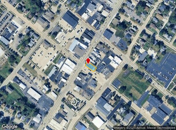
Property Record
150 S Main St, Morton, IL 61550

Current Lease Availabilities
NEARBY LISTINGS FOR SALE OR LEASE
-
-
View all Morton listings for lease on LoopNet.com
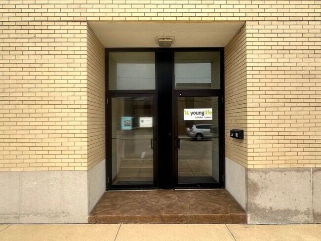
Property Detail
150 S Main St
Peoria, IL
J M Campbells 1St Addn
06-06-20-233-010
SEC 20 T25N R3W J M CAMPBELLS 1ST ADDN LOT 7 & S 12 X 116 X 9.9 LOT 6 IN BLK 1 NE 1/4
Storebuilding
Tazewell
X
Illinois
17179C0202E
7,6
2023
0.15 AC
2024
Outlying Tazewell County
021605
Peoria
9,328 SF
DEMOGRAPHICS near 150 S Main St
1 Mile
3 Mile
5 Mile
2024 Total Population
7,062
17,532
24,983
2029 Population
6,917
17,277
24,624
Pop Growth 2024-2029
(2.05%)
(1.45%)
(1.44%)
Average Age
40
42
42
2024 Total Households
2,964
7,089
10,094
HH Growth 2024-2029
(2.36%)
(1.66%)
(1.60%)
Median Household Inc
$75,511
$82,341
$81,042
Avg Household Size
2.30
2.40
2.40
2024 Avg HH Vehicles
2.00
2.00
2.00
Median Home Value
$183,361
$208,333
$197,367
Median Year Built
1966
1974
1973
Nearby Places
Map Layers
Map Styles
 Street
 Aerial
- Restaurants
- Banks
- Shops
- Fitness
- Groceries
PUBLIC TRANSPORTATION
AIRPORT
General Downing - Peoria International
DRIVE
WALK
Distance
General Downing - Peoria International
23 min
15.7 mi
Central Il Regional/Bloomington-Normal
DRIVE
WALK
Distance
Central Il Regional/Bloomington-Normal
50 min
36.6 mi
Nearby Properties
Address
Land Use
TOTAL SIZE
Lot Size
Zoning
Address
Land Use
TOTAL SIZE
Lot Size
Zoning
61.31 AC
Address
Land Use
TOTAL SIZE
Lot Size
Zoning
240,900 SF
117.64 AC
Address
Land Use
TOTAL SIZE
Lot Size
Zoning
39,328 SF
5.60 AC
Address
Land Use
TOTAL SIZE
Lot Size
Zoning
95,880 SF
5.38 AC
Address
Land Use
TOTAL SIZE
Lot Size
Zoning
81,129 SF
12.05 AC
Address
Land Use
TOTAL SIZE
Lot Size
Zoning
156,812 SF
20.54 AC
Address
Land Use
TOTAL SIZE
Lot Size
Zoning
7.81 AC
Address
Land Use
TOTAL SIZE
Lot Size
Zoning
122,084 SF
8.12 AC
Address
Land Use
TOTAL SIZE
Lot Size
Zoning
117,138 SF
24.53 AC
Address
Land Use
TOTAL SIZE
Lot Size
Zoning
110,434 SF
11.67 AC
Address
Land Use
TOTAL SIZE
Lot Size
Zoning
122,500 SF
11 AC
Address
Land Use
TOTAL SIZE
Lot Size
Zoning
125,182 SF
13.12 AC
Address
Land Use
TOTAL SIZE
Lot Size
Zoning
227,653 SF
12 AC
Address
Land Use
TOTAL SIZE
Lot Size
Zoning
91,468 SF
11.75 AC
Address
Land Use
TOTAL SIZE
Lot Size
Zoning
104,000 SF
15.41 AC
Address
Land Use
TOTAL SIZE
Lot Size
Zoning
47,900 SF
8.88 AC
Address
Land Use
TOTAL SIZE
Lot Size
Zoning
100,000 SF
14.91 AC
Address
Land Use
TOTAL SIZE
Lot Size
Zoning
77,186 SF
4 AC
Address
Land Use
TOTAL SIZE
Lot Size
Zoning
50,616 SF
4.43 AC
Address
Land Use
TOTAL SIZE
Lot Size
Zoning
131,230 SF
10.86 AC
Address
Land Use
TOTAL SIZE
Lot Size
Zoning
124,200 SF
8.60 AC
Address
Land Use
TOTAL SIZE
Lot Size
Zoning
257,649 SF
15.79 AC
Address
Land Use
TOTAL SIZE
Lot Size
Zoning
75,838 SF
5.55 AC
Address
Land Use
TOTAL SIZE
Lot Size
Zoning
71,502 SF
7.90 AC
Address
Land Use
TOTAL SIZE
Lot Size
Zoning
163,000 SF
7.01 AC
Address
Land Use
TOTAL SIZE
Lot Size
Zoning
103,341 SF
15.76 AC
Address
Land Use
TOTAL SIZE
Lot Size
Zoning
105,463 SF
7.67 AC
Address
Land Use
TOTAL SIZE
Lot Size
Zoning
88,568 SF
1.36 AC
Address
Land Use
TOTAL SIZE
Lot Size
Zoning
76,438 SF
3.87 AC
Address
Land Use
TOTAL SIZE
Lot Size
Zoning
79,788 SF
30 AC
The World's #1 Commercial Real Estate Marketplace
Connect with us
© 2026 CoStar Group
The information above has been obtained from sources believed reliable. While we do not doubt its accuracy we have not verified it and make no guarantee, warranty or representation about it. It is your responsibility to independently confirm its accuracy and completeness. Any projections, opinions, assumptions, or estimates used are for example only and do not represent the current or future performance of the property. The value of this transaction to you depends on tax and other factors which should be evaluated by your tax, financial, and legal advisors. You and your advisors should conduct a careful, independent investigation of the property to determine to your satisfaction the suitability of the property for your needs.