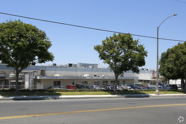
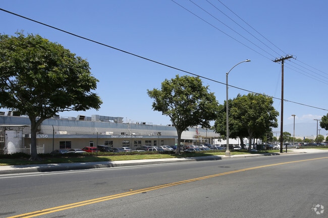
Property Record
150 S Maple St, Corona, CA 92878

Property Detail
150 S Maple St
Riverside-San Bernardino-Ontario, CA
34.31 ACRES M/L IN POR PAR 3 AND PAR 4 RS 056/023
102-040-023
Riverside
Lightindustrial
California
B and X Area of moderate flood hazard, usually the area between the limits of the 100-year and 500-year floods.
3,4
2024
34.31 AC
2025
Corona/Eastvale
041601
Inland Empire (California)
724,238 SF
NEARBY LISTINGS FOR SALE OR LEASE
DEMOGRAPHICS near 150 S Maple St
1 mile
3 mile
5 mile
2025 Total Population
7,578
88,102
182,302
2030 Population
7,671
89,432
185,195
Pop Growth 2025-2030
+ 1.23%
+ 1.51%
+ 1.59%
Average Age
36
37
38
2025 Total Households
2,244
25,427
52,045
HH Growth 2025-2030
+ 0.67%
+ 0.95%
+ 1.10%
Median Household Inc
$80,301
$99,899
$111,004
Avg Household Size
3.30
3.20
3.30
2025 Avg HH Vehicles
2.00
2.00
2.00
Median Home Value
$632,332
$721,151
$734,354
Median Year Built
1975
1983
1988
Nearby Places
Map Layers
Map Styles
 Street
 Aerial
Transit
 Traffic
 Biking
Places
Listings with unknown addresses are not visible on the map
- Restaurants
- Banks
- Shops
- Fitness
- Groceries
PUBLIC TRANSPORTATION
COMMUTER RAIL
West Corona (91 Line - Southern California Regional Rail Authority (Metrolink), Inland Empire-Orange County Line - Southern California Regional Rail Authority (Metrolink))
Drive
Walk
Distance
West Corona (91 Line - Southern California Regional Rail Authority (Metrolink), Inland Empire-Orange County Line - Southern California Regional Rail Authority (Metrolink))
2 min
13 min
0.7 mi
North Main Corona (91 Line - Southern California Regional Rail Authority (Metrolink), Inland Empire-Orange County Line - Southern California Regional Rail Authority (Metrolink))
Drive
Walk
Distance
North Main Corona (91 Line - Southern California Regional Rail Authority (Metrolink), Inland Empire-Orange County Line - Southern California Regional Rail Authority (Metrolink))
6 min
3.2 mi
AIRPORT
Ontario International
Drive
Walk
Distance
Ontario International
26 min
18.5 mi
John Wayne/Orange County
Drive
Walk
Distance
John Wayne/Orange County
32 min
26.1 mi
Freight Ports
Port of Long Beach
Drive
Walk
Distance
Port of Long Beach
53 min
40.1 mi
Nearby Properties
Address
Land Use
TOTAL SIZE
Lot Size
Zoning
Address
Land Use
TOTAL SIZE
Lot Size
Zoning
12.69 AC
Address
Land Use
TOTAL SIZE
Lot Size
Zoning
91,619 SF
12.54 AC
HDR
Address
Land Use
TOTAL SIZE
Lot Size
Zoning
29,695 SF
18.71 AC
R3
Address
Land Use
TOTAL SIZE
Lot Size
Zoning
263,872 SF
12.87 AC
Address
Land Use
TOTAL SIZE
Lot Size
Zoning
24,144 SF
13.34 AC
R3
Address
Land Use
TOTAL SIZE
Lot Size
Zoning
245,658 SF
15.38 AC
PD
Address
Land Use
TOTAL SIZE
Lot Size
Zoning
182,066 SF
9.31 AC
Address
Land Use
TOTAL SIZE
Lot Size
Zoning
421,898 SF
3 AC
Address
Land Use
TOTAL SIZE
Lot Size
Zoning
217,299 SF
7.41 AC
Address
Land Use
TOTAL SIZE
Lot Size
Zoning
141,280 SF
9.31 AC
Address
Land Use
TOTAL SIZE
Lot Size
Zoning
159,517 SF
7.81 AC
Address
Land Use
TOTAL SIZE
Lot Size
Zoning
140,216 SF
6.43 AC
Address
Land Use
TOTAL SIZE
Lot Size
Zoning
145,424 SF
7.23 AC
Address
Land Use
TOTAL SIZE
Lot Size
Zoning
357,900 SF
18.93 AC
Address
Land Use
TOTAL SIZE
Lot Size
Zoning
311,297 SF
13.39 AC
Address
Land Use
TOTAL SIZE
Lot Size
Zoning
482,479 SF
26.14 AC
M2
Address
Land Use
TOTAL SIZE
Lot Size
Zoning
63,130 SF
10.20 AC
R3
Address
Land Use
TOTAL SIZE
Lot Size
Zoning
203,476 SF
10.40 AC
C3
Address
Land Use
TOTAL SIZE
Lot Size
Zoning
105,813 SF
3.54 AC
Address
Land Use
TOTAL SIZE
Lot Size
Zoning
105,813 SF
3.50 AC
A144
Address
Land Use
TOTAL SIZE
Lot Size
Zoning
110,334 SF
11 AC
NCD
Address
Land Use
TOTAL SIZE
Lot Size
Zoning
128,674 SF
6.71 AC
M1
Address
Land Use
TOTAL SIZE
Lot Size
Zoning
95,028 SF
5.44 AC
Address
Land Use
TOTAL SIZE
Lot Size
Zoning
321,700 SF
15.01 AC
M2
Address
Land Use
TOTAL SIZE
Lot Size
Zoning
185,736 SF
9.90 AC
Address
Land Use
TOTAL SIZE
Lot Size
Zoning
98,000 SF
5.17 AC
Address
Land Use
TOTAL SIZE
Lot Size
Zoning
150,375 SF
7.11 AC
Address
Land Use
TOTAL SIZE
Lot Size
Zoning
188,875 SF
9.37 AC
The World's #1 Commercial Real Estate Marketplace
Connect with us
© 2026 CoStar Group
The information above has been obtained from sources believed reliable. While we do not doubt its accuracy we have not verified it and make no guarantee, warranty or representation about it. It is your responsibility to independently confirm its accuracy and completeness. Any projections, opinions, assumptions, or estimates used are for example only and do not represent the current or future performance of the property. The value of this transaction to you depends on tax and other factors which should be evaluated by your tax, financial, and legal advisors. You and your advisors should conduct a careful, independent investigation of the property to determine to your satisfaction the suitability of the property for your needs.