Property Record
150 Smith Rd, Saint Charles, IL 60174
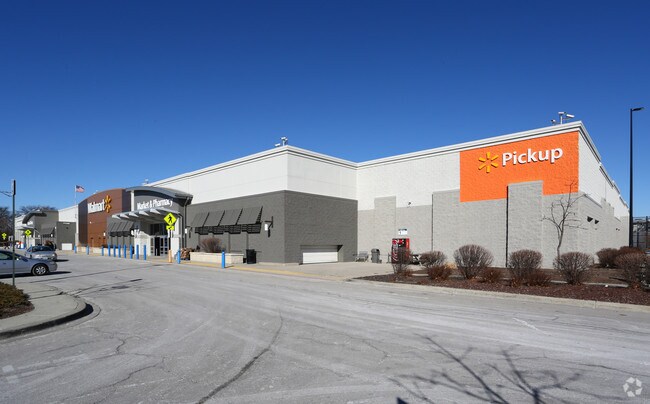

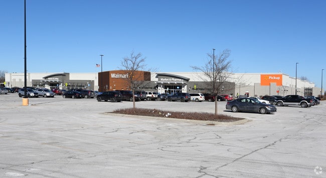
Property Detail
150 Smith Rd
01-30-101-020
WAL-MART ST CHARLES RESUB ALL
Commercialnec
DUPAGE
C
Illinois
B and X Area of moderate flood hazard, usually the area between the limits of the 100-year and 500-year floods.
1
2024
19.37 AC
2024
Western East/West Corr
841313
Chicago
143,539 SF
Chicago-Naperville-Elgin, IL-IN
NEARBY LISTINGS FOR SALE OR LEASE
DEMOGRAPHICS near 150 Smith Rd
1 mile
3 mile
5 mile
2025 Total Population
5,594
31,097
111,756
2030 Population
5,698
31,341
112,459
Pop Growth 2025-2030
+ 1.86%
+ 0.78%
+ 0.63%
Average Age
42
43
41
2025 Total Households
1,900
11,774
39,860
HH Growth 2025-2030
+ 1.95%
+ 0.78%
+ 0.63%
Median Household Inc
$141,238
$118,695
$118,999
Avg Household Size
2.90
2.60
2.70
2025 Avg HH Vehicles
2.00
2.00
2.00
Median Home Value
$439,062
$383,113
$385,492
Median Year Built
1996
1987
1984
Nearby Places
Map Layers
Map Styles
 Street
 Aerial
Layers
 Traffic
 Biking
Places
Listings with unknown addresses are not visible on the map
- Restaurants
- Banks
- Shops
- Fitness
- Groceries
PUBLIC TRANSPORTATION
COMMUTER RAIL
Geneva Station (Union Pacific West Line - Northeast Illinois Regional Commuter Railroad (Metra))
Drive
Walk
Distance
Geneva Station (Union Pacific West Line - Northeast Illinois Regional Commuter Railroad (Metra))
12 min
5.5 mi
West Chicago Station (Union Pacific West Line - Northeast Illinois Regional Commuter Railroad (Metra))
Drive
Walk
Distance
West Chicago Station (Union Pacific West Line - Northeast Illinois Regional Commuter Railroad (Metra))
12 min
5.9 mi
AIRPORT
Chicago O'Hare International
Drive
Walk
Distance
Chicago O'Hare International
45 min
28.0 mi
Chicago Midway International
Drive
Walk
Distance
Chicago Midway International
54 min
32.9 mi
Nearby Properties
Address
Land Use
TOTAL SIZE
Lot Size
Zoning
Address
Land Use
TOTAL SIZE
Lot Size
Zoning
5,482 SF
21.55 AC
Address
Land Use
TOTAL SIZE
Lot Size
Zoning
124,474 SF
25.38 AC
Address
Land Use
TOTAL SIZE
Lot Size
Zoning
Address
Land Use
TOTAL SIZE
Lot Size
Zoning
75.23 AC
Address
Land Use
TOTAL SIZE
Lot Size
Zoning
11.08 AC
Address
Land Use
TOTAL SIZE
Lot Size
Zoning
667,636 SF
38 AC
Address
Land Use
TOTAL SIZE
Lot Size
Zoning
306,375 SF
23.82 AC
Address
Land Use
TOTAL SIZE
Lot Size
Zoning
17.54 AC
Address
Land Use
TOTAL SIZE
Lot Size
Zoning
18.39 AC
Address
Land Use
TOTAL SIZE
Lot Size
Zoning
4,500 SF
11 AC
Address
Land Use
TOTAL SIZE
Lot Size
Zoning
178,890 SF
34.20 AC
Address
Land Use
TOTAL SIZE
Lot Size
Zoning
168,302 SF
13.78 AC
I
Address
Land Use
TOTAL SIZE
Lot Size
Zoning
474,191 SF
29.95 AC
I
Address
Land Use
TOTAL SIZE
Lot Size
Zoning
14.98 AC
Address
Land Use
TOTAL SIZE
Lot Size
Zoning
36,199 SF
5.84 AC
Address
Land Use
TOTAL SIZE
Lot Size
Zoning
321,702 SF
22.39 AC
Address
Land Use
TOTAL SIZE
Lot Size
Zoning
258,768 SF
28.43 AC
Address
Land Use
TOTAL SIZE
Lot Size
Zoning
18,861 SF
135.23 AC
Address
Land Use
TOTAL SIZE
Lot Size
Zoning
291,219 SF
12.25 AC
I
Address
Land Use
TOTAL SIZE
Lot Size
Zoning
13.46 AC
Address
Land Use
TOTAL SIZE
Lot Size
Zoning
216,354 SF
16.05 AC
Address
Land Use
TOTAL SIZE
Lot Size
Zoning
48,087 SF
17.49 AC
Address
Land Use
TOTAL SIZE
Lot Size
Zoning
Address
Land Use
TOTAL SIZE
Lot Size
Zoning
140,232 SF
9.22 AC
Address
Land Use
TOTAL SIZE
Lot Size
Zoning
176,024 SF
16.84 AC
Address
Land Use
TOTAL SIZE
Lot Size
Zoning
83,167 SF
4.46 AC
C
Address
Land Use
TOTAL SIZE
Lot Size
Zoning
59,994 SF
4.86 AC
Address
Land Use
TOTAL SIZE
Lot Size
Zoning
174,754 SF
11.23 AC
The World's #1 Commercial Real Estate Marketplace
Connect with us
© 2026 CoStar Group
The information above has been obtained from sources believed reliable. While we do not doubt its accuracy we have not verified it and make no guarantee, warranty or representation about it. It is your responsibility to independently confirm its accuracy and completeness. Any projections, opinions, assumptions, or estimates used are for example only and do not represent the current or future performance of the property. The value of this transaction to you depends on tax and other factors which should be evaluated by your tax, financial, and legal advisors. You and your advisors should conduct a careful, independent investigation of the property to determine to your satisfaction the suitability of the property for your needs.