Property Record
150 W Fm, Driftwood, TX 78619


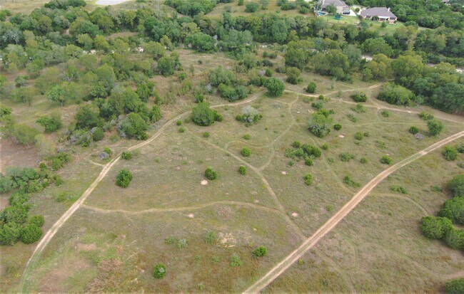

Property Detail
150 W Fm
Austin-Round Rock-San Marcos, TX
J V ASH JR SUBD, LOT 5, ACRES 10
R149614
HAYS
Residentialacreage
Texas
AE The base floodplain where base flood elevations are provided. AE Zones are now used on new format FIRMs instead of A1-A30 Zones.
5
2024
10 AC
2025
Hays County
010812
Austin
NEARBY LISTINGS FOR SALE OR LEASE
-
-
View all Driftwood listings for sale on LoopNet.com
DEMOGRAPHICS near 150 W Fm
1 mile
3 mile
5 mile
2024 Total Population
502
7,076
30,518
2029 Population
660
9,382
40,470
Pop Growth 2024-2029
+ 31.47%
+ 32.59%
+ 32.61%
Average Age
41
39
39
2024 Total Households
179
2,355
10,481
HH Growth 2024-2029
+ 32.40%
+ 33.50%
+ 33.66%
Median Household Inc
$131,250
$150,375
$145,271
Avg Household Size
2.80
3.00
2.90
2024 Avg HH Vehicles
3.00
2.00
2.00
Median Home Value
$763,888
$683,164
$634,740
Median Year Built
2010
2010
2010
Nearby Places
Map Layers
Map Styles
 Street
 Aerial
Transit
 Traffic
 Biking
Places
Listings with unknown addresses are not visible on the map
- Restaurants
- Banks
- Shops
- Fitness
- Groceries
PUBLIC TRANSPORTATION
AIRPORT
Austin-Bergstrom International
Drive
Walk
Distance
Austin-Bergstrom International
49 min
30.7 mi
Freight Ports
Calhoun Port
Drive
Walk
Distance
Calhoun Port
198 min
161.8 mi
SALE & LEASE HISTORY
LISTING DATE
SALE/LEASE

Jan 04, 2022
For Sale
Nearby Properties
Address
Land Use
TOTAL SIZE
Lot Size
Zoning
Address
Land Use
TOTAL SIZE
Lot Size
Zoning
199,572 SF
9.63 AC
Address
Land Use
TOTAL SIZE
Lot Size
Zoning
840 SF
37.50 AC
Address
Land Use
TOTAL SIZE
Lot Size
Zoning
Address
Land Use
TOTAL SIZE
Lot Size
Zoning
2,840 SF
15.83 AC
Address
Land Use
TOTAL SIZE
Lot Size
Zoning
600 SF
12.61 AC
Address
Land Use
TOTAL SIZE
Lot Size
Zoning
82,488 SF
20.23 AC
Address
Land Use
TOTAL SIZE
Lot Size
Zoning
4,844 SF
13.44 AC
Address
Land Use
TOTAL SIZE
Lot Size
Zoning
150.74 AC
Address
Land Use
TOTAL SIZE
Lot Size
Zoning
Address
Land Use
TOTAL SIZE
Lot Size
Zoning
129.32 AC
Address
Land Use
TOTAL SIZE
Lot Size
Zoning
400 SF
11.74 AC
Address
Land Use
TOTAL SIZE
Lot Size
Zoning
15,000 SF
13.58 AC
Address
Land Use
TOTAL SIZE
Lot Size
Zoning
12,197 SF
1.21 AC
Address
Land Use
TOTAL SIZE
Lot Size
Zoning
23,742 SF
31.02 AC
Address
Land Use
TOTAL SIZE
Lot Size
Zoning
3,420 SF
3.65 AC
Address
Land Use
TOTAL SIZE
Lot Size
Zoning
40.58 AC
Address
Land Use
TOTAL SIZE
Lot Size
Zoning
26,500 SF
10 AC
Address
Land Use
TOTAL SIZE
Lot Size
Zoning
12,780 SF
83.76 AC
Address
Land Use
TOTAL SIZE
Lot Size
Zoning
13,467 SF
44.39 AC
Address
Land Use
TOTAL SIZE
Lot Size
Zoning
7,716 SF
2.41 AC
Address
Land Use
TOTAL SIZE
Lot Size
Zoning
8,824 SF
0.99 AC
Address
Land Use
TOTAL SIZE
Lot Size
Zoning
9,600 SF
5.77 AC
Address
Land Use
TOTAL SIZE
Lot Size
Zoning
8,985 SF
1.03 AC
Address
Land Use
TOTAL SIZE
Lot Size
Zoning
9,520 SF
0.83 AC
Address
Land Use
TOTAL SIZE
Lot Size
Zoning
12,393 SF
1.88 AC
Address
Land Use
TOTAL SIZE
Lot Size
Zoning
22,729 SF
8 AC
Address
Land Use
TOTAL SIZE
Lot Size
Zoning
Address
Land Use
TOTAL SIZE
Lot Size
Zoning
10,480 SF
54.75 AC
Address
Land Use
TOTAL SIZE
Lot Size
Zoning
6,461 SF
1.46 AC
Address
Land Use
TOTAL SIZE
Lot Size
Zoning
11,020 SF
1.52 AC
The World's #1 Commercial Real Estate Marketplace
Connect with us
© 2026 CoStar Group
The information above has been obtained from sources believed reliable. While we do not doubt its accuracy we have not verified it and make no guarantee, warranty or representation about it. It is your responsibility to independently confirm its accuracy and completeness. Any projections, opinions, assumptions, or estimates used are for example only and do not represent the current or future performance of the property. The value of this transaction to you depends on tax and other factors which should be evaluated by your tax, financial, and legal advisors. You and your advisors should conduct a careful, independent investigation of the property to determine to your satisfaction the suitability of the property for your needs.