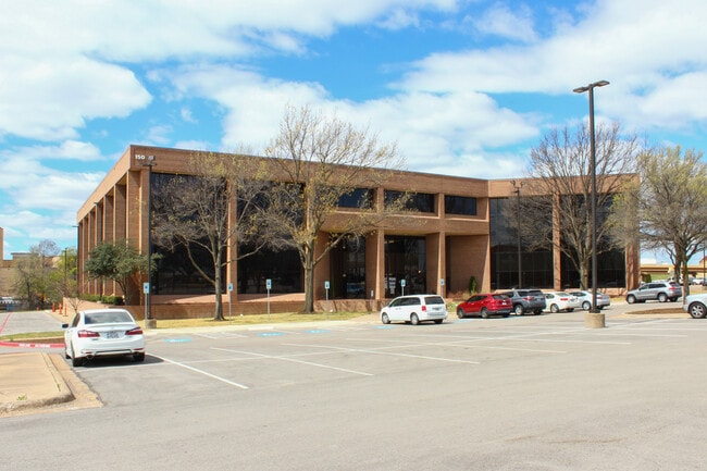
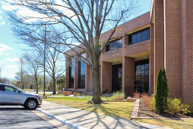
Property Record
150 Westpark Way, Euless, TX 76040

Current Lease Availabilities
Property Detail
150 Westpark Way
Dallas-Fort Worth-Arlington, TX
WESTPARK CENTRAL BLOCK 1 LOT 3R1
05668700
TARRANT
Commercialnec
Texas
AE The base floodplain where base flood elevations are provided. AE Zones are now used on new format FIRMs instead of A1-A30 Zones.
3
2023
4.32 AC
2025
HEB/Mid-Cities
113512
Dallas/Ft Worth
75,733 SF
NEARBY LISTINGS FOR SALE OR LEASE
DEMOGRAPHICS near 150 Westpark Way
1 mile
3 mile
5 mile
2025 Total Population
16,071
119,807
266,425
2030 Population
16,798
125,922
280,482
Pop Growth 2025-2030
+ 4.52%
+ 5.10%
+ 5.28%
Average Age
39
39
39
2025 Total Households
7,182
48,044
110,127
HH Growth 2025-2030
+ 4.65%
+ 5.19%
+ 5.31%
Median Household Inc
$70,399
$81,271
$83,022
Avg Household Size
2.20
2.40
2.40
2025 Avg HH Vehicles
2.00
2.00
2.00
Median Home Value
$340,392
$361,059
$387,591
Median Year Built
1986
1983
1986
Nearby Places
Map Layers
Map Styles
 Street
 Aerial
Transit
 Traffic
 Biking
Places
Listings with unknown addresses are not visible on the map
- Restaurants
- Banks
- Shops
- Fitness
- Groceries
PUBLIC TRANSPORTATION
COMMUTER RAIL
Drive
Walk
Distance
8 min
3.6 mi
Drive
Walk
Distance
10 min
5.4 mi
AIRPORT
Dallas-Fort Worth International
Drive
Walk
Distance
Dallas-Fort Worth International
16 min
9.8 mi
Dallas Love Field
Drive
Walk
Distance
Dallas Love Field
26 min
18.5 mi
Nearby Properties
Address
Land Use
TOTAL SIZE
Lot Size
Zoning
Address
Land Use
TOTAL SIZE
Lot Size
Zoning
631,558 SF
15.49 AC
Address
Land Use
TOTAL SIZE
Lot Size
Zoning
394,769 SF
20.36 AC
Address
Land Use
TOTAL SIZE
Lot Size
Zoning
415,563 SF
25.40 AC
Address
Land Use
TOTAL SIZE
Lot Size
Zoning
521,200 SF
7.99 AC
Address
Land Use
TOTAL SIZE
Lot Size
Zoning
548,095 SF
7.19 AC
Address
Land Use
TOTAL SIZE
Lot Size
Zoning
419,655 SF
20.44 AC
Address
Land Use
TOTAL SIZE
Lot Size
Zoning
363,849 SF
8.08 AC
Address
Land Use
TOTAL SIZE
Lot Size
Zoning
290,680 SF
26.31 AC
Address
Land Use
TOTAL SIZE
Lot Size
Zoning
348,842 SF
17.09 AC
Address
Land Use
TOTAL SIZE
Lot Size
Zoning
345,961 SF
14.73 AC
Address
Land Use
TOTAL SIZE
Lot Size
Zoning
356,000 SF
39.44 AC
Address
Land Use
TOTAL SIZE
Lot Size
Zoning
1,544,748 SF
76.25 AC
Address
Land Use
TOTAL SIZE
Lot Size
Zoning
282,665 SF
14.29 AC
Address
Land Use
TOTAL SIZE
Lot Size
Zoning
172,000 SF
6.34 AC
Address
Land Use
TOTAL SIZE
Lot Size
Zoning
223,131 SF
12.50 AC
Address
Land Use
TOTAL SIZE
Lot Size
Zoning
236,016 SF
12.81 AC
Address
Land Use
TOTAL SIZE
Lot Size
Zoning
79,244 SF
54.50 AC
Address
Land Use
TOTAL SIZE
Lot Size
Zoning
269,700 SF
48.40 AC
Address
Land Use
TOTAL SIZE
Lot Size
Zoning
236,701 SF
15.96 AC
Address
Land Use
TOTAL SIZE
Lot Size
Zoning
211,449 SF
11.30 AC
Address
Land Use
TOTAL SIZE
Lot Size
Zoning
208,238 SF
12.55 AC
Address
Land Use
TOTAL SIZE
Lot Size
Zoning
346,112 SF
15.89 AC
Address
Land Use
TOTAL SIZE
Lot Size
Zoning
266,000 SF
0.56 AC
Address
Land Use
TOTAL SIZE
Lot Size
Zoning
186,377 SF
20.59 AC
Address
Land Use
TOTAL SIZE
Lot Size
Zoning
224,654 SF
15.98 AC
Address
Land Use
TOTAL SIZE
Lot Size
Zoning
187,382 SF
5.96 AC
Address
Land Use
TOTAL SIZE
Lot Size
Zoning
161,332 SF
8.56 AC
Address
Land Use
TOTAL SIZE
Lot Size
Zoning
201,121 SF
8.96 AC
Address
Land Use
TOTAL SIZE
Lot Size
Zoning
210,072 SF
16.84 AC
Address
Land Use
TOTAL SIZE
Lot Size
Zoning
170,141 SF
9.18 AC
The World's #1 Commercial Real Estate Marketplace
Connect with us
© 2026 CoStar Group
The information above has been obtained from sources believed reliable. While we do not doubt its accuracy we have not verified it and make no guarantee, warranty or representation about it. It is your responsibility to independently confirm its accuracy and completeness. Any projections, opinions, assumptions, or estimates used are for example only and do not represent the current or future performance of the property. The value of this transaction to you depends on tax and other factors which should be evaluated by your tax, financial, and legal advisors. You and your advisors should conduct a careful, independent investigation of the property to determine to your satisfaction the suitability of the property for your needs.