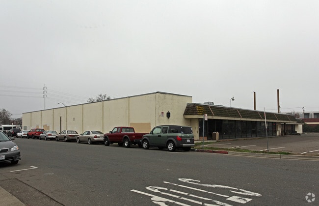
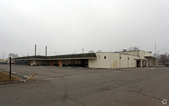
Property Record
1500 67Th St, Sacramento, CA 95819


NEARBY LISTINGS FOR SALE OR LEASE
Property Detail
1500 67Th St
015-0010-046
, BLDG 0
Apartment
Sacramento
X
California
06067C0195H
1.57 AC
2024
East Sacramento
2025
Sacramento
001601
Sacramento--Roseville--Arden-Arcade, CA
31,163 SF
DEMOGRAPHICS near 1500 67Th St
1 Mile
3 Mile
5 Mile
2024 Total Population
15,834
155,344
406,969
2029 Population
15,888
156,888
410,698
Pop Growth 2024-2029
+ 0.34%
+ 0.99%
+ 0.92%
Average Age
35
38
38
2024 Total Households
5,892
63,706
158,244
HH Growth 2024-2029
+ 0.49%
+ 1.05%
+ 1.04%
Median Household Inc
$63,473
$69,532
$66,777
Avg Household Size
2.10
2.30
2.40
2024 Avg HH Vehicles
2.00
2.00
2.00
Median Home Value
$497,240
$491,178
$455,703
Median Year Built
1960
1964
1965
Nearby Places
Map Layers
Map Styles
 Street
 Aerial
- Restaurants
- Banks
- Shops
- Fitness
- Groceries
PUBLIC TRANSPORTATION
TRANSIT/SUBWAY
University/65Th Street (Gold Line - Sacramento Regional Transit District Light Rail (The RT))
DRIVE
WALK
Distance
University/65Th Street (Gold Line - Sacramento Regional Transit District Light Rail (The RT))
0 min
2 min
0.1 mi
59Th Street (Gold Line - Sacramento Regional Transit District Light Rail (The RT))
DRIVE
WALK
Distance
59Th Street (Gold Line - Sacramento Regional Transit District Light Rail (The RT))
2 min
14 min
0.7 mi
COMMUTER RAIL
Sacramento (Capitol Corridor - Capitol Corridor Joint Powers Authority)
DRIVE
WALK
Distance
Sacramento (Capitol Corridor - Capitol Corridor Joint Powers Authority)
9 min
4.9 mi
AIRPORT
Sacramento International
DRIVE
WALK
Distance
Sacramento International
23 min
16.6 mi
Freight Ports
Port of Stockton
DRIVE
WALK
Distance
Port of Stockton
59 min
50.2 mi
SALE & LEASE HISTORY
LISTING DATE
SALE/LEASE

Sep 24, 2016
For Lease
Nearby Properties
Address
Land Use
TOTAL SIZE
Lot Size
Zoning
Address
Land Use
TOTAL SIZE
Lot Size
Zoning
1,095,507 SF
1.39 AC
H-SPD C-2-
Address
Land Use
TOTAL SIZE
Lot Size
Zoning
10.28 AC
H
Address
Land Use
TOTAL SIZE
Lot Size
Zoning
7,742 SF
12.66 AC
M-1S-SWR
Address
Land Use
TOTAL SIZE
Lot Size
Zoning
299,943 SF
4.95 AC
H
Address
Land Use
TOTAL SIZE
Lot Size
Zoning
1.33 AC
R-1
Address
Land Use
TOTAL SIZE
Lot Size
Zoning
756,831 SF
1.39 AC
C-2-SPD
Address
Land Use
TOTAL SIZE
Lot Size
Zoning
9.29 AC
R-1 OB-R-P
Address
Land Use
TOTAL SIZE
Lot Size
Zoning
1.15 AC
R-1
Address
Land Use
TOTAL SIZE
Lot Size
Zoning
490,607 SF
32.63 AC
RD-30
Address
Land Use
TOTAL SIZE
Lot Size
Zoning
350,049 SF
8.51 AC
MRD-SWR
Address
Land Use
TOTAL SIZE
Lot Size
Zoning
45.93 AC
M-2S
Address
Land Use
TOTAL SIZE
Lot Size
Zoning
226,731 SF
15.73 AC
OB-PUD
Address
Land Use
TOTAL SIZE
Lot Size
Zoning
281,448 SF
13.42 AC
RMX-TO R-2
Address
Land Use
TOTAL SIZE
Lot Size
Zoning
320,072 SF
2.65 AC
C-2
Address
Land Use
TOTAL SIZE
Lot Size
Zoning
383,000 SF
25.52 AC
M-1
Address
Land Use
TOTAL SIZE
Lot Size
Zoning
179,178 SF
3.35 AC
RO
Address
Land Use
TOTAL SIZE
Lot Size
Zoning
2.59 AC
OB-R
Address
Land Use
TOTAL SIZE
Lot Size
Zoning
122,425 SF
0.59 AC
C-2-SPD
Address
Land Use
TOTAL SIZE
Lot Size
Zoning
119,380 SF
18.92 AC
M-2S
Address
Land Use
TOTAL SIZE
Lot Size
Zoning
1.15 AC
R-1
Address
Land Use
TOTAL SIZE
Lot Size
Zoning
148,642 SF
7.15 AC
RD-30
Address
Land Use
TOTAL SIZE
Lot Size
Zoning
156,462 SF
8.36 AC
R-3
Address
Land Use
TOTAL SIZE
Lot Size
Zoning
280,519 SF
2.50 AC
C-2-SPD
Address
Land Use
TOTAL SIZE
Lot Size
Zoning
258,252 SF
1.66 AC
C-2-SPD
Address
Land Use
TOTAL SIZE
Lot Size
Zoning
190,723 SF
9.10 AC
RD-30
Address
Land Use
TOTAL SIZE
Lot Size
Zoning
141,251 SF
4.86 AC
C-2-SPD RM
Address
Land Use
TOTAL SIZE
Lot Size
Zoning
156,649 SF
6.14 AC
LC
Address
Land Use
TOTAL SIZE
Lot Size
Zoning
91,185 SF
1.37 AC
C-2-SPD
Address
Land Use
TOTAL SIZE
Lot Size
Zoning
345,600 SF
14.84 AC
M-1S-SWR
The World's #1 Commercial Real Estate Marketplace
Connect with us
© 2025 CoStar Group
The information above has been obtained from sources believed reliable. While we do not doubt its accuracy we have not verified it and make no guarantee, warranty or representation about it. It is your responsibility to independently confirm its accuracy and completeness. Any projections, opinions, assumptions, or estimates used are for example only and do not represent the current or future performance of the property. The value of this transaction to you depends on tax and other factors which should be evaluated by your tax, financial, and legal advisors. You and your advisors should conduct a careful, independent investigation of the property to determine to your satisfaction the suitability of the property for your needs.