Property Record
1500 Chestnut Rd, Elgin, SC 29045
NEARBY LISTINGS FOR SALE OR LEASE
-
-
View all Elgin listings for sale on LoopNet.com
Property Detail
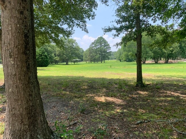
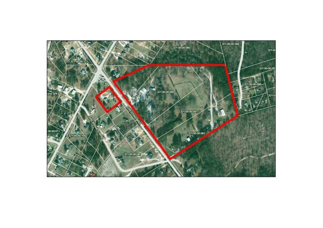
1500 Chestnut Rd
321-00-00-079
Carl E Herring
Sfr
Kershaw
X
South Carolina
45055C0408F
2.50 AC
2025
Kershaw County
2025
Columbia
970909
Columbia, SC
5,374 SF
DEMOGRAPHICS near 1500 Chestnut Rd
1 mile
3 mile
5 mile
2024 Total Population
2,499
13,572
25,673
2029 Population
2,696
14,708
27,621
Pop Growth 2024-2029
+ 7.88%
+ 8.37%
+ 7.59%
Average Age
38
39
39
2024 Total Households
876
4,943
9,492
HH Growth 2024-2029
+ 7.65%
+ 8.23%
+ 7.53%
Median Household Inc
$63,485
$63,861
$67,630
Avg Household Size
2.70
2.70
2.70
2024 Avg HH Vehicles
2.00
2.00
2.00
Median Home Value
$171,841
$172,105
$183,454
Median Year Built
1999
1999
1999
Nearby Places
Map Layers
Map Styles
 Street
 Aerial
Transit
 Traffic
 Biking
Places
Listings with unknown addresses are not visible on the map
- Restaurants
- Banks
- Shops
- Fitness
- Groceries
PUBLIC TRANSPORTATION
AIRPORT
Columbia Metro
Drive
Walk
Distance
Columbia Metro
57 min
32.4 mi
Freight Ports
North Charleston Terminal
Drive
Walk
Distance
North Charleston Terminal
152 min
128.1 mi
SALE & LEASE HISTORY
LISTING DATE
SALE/LEASE

Jan 18, 2024
For Sale
Nearby Properties
Address
Land Use
TOTAL SIZE
Lot Size
Zoning
Address
Land Use
TOTAL SIZE
Lot Size
Zoning
84,840 SF
5.19 AC
B2
Address
Land Use
TOTAL SIZE
Lot Size
Zoning
40,603 SF
4.64 AC
MUNICIPAL
Address
Land Use
TOTAL SIZE
Lot Size
Zoning
2.95 AC
B2
Address
Land Use
TOTAL SIZE
Lot Size
Zoning
41,886 SF
4.56 AC
MUNICIPAL
Address
Land Use
TOTAL SIZE
Lot Size
Zoning
9,397 SF
5.50 AC
OI
Address
Land Use
TOTAL SIZE
Lot Size
Zoning
78.22 AC
I1
Address
Land Use
TOTAL SIZE
Lot Size
Zoning
2,583 SF
1.24 AC
MUNICIPAL
Address
Land Use
TOTAL SIZE
Lot Size
Zoning
14,550 SF
2.02 AC
MUNICIPAL
Address
Land Use
TOTAL SIZE
Lot Size
Zoning
63.97 AC
R15
Address
Land Use
TOTAL SIZE
Lot Size
Zoning
9,170 SF
1.91 AC
B2
Address
Land Use
TOTAL SIZE
Lot Size
Zoning
7,366 SF
0.52 AC
MUNICIPAL
Address
Land Use
TOTAL SIZE
Lot Size
Zoning
2,651 SF
0.95 AC
MUNICIPAL
Address
Land Use
TOTAL SIZE
Lot Size
Zoning
9,020 SF
0.83 AC
MUNICIPAL
Address
Land Use
TOTAL SIZE
Lot Size
Zoning
1,620 SF
15.25 AC
RD2
Address
Land Use
TOTAL SIZE
Lot Size
Zoning
100.31 AC
GD
Address
Land Use
TOTAL SIZE
Lot Size
Zoning
6,650 SF
1.19 AC
MUNICIPAL
Address
Land Use
TOTAL SIZE
Lot Size
Zoning
3,512 SF
0.83 AC
MUNICIPAL
Address
Land Use
TOTAL SIZE
Lot Size
Zoning
4,680 SF
7.54 AC
I1
Address
Land Use
TOTAL SIZE
Lot Size
Zoning
5,961 SF
3 AC
MUNICIPAL
Address
Land Use
TOTAL SIZE
Lot Size
Zoning
4,319 SF
2.24 AC
RD2
Address
Land Use
TOTAL SIZE
Lot Size
Zoning
11,522 SF
1.09 AC
R15
Address
Land Use
TOTAL SIZE
Lot Size
Zoning
5,824 SF
6 AC
R15
Address
Land Use
TOTAL SIZE
Lot Size
Zoning
4,570 SF
2.16 AC
Address
Land Use
TOTAL SIZE
Lot Size
Zoning
6,416 SF
10.21 AC
Address
Land Use
TOTAL SIZE
Lot Size
Zoning
6,337 SF
5 AC
Address
Land Use
TOTAL SIZE
Lot Size
Zoning
3,416 SF
3.58 AC
Address
Land Use
TOTAL SIZE
Lot Size
Zoning
5,584 SF
10.20 AC
Address
Land Use
TOTAL SIZE
Lot Size
Zoning
5,272 SF
0.67 AC
Address
Land Use
TOTAL SIZE
Lot Size
Zoning
6,656 SF
10.21 AC
Address
Land Use
TOTAL SIZE
Lot Size
Zoning
4.06 AC
MUNICIPAL
The World's #1 Commercial Real Estate Marketplace
Connect with us
© 2026 CoStar Group
The information above has been obtained from sources believed reliable. While we do not doubt its accuracy we have not verified it and make no guarantee, warranty or representation about it. It is your responsibility to independently confirm its accuracy and completeness. Any projections, opinions, assumptions, or estimates used are for example only and do not represent the current or future performance of the property. The value of this transaction to you depends on tax and other factors which should be evaluated by your tax, financial, and legal advisors. You and your advisors should conduct a careful, independent investigation of the property to determine to your satisfaction the suitability of the property for your needs.