Property Record
1500 Garret Ln, Lincoln, NE 68512


NEARBY LISTINGS FOR SALE OR LEASE
-
-
View all Lincoln listings for sale on LoopNet.com
Property Detail
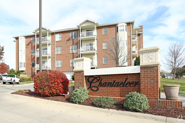
1500 Garret Ln
Lincoln, NE
Vavrina Meadows 8Th Addition
09-24-136-001-000
VAVRINA MEADOWS 8TH ADDITION, LOT 1
Commercialnec
Lancaster
X
Nebraska
31109C0430G
1
2024
0.91 AC
2025
South Lincoln
003607
Lincoln
22,312 SF
DEMOGRAPHICS near 1500 Garret Ln
1 Mile
3 Mile
5 Mile
2024 Total Population
6,795
44,984
125,494
2029 Population
6,990
46,466
129,755
Pop Growth 2024-2029
+ 2.87%
+ 3.29%
+ 3.40%
Average Age
37
39
39
2024 Total Households
2,772
18,417
52,784
HH Growth 2024-2029
+ 2.99%
+ 3.34%
+ 3.51%
Median Household Inc
$87,694
$85,220
$69,600
Avg Household Size
2.40
2.40
2.30
2024 Avg HH Vehicles
2.00
2.00
2.00
Median Home Value
$321,464
$282,564
$256,682
Median Year Built
2003
1991
1978
Nearby Places
Map Layers
Map Styles
 Street
 Aerial
- Restaurants
- Banks
- Shops
- Fitness
- Groceries
PUBLIC TRANSPORTATION
COMMUTER RAIL
DRIVE
WALK
Distance
12 min
6.1 mi
AIRPORT
Lincoln
DRIVE
WALK
Distance
Lincoln
18 min
10.9 mi
Nearby Properties
Address
Land Use
TOTAL SIZE
Lot Size
Zoning
Address
Land Use
TOTAL SIZE
Lot Size
Zoning
48,378 SF
9.53 AC
R5
Address
Land Use
TOTAL SIZE
Lot Size
Zoning
213,738 SF
14.97 AC
B5
Address
Land Use
TOTAL SIZE
Lot Size
Zoning
75,371 SF
12.46 AC
R3
Address
Land Use
TOTAL SIZE
Lot Size
Zoning
188,540 SF
4.57 AC
Address
Land Use
TOTAL SIZE
Lot Size
Zoning
126,172 SF
5.46 AC
B2
Address
Land Use
TOTAL SIZE
Lot Size
Zoning
172,989 SF
6.16 AC
Address
Land Use
TOTAL SIZE
Lot Size
Zoning
35,972 SF
10.13 AC
O3
Address
Land Use
TOTAL SIZE
Lot Size
Zoning
44,957 SF
7.93 AC
R4
Address
Land Use
TOTAL SIZE
Lot Size
Zoning
40,602 SF
7.07 AC
B2
Address
Land Use
TOTAL SIZE
Lot Size
Zoning
169,890 SF
3.05 AC
O3
Address
Land Use
TOTAL SIZE
Lot Size
Zoning
32,854 SF
22.09 AC
NULL
Address
Land Use
TOTAL SIZE
Lot Size
Zoning
81,149 SF
6.46 AC
R5
Address
Land Use
TOTAL SIZE
Lot Size
Zoning
33,983 SF
23.08 AC
R4
Address
Land Use
TOTAL SIZE
Lot Size
Zoning
22,324 SF
16.59 AC
NULL
Address
Land Use
TOTAL SIZE
Lot Size
Zoning
14,637 SF
18.90 AC
NULL
Address
Land Use
TOTAL SIZE
Lot Size
Zoning
43,921 SF
15.65 AC
B2
Address
Land Use
TOTAL SIZE
Lot Size
Zoning
16,284 SF
8.77 AC
NULL
Address
Land Use
TOTAL SIZE
Lot Size
Zoning
39,968 SF
13.41 AC
NULL
Address
Land Use
TOTAL SIZE
Lot Size
Zoning
129,038 SF
17.43 AC
O3
Address
Land Use
TOTAL SIZE
Lot Size
Zoning
131,049 SF
78.38 AC
P
Address
Land Use
TOTAL SIZE
Lot Size
Zoning
63,298 SF
10.15 AC
R1
Address
Land Use
TOTAL SIZE
Lot Size
Zoning
78,993 SF
3.56 AC
H4
Address
Land Use
TOTAL SIZE
Lot Size
Zoning
68,764 SF
10.45 AC
R3
Address
Land Use
TOTAL SIZE
Lot Size
Zoning
111,178 SF
15.53 AC
O3
Address
Land Use
TOTAL SIZE
Lot Size
Zoning
372,652 SF
24.70 AC
I2
Address
Land Use
TOTAL SIZE
Lot Size
Zoning
149,431 SF
13.38 AC
O3
Address
Land Use
TOTAL SIZE
Lot Size
Zoning
70,676 SF
26.52 AC
P
Address
Land Use
TOTAL SIZE
Lot Size
Zoning
45,057 SF
37.07 AC
NULL
Address
Land Use
TOTAL SIZE
Lot Size
Zoning
32,942 SF
8.94 AC
R1
Address
Land Use
TOTAL SIZE
Lot Size
Zoning
28,126 SF
7.27 AC
NULL
The World's #1 Commercial Real Estate Marketplace
Connect with us
© 2026 CoStar Group
The information above has been obtained from sources believed reliable. While we do not doubt its accuracy we have not verified it and make no guarantee, warranty or representation about it. It is your responsibility to independently confirm its accuracy and completeness. Any projections, opinions, assumptions, or estimates used are for example only and do not represent the current or future performance of the property. The value of this transaction to you depends on tax and other factors which should be evaluated by your tax, financial, and legal advisors. You and your advisors should conduct a careful, independent investigation of the property to determine to your satisfaction the suitability of the property for your needs.