Property Record
1500 Glencoe Rd, Sparks Glencoe, MD 21152

Property Detail
1500 Glencoe Rd
10-1015037105
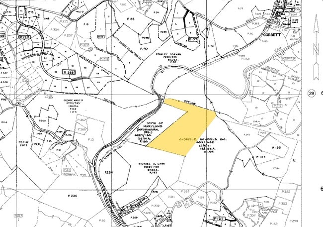
100.6761AC
Commercialacreage
Baltimore
RC4
Maryland
B and X Area of moderate flood hazard, usually the area between the limits of the 100-year and 500-year floods.
100.68 AC
2024
Route 83 Corridor North
2025
Baltimore
410100
Baltimore-Columbia-Towson, MD
2,522 SF
NEARBY LISTINGS FOR SALE OR LEASE
-
-
View all Sparks Glencoe listings for sale on LoopNet.com
DEMOGRAPHICS near 1500 Glencoe Rd
1 mile
3 mile
5 mile
2025 Total Population
347
7,192
20,237
2030 Population
348
7,183
20,301
Pop Growth 2025-2030
+ 0.29%
(0.13%)
+ 0.32%
Average Age
44
44
45
2025 Total Households
116
2,860
7,869
HH Growth 2025-2030
0.00%
(0.17%)
+ 0.42%
Median Household Inc
$198,528
$122,678
$144,154
Avg Household Size
2.90
2.40
2.50
2025 Avg HH Vehicles
3.00
2.00
2.00
Median Home Value
$818,965
$551,557
$579,572
Median Year Built
1982
1984
1985
Nearby Places
Map Layers
Map Styles
 Street
 Aerial
Layers
 Traffic
 Biking
Places
Listings with unknown addresses are not visible on the map
- Restaurants
- Banks
- Shops
- Fitness
- Groceries
PUBLIC TRANSPORTATION
AIRPORT
Baltimore/Washington International Thurgood Marshall
Drive
Walk
Distance
Baltimore/Washington International Thurgood Marshall
53 min
35.1 mi
Freight Ports
Port of Baltimore
Drive
Walk
Distance
Port of Baltimore
46 min
26.9 mi
Nearby Properties
Address
Land Use
TOTAL SIZE
Lot Size
Zoning
Address
Land Use
TOTAL SIZE
Lot Size
Zoning
218,049 SF
22.47 AC
Address
Land Use
TOTAL SIZE
Lot Size
Zoning
418,286 SF
22.60 AC
ML
Address
Land Use
TOTAL SIZE
Lot Size
Zoning
130,720 SF
10.48 AC
ML
Address
Land Use
TOTAL SIZE
Lot Size
Zoning
289,231 SF
10.23 AC
ML
Address
Land Use
TOTAL SIZE
Lot Size
Zoning
10.61 AC
DR5.5
Address
Land Use
TOTAL SIZE
Lot Size
Zoning
44,304 SF
11.98 AC
ML
Address
Land Use
TOTAL SIZE
Lot Size
Zoning
8.28 AC
DR5.5
Address
Land Use
TOTAL SIZE
Lot Size
Zoning
54,825 SF
30.63 AC
RC4
Address
Land Use
TOTAL SIZE
Lot Size
Zoning
49,384 SF
6.30 AC
ML
Address
Land Use
TOTAL SIZE
Lot Size
Zoning
143,929 SF
21.15 AC
Address
Land Use
TOTAL SIZE
Lot Size
Zoning
45,945 SF
2.72 AC
ML
Address
Land Use
TOTAL SIZE
Lot Size
Zoning
157,350 SF
14.80 AC
ML
Address
Land Use
TOTAL SIZE
Lot Size
Zoning
142,400 SF
18.60 AC
MLR
Address
Land Use
TOTAL SIZE
Lot Size
Zoning
52,700 SF
3.78 AC
ML
Address
Land Use
TOTAL SIZE
Lot Size
Zoning
92,909 SF
13.10 AC
ML
Address
Land Use
TOTAL SIZE
Lot Size
Zoning
56,323 SF
15.12 AC
ML
Address
Land Use
TOTAL SIZE
Lot Size
Zoning
4.31 AC
DR5.5
Address
Land Use
TOTAL SIZE
Lot Size
Zoning
72,003 SF
5 AC
ML
Address
Land Use
TOTAL SIZE
Lot Size
Zoning
33,234 SF
4.85 AC
ML
Address
Land Use
TOTAL SIZE
Lot Size
Zoning
78,240 SF
12.07 AC
ML
Address
Land Use
TOTAL SIZE
Lot Size
Zoning
27,323 SF
0.63 AC
Address
Land Use
TOTAL SIZE
Lot Size
Zoning
135,813 SF
12.14 AC
ML
Address
Land Use
TOTAL SIZE
Lot Size
Zoning
51,896 SF
5.39 AC
ML
Address
Land Use
TOTAL SIZE
Lot Size
Zoning
47,036 SF
3.82 AC
ML
Address
Land Use
TOTAL SIZE
Lot Size
Zoning
127,800 SF
3.01 AC
ML
Address
Land Use
TOTAL SIZE
Lot Size
Zoning
45,689 SF
3.50 AC
ML
Address
Land Use
TOTAL SIZE
Lot Size
Zoning
32,604 SF
3.50 AC
ML
Address
Land Use
TOTAL SIZE
Lot Size
Zoning
38,454 SF
3.29 AC
ML
Address
Land Use
TOTAL SIZE
Lot Size
Zoning
16,378 SF
4.50 AC
ML
The World's #1 Commercial Real Estate Marketplace
Connect with us
© 2026 CoStar Group
The information above has been obtained from sources believed reliable. While we do not doubt its accuracy we have not verified it and make no guarantee, warranty or representation about it. It is your responsibility to independently confirm its accuracy and completeness. Any projections, opinions, assumptions, or estimates used are for example only and do not represent the current or future performance of the property. The value of this transaction to you depends on tax and other factors which should be evaluated by your tax, financial, and legal advisors. You and your advisors should conduct a careful, independent investigation of the property to determine to your satisfaction the suitability of the property for your needs.