Property Record
1500 Horizon Dr, Sturtevant, WI 53177


NEARBY LISTINGS FOR SALE OR LEASE
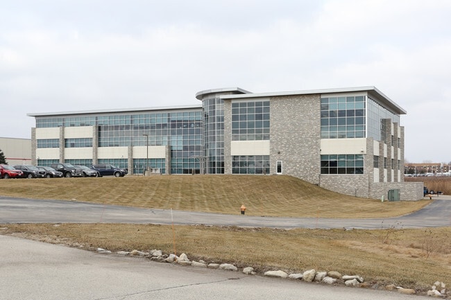
Property Detail
1500 Horizon Dr
Racine, WI
Hwy 20/31 - Prime
151-032215050023
PT SW1/4 CSM #2731 V8 P678 #2046910 LOT 3 FROM 151032215050020 IN 05 FOR 06 ROLL **TOTAL ACRES** 10.02
Storesoffices
Racine
X
Wisconsin
55101C0209D
3
2024
10.02 AC
2024
Racine East
001702
Milwaukee/Madison
DEMOGRAPHICS near 1500 Horizon Dr
1 Mile
3 Mile
5 Mile
2024 Total Population
3,100
30,545
90,389
2029 Population
3,087
30,310
89,658
Pop Growth 2024-2029
(0.42%)
(0.77%)
(0.81%)
Average Age
44
43
40
2024 Total Households
862
12,583
36,171
HH Growth 2024-2029
+ 1.39%
(0.61%)
(0.80%)
Median Household Inc
$75,916
$70,671
$65,060
Avg Household Size
2.10
2.20
2.40
2024 Avg HH Vehicles
2.00
2.00
2.00
Median Home Value
$203,929
$222,274
$190,024
Median Year Built
1992
1979
1966
Nearby Places
Map Layers
Map Styles
 Street
 Aerial
- Restaurants
- Banks
- Shops
- Fitness
- Groceries
PUBLIC TRANSPORTATION
COMMUTER RAIL
Sturtevant Amtrak Station (Hiawatha Service - Amtrak)
DRIVE
WALK
Distance
Sturtevant Amtrak Station (Hiawatha Service - Amtrak)
4 min
1.8 mi
AIRPORT
General Mitchell International
DRIVE
WALK
Distance
General Mitchell International
28 min
20.8 mi
Freight Ports
Port Milwaukee
DRIVE
WALK
Distance
Port Milwaukee
32 min
24.7 mi
SALE & LEASE HISTORY
LISTING DATE
SALE/LEASE

Sep 25, 2016
For Lease
Dec 01, 2016
For Sale
Nearby Properties
Address
Land Use
TOTAL SIZE
Lot Size
Zoning
Address
Land Use
TOTAL SIZE
Lot Size
Zoning
318.64 AC
Address
Land Use
TOTAL SIZE
Lot Size
Zoning
22.34 AC
Address
Land Use
TOTAL SIZE
Lot Size
Zoning
Address
Land Use
TOTAL SIZE
Lot Size
Zoning
241.29 AC
Address
Land Use
TOTAL SIZE
Lot Size
Zoning
241.29 AC
Address
Land Use
TOTAL SIZE
Lot Size
Zoning
Address
Land Use
TOTAL SIZE
Lot Size
Zoning
9.40 AC
B-3
Address
Land Use
TOTAL SIZE
Lot Size
Zoning
23.10 AC
Address
Land Use
TOTAL SIZE
Lot Size
Zoning
37.55 AC
Address
Land Use
TOTAL SIZE
Lot Size
Zoning
47.01 AC
M-1
Address
Land Use
TOTAL SIZE
Lot Size
Zoning
32.55 AC
Address
Land Use
TOTAL SIZE
Lot Size
Zoning
57.80 AC
M1
Address
Land Use
TOTAL SIZE
Lot Size
Zoning
26.79 AC
Address
Land Use
TOTAL SIZE
Lot Size
Zoning
Address
Land Use
TOTAL SIZE
Lot Size
Zoning
Address
Land Use
TOTAL SIZE
Lot Size
Zoning
23.21 AC
Address
Land Use
TOTAL SIZE
Lot Size
Zoning
140.07 AC
Address
Land Use
TOTAL SIZE
Lot Size
Zoning
9.31 AC
Address
Land Use
TOTAL SIZE
Lot Size
Zoning
Address
Land Use
TOTAL SIZE
Lot Size
Zoning
30.45 AC
002
Address
Land Use
TOTAL SIZE
Lot Size
Zoning
18.33 AC
Address
Land Use
TOTAL SIZE
Lot Size
Zoning
10.72 AC
Address
Land Use
TOTAL SIZE
Lot Size
Zoning
20.61 AC
Address
Land Use
TOTAL SIZE
Lot Size
Zoning
19.29 AC
002
Address
Land Use
TOTAL SIZE
Lot Size
Zoning
5.74 AC
Address
Land Use
TOTAL SIZE
Lot Size
Zoning
Address
Land Use
TOTAL SIZE
Lot Size
Zoning
Address
Land Use
TOTAL SIZE
Lot Size
Zoning
22.98 AC
M-1
Address
Land Use
TOTAL SIZE
Lot Size
Zoning
32.99 AC
002
Address
Land Use
TOTAL SIZE
Lot Size
Zoning
16.97 AC
The World's #1 Commercial Real Estate Marketplace
Connect with us
© 2025 CoStar Group
The information above has been obtained from sources believed reliable. While we do not doubt its accuracy we have not verified it and make no guarantee, warranty or representation about it. It is your responsibility to independently confirm its accuracy and completeness. Any projections, opinions, assumptions, or estimates used are for example only and do not represent the current or future performance of the property. The value of this transaction to you depends on tax and other factors which should be evaluated by your tax, financial, and legal advisors. You and your advisors should conduct a careful, independent investigation of the property to determine to your satisfaction the suitability of the property for your needs.