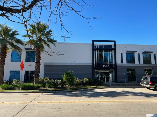
Property Record
2603 La Branch St, Houston, TX 77004

Current Lease Availabilities
Property Detail
2603 La Branch St
Houston-Pasadena-The Woodlands, TX
LTS 8 9 & 10 BLK 1 HOLMAN OUTLOT 19
0190790000008
HARRIS
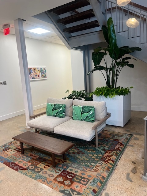
Officebuilding
Texas
B and X Area of moderate flood hazard, usually the area between the limits of the 100-year and 500-year floods.
8
2024
0.35 AC
2025
Inner Loop River Oaks
312501
Houston
33,166 SF
NEARBY LISTINGS FOR SALE OR LEASE
DEMOGRAPHICS near 2603 La Branch St
1 mile
3 mile
5 mile
2025 Total Population
31,340
225,717
524,035
2030 Population
34,379
244,773
567,233
Pop Growth 2025-2030
+ 9.70%
+ 8.44%
+ 8.24%
Average Age
37
38
38
2025 Total Households
18,052
105,029
234,190
HH Growth 2025-2030
+ 9.93%
+ 9.46%
+ 8.86%
Median Household Inc
$96,002
$91,157
$84,367
Avg Household Size
1.60
1.80
2.10
2025 Avg HH Vehicles
1.00
1.00
2.00
Median Home Value
$410,942
$475,170
$461,625
Median Year Built
2006
2000
1993
Nearby Places
Map Layers
Map Styles
 Street
 Aerial
Transit
 Traffic
 Biking
Places
Listings with unknown addresses are not visible on the map
- Restaurants
- Banks
- Shops
- Fitness
- Groceries
PUBLIC TRANSPORTATION
TRANSIT/SUBWAY
Mcgowen (METRORAIL RED LINE - Metropolitan Transit Authority of Harris County, Redline - Metropolitan Transit Authority of Harris County)
Drive
Walk
Distance
Mcgowen (METRORAIL RED LINE - Metropolitan Transit Authority of Harris County, Redline - Metropolitan Transit Authority of Harris County)
1 min
6 min
0.3 mi
Downtown Transit Center Stn Sb (METRORAIL RED LINE - Metropolitan Transit Authority of Harris County)
Drive
Walk
Distance
Downtown Transit Center Stn Sb (METRORAIL RED LINE - Metropolitan Transit Authority of Harris County)
2 min
13 min
0.7 mi
Ensemble/Hcc Stn Nb (METRORAIL RED LINE - Metropolitan Transit Authority of Harris County)
Drive
Walk
Distance
Ensemble/Hcc Stn Nb (METRORAIL RED LINE - Metropolitan Transit Authority of Harris County)
2 min
15 min
0.8 mi
Ensemble/Hcc Stn Sb (METRORAIL RED LINE - Metropolitan Transit Authority of Harris County)
Drive
Walk
Distance
Ensemble/Hcc Stn Sb (METRORAIL RED LINE - Metropolitan Transit Authority of Harris County)
2 min
16 min
0.8 mi
Bell Stn Sb (METRORAIL RED LINE - Metropolitan Transit Authority of Harris County)
Drive
Walk
Distance
Bell Stn Sb (METRORAIL RED LINE - Metropolitan Transit Authority of Harris County)
3 min
18 min
1.0 mi
COMMUTER RAIL
Houston (Sunset Limited - Amtrak)
Drive
Walk
Distance
Houston (Sunset Limited - Amtrak)
6 min
2.5 mi
AIRPORT
William P Hobby
Drive
Walk
Distance
William P Hobby
23 min
11.6 mi
George Bush Intcntl/Houston
Drive
Walk
Distance
George Bush Intcntl/Houston
27 min
20.3 mi
Freight Ports
Port of Houston
Drive
Walk
Distance
Port of Houston
20 min
11.0 mi
Nearby Properties
Address
Land Use
TOTAL SIZE
Lot Size
Zoning
Address
Land Use
TOTAL SIZE
Lot Size
Zoning
1,383,720 SF
1.47 AC
Address
Land Use
TOTAL SIZE
Lot Size
Zoning
1,101,686 SF
1.45 AC
Address
Land Use
TOTAL SIZE
Lot Size
Zoning
973,861 SF
1.18 AC
Address
Land Use
TOTAL SIZE
Lot Size
Zoning
899,279 SF
1.18 AC
Address
Land Use
TOTAL SIZE
Lot Size
Zoning
797,208 SF
1.46 AC
Address
Land Use
TOTAL SIZE
Lot Size
Zoning
1,916,394 SF
1.46 AC
Address
Land Use
TOTAL SIZE
Lot Size
Zoning
1,871,418 SF
1.44 AC
Address
Land Use
TOTAL SIZE
Lot Size
Zoning
1,252,274 SF
2.02 AC
Address
Land Use
TOTAL SIZE
Lot Size
Zoning
1,091,726 SF
2.60 AC
Address
Land Use
TOTAL SIZE
Lot Size
Zoning
1,232,364 SF
1.49 AC
Address
Land Use
TOTAL SIZE
Lot Size
Zoning
1,436,400 SF
1.44 AC
Address
Land Use
TOTAL SIZE
Lot Size
Zoning
1,321,033 SF
1.46 AC
Address
Land Use
TOTAL SIZE
Lot Size
Zoning
4,169,721 SF
31.23 AC
Address
Land Use
TOTAL SIZE
Lot Size
Zoning
2,005,097 SF
1.44 AC
Address
Land Use
TOTAL SIZE
Lot Size
Zoning
1,374,271 SF
1.44 AC
Address
Land Use
TOTAL SIZE
Lot Size
Zoning
1,150,681 SF
1.17 AC
Address
Land Use
TOTAL SIZE
Lot Size
Zoning
515,025 SF
1.50 AC
Address
Land Use
TOTAL SIZE
Lot Size
Zoning
1,657,484 SF
1.44 AC
Address
Land Use
TOTAL SIZE
Lot Size
Zoning
1,282,908 SF
2.74 AC
Address
Land Use
TOTAL SIZE
Lot Size
Zoning
1,311,133 SF
1.44 AC
Address
Land Use
TOTAL SIZE
Lot Size
Zoning
555,351 SF
1.40 AC
Address
Land Use
TOTAL SIZE
Lot Size
Zoning
1,181,384 SF
1.47 AC
Address
Land Use
TOTAL SIZE
Lot Size
Zoning
1,162,204 SF
1.44 AC
Address
Land Use
TOTAL SIZE
Lot Size
Zoning
934,258 SF
1.45 AC
Address
Land Use
TOTAL SIZE
Lot Size
Zoning
1,103,424 SF
1.44 AC
Address
Land Use
TOTAL SIZE
Lot Size
Zoning
1,365,801 SF
1.44 AC
Address
Land Use
TOTAL SIZE
Lot Size
Zoning
644,352 SF
8.05 AC
Address
Land Use
TOTAL SIZE
Lot Size
Zoning
1,017,783 SF
1.44 AC
Address
Land Use
TOTAL SIZE
Lot Size
Zoning
1,182,525 SF
1.11 AC
Address
Land Use
TOTAL SIZE
Lot Size
Zoning
608,233 SF
2.23 AC
The World's #1 Commercial Real Estate Marketplace
Connect with us
© 2026 CoStar Group
The information above has been obtained from sources believed reliable. While we do not doubt its accuracy we have not verified it and make no guarantee, warranty or representation about it. It is your responsibility to independently confirm its accuracy and completeness. Any projections, opinions, assumptions, or estimates used are for example only and do not represent the current or future performance of the property. The value of this transaction to you depends on tax and other factors which should be evaluated by your tax, financial, and legal advisors. You and your advisors should conduct a careful, independent investigation of the property to determine to your satisfaction the suitability of the property for your needs.