Property Record
1500 N Cherry St, Mount Carmel, IL 62863
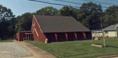

Property Detail
1500 N Cherry St
Other Market Areas
LOT 17 HARRIS ADDN 100' X 230' & .177 A & E PT LOT 1 OF S 1/2 SW 1/4 SE 1/4 W OF CHERRY ST ROAD 05-211-17-403-002
05-211-17-403-002
Wabash
Commercialnec
Illinois
B and X Area of moderate flood hazard, usually the area between the limits of the 100-year and 500-year floods.
1,17
2025
0.53 AC
2024
Effingham/Central Illinois Area
957300
NEARBY LISTINGS FOR SALE OR LEASE
-
-
View all Mount Carmel listings for sale on LoopNet.com
DEMOGRAPHICS near 1500 N Cherry St
1 mile
3 mile
5 mile
2025 Total Population
4,161
7,456
8,196
2030 Population
4,108
7,370
8,088
Pop Growth 2025-2030
(1.27%)
(1.15%)
(1.32%)
Average Age
42
43
42
2025 Total Households
1,737
3,125
3,418
HH Growth 2025-2030
(1.50%)
(1.31%)
(1.43%)
Median Household Inc
$51,020
$48,771
$50,237
Avg Household Size
2.20
2.20
2.20
2025 Avg HH Vehicles
2.00
2.00
2.00
Median Home Value
$114,008
$94,864
$98,987
Median Year Built
1957
1958
1959
Nearby Places
Map Layers
Map Styles
 Street
 Aerial
Layers
 Traffic
 Biking
Places
Listings with unknown addresses are not visible on the map
- Restaurants
- Banks
- Shops
- Fitness
- Groceries
PUBLIC TRANSPORTATION
AIRPORT
Evansville Regional
Drive
Walk
Distance
Evansville Regional
51 min
36.2 mi
Freight Ports
Port Milwaukee
Drive
Walk
Distance
Port Milwaukee
458 min
379.6 mi
Nearby Properties
Address
Land Use
TOTAL SIZE
Lot Size
Zoning
Address
Land Use
TOTAL SIZE
Lot Size
Zoning
Address
Land Use
TOTAL SIZE
Lot Size
Zoning
7.74 AC
Address
Land Use
TOTAL SIZE
Lot Size
Zoning
3.62 AC
Address
Land Use
TOTAL SIZE
Lot Size
Zoning
5.32 AC
Address
Land Use
TOTAL SIZE
Lot Size
Zoning
5.26 AC
Address
Land Use
TOTAL SIZE
Lot Size
Zoning
5.51 AC
Address
Land Use
TOTAL SIZE
Lot Size
Zoning
Address
Land Use
TOTAL SIZE
Lot Size
Zoning
Address
Land Use
TOTAL SIZE
Lot Size
Zoning
Address
Land Use
TOTAL SIZE
Lot Size
Zoning
Address
Land Use
TOTAL SIZE
Lot Size
Zoning
Address
Land Use
TOTAL SIZE
Lot Size
Zoning
Address
Land Use
TOTAL SIZE
Lot Size
Zoning
5.15 AC
Address
Land Use
TOTAL SIZE
Lot Size
Zoning
6.83 AC
Address
Land Use
TOTAL SIZE
Lot Size
Zoning
Address
Land Use
TOTAL SIZE
Lot Size
Zoning
Address
Land Use
TOTAL SIZE
Lot Size
Zoning
326.50 AC
Address
Land Use
TOTAL SIZE
Lot Size
Zoning
10.99 AC
Address
Land Use
TOTAL SIZE
Lot Size
Zoning
Address
Land Use
TOTAL SIZE
Lot Size
Zoning
Address
Land Use
TOTAL SIZE
Lot Size
Zoning
193.23 AC
Address
Land Use
TOTAL SIZE
Lot Size
Zoning
2.99 AC
Address
Land Use
TOTAL SIZE
Lot Size
Zoning
0.43 AC
Address
Land Use
TOTAL SIZE
Lot Size
Zoning
4,000 SF
1.32 AC
Address
Land Use
TOTAL SIZE
Lot Size
Zoning
2.43 AC
Address
Land Use
TOTAL SIZE
Lot Size
Zoning
Address
Land Use
TOTAL SIZE
Lot Size
Zoning
Address
Land Use
TOTAL SIZE
Lot Size
Zoning
Address
Land Use
TOTAL SIZE
Lot Size
Zoning
Address
Land Use
TOTAL SIZE
Lot Size
Zoning
0.94 AC
The World's #1 Commercial Real Estate Marketplace
Connect with us
© 2026 CoStar Group
The information above has been obtained from sources believed reliable. While we do not doubt its accuracy we have not verified it and make no guarantee, warranty or representation about it. It is your responsibility to independently confirm its accuracy and completeness. Any projections, opinions, assumptions, or estimates used are for example only and do not represent the current or future performance of the property. The value of this transaction to you depends on tax and other factors which should be evaluated by your tax, financial, and legal advisors. You and your advisors should conduct a careful, independent investigation of the property to determine to your satisfaction the suitability of the property for your needs.