Property Record
1500 Oberle Ave, Memphis, TN 38127


NEARBY LISTINGS FOR SALE OR LEASE
-
-
View all Memphis listings for sale on LoopNet.com
Property Detail
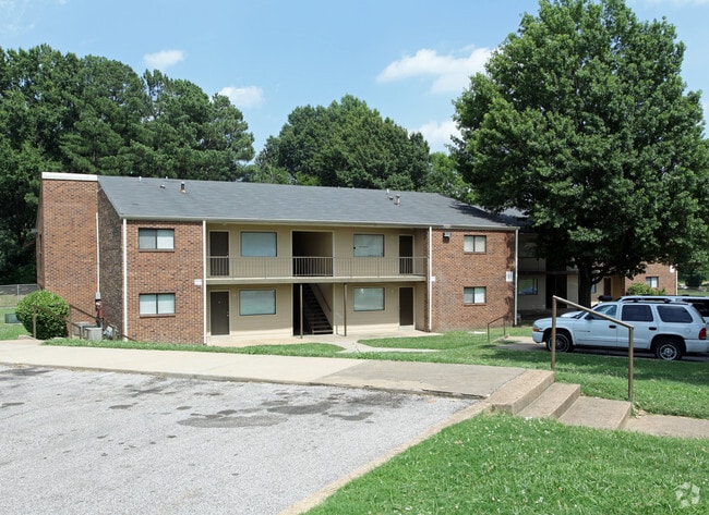
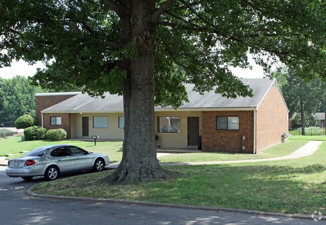
1500 Oberle Ave
07-0037-0-0041C
Breezy Point Apartments
Apartment
PT LOT SEE MAP 109B
X
Shelby
05035C0375E
Tennessee
0
25.08 AC
2025
Frayser
010121
Memphis
56,620 SF
Memphis, TN-MS-AR
DEMOGRAPHICS near 1500 Oberle Ave
1 Mile
3 Mile
5 Mile
2024 Total Population
8,701
56,965
141,277
2029 Population
8,901
57,477
142,102
Pop Growth 2024-2029
+ 2.30%
+ 0.90%
+ 0.58%
Average Age
33
37
37
2024 Total Households
3,056
21,967
59,447
HH Growth 2024-2029
+ 2.19%
+ 0.80%
+ 0.50%
Median Household Inc
$36,200
$35,827
$39,864
Avg Household Size
2.80
2.50
2.30
2024 Avg HH Vehicles
2.00
1.00
1.00
Median Home Value
$76,122
$74,913
$116,493
Median Year Built
1966
1964
1963
Nearby Places
Map Layers
Map Styles
 Street
 Aerial
- Restaurants
- Banks
- Shops
- Fitness
- Groceries
PUBLIC TRANSPORTATION
COMMUTER RAIL
Central Station (Riverfront Loop - Memphis Area Transit Authority Trolley (MataTrolley))
DRIVE
WALK
Distance
Central Station (Riverfront Loop - Memphis Area Transit Authority Trolley (MataTrolley))
13 min
7.5 mi
AIRPORT
Memphis International
DRIVE
WALK
Distance
Memphis International
21 min
13.3 mi
Freight Ports
Port of Shreveport
DRIVE
WALK
Distance
Port of Shreveport
405 min
373.6 mi
Nearby Properties
Address
Land Use
TOTAL SIZE
Lot Size
Zoning
Address
Land Use
TOTAL SIZE
Lot Size
Zoning
81,088 SF
23.12 AC
RU-3
Address
Land Use
TOTAL SIZE
Lot Size
Zoning
1,913,224 SF
78.98 AC
IH
Address
Land Use
TOTAL SIZE
Lot Size
Zoning
2,912 SF
100 AC
CA
Address
Land Use
TOTAL SIZE
Lot Size
Zoning
111,016 SF
6.90 AC
CMU-1
Address
Land Use
TOTAL SIZE
Lot Size
Zoning
95,448 SF
8.04 AC
RU-3
Address
Land Use
TOTAL SIZE
Lot Size
Zoning
104,641 SF
3.55 AC
MDR
Address
Land Use
TOTAL SIZE
Lot Size
Zoning
76,727 SF
13.03 AC
RU-3
Address
Land Use
TOTAL SIZE
Lot Size
Zoning
14,104 SF
3.95 AC
MDR
Address
Land Use
TOTAL SIZE
Lot Size
Zoning
92,798 SF
12.66 AC
RU-3
Address
Land Use
TOTAL SIZE
Lot Size
Zoning
82,859 SF
9.88 AC
MU
Address
Land Use
TOTAL SIZE
Lot Size
Zoning
19,013 SF
3.51 AC
RU-3
Address
Land Use
TOTAL SIZE
Lot Size
Zoning
18,492 SF
8.35 AC
R-6
Address
Land Use
TOTAL SIZE
Lot Size
Zoning
27,930 SF
12.14 AC
RU-3
Address
Land Use
TOTAL SIZE
Lot Size
Zoning
53,176 SF
12.57 AC
RU-3
Address
Land Use
TOTAL SIZE
Lot Size
Zoning
47,756 SF
9.94 AC
RU-3
Address
Land Use
TOTAL SIZE
Lot Size
Zoning
35,890 SF
10.53 AC
RU-3
Address
Land Use
TOTAL SIZE
Lot Size
Zoning
10.26 AC
R-10
Address
Land Use
TOTAL SIZE
Lot Size
Zoning
39,628 SF
8.81 AC
RU-3
Address
Land Use
TOTAL SIZE
Lot Size
Zoning
22,925 SF
13.53 AC
RU-3
Address
Land Use
TOTAL SIZE
Lot Size
Zoning
48,194 SF
5.49 AC
R-6
Address
Land Use
TOTAL SIZE
Lot Size
Zoning
229,514 SF
15.41 AC
IH
Address
Land Use
TOTAL SIZE
Lot Size
Zoning
21,650 SF
6.09 AC
RU-3
Address
Land Use
TOTAL SIZE
Lot Size
Zoning
51,253 SF
17.50 AC
RU-3
Address
Land Use
TOTAL SIZE
Lot Size
Zoning
37,092 SF
4.30 AC
RU-3
Address
Land Use
TOTAL SIZE
Lot Size
Zoning
236,244 SF
11.24 AC
EMP
Address
Land Use
TOTAL SIZE
Lot Size
Zoning
84,851 SF
11.25 AC
CMU-2
Address
Land Use
TOTAL SIZE
Lot Size
Zoning
62,008 SF
6.45 AC
RU-3
Address
Land Use
TOTAL SIZE
Lot Size
Zoning
49,200 SF
3.38 AC
CMU-2
Address
Land Use
TOTAL SIZE
Lot Size
Zoning
15,468 SF
3.87 AC
RU-3
The World's #1 Commercial Real Estate Marketplace
Connect with us
© 2026 CoStar Group
The information above has been obtained from sources believed reliable. While we do not doubt its accuracy we have not verified it and make no guarantee, warranty or representation about it. It is your responsibility to independently confirm its accuracy and completeness. Any projections, opinions, assumptions, or estimates used are for example only and do not represent the current or future performance of the property. The value of this transaction to you depends on tax and other factors which should be evaluated by your tax, financial, and legal advisors. You and your advisors should conduct a careful, independent investigation of the property to determine to your satisfaction the suitability of the property for your needs.