Property Record
1500 Progress St, Sturgis, MI 49091
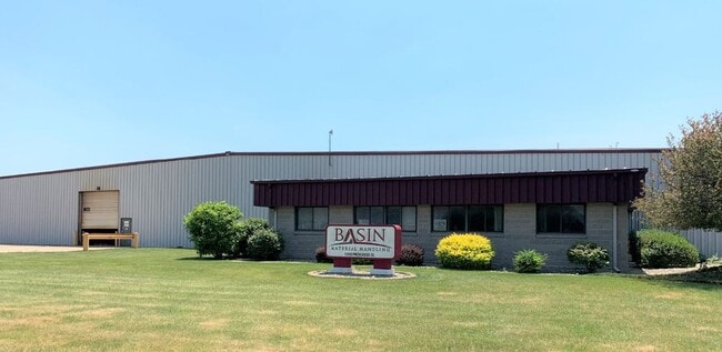

Property Detail
1500 Progress St
Sturgis, MI
PT OF LOTS 41 & 42 OF STURGIS AIRPORT INDUSTRIAL PARK COM AT NE COR LOT 41 TH S 82D25M52S W 141.53FT TO POB TH S 00D26M57S W
052-605-042-00
Saint Joseph
Industrialgeneral
Michigan
B and X Area of moderate flood hazard, usually the area between the limits of the 100-year and 500-year floods.
41-42
2025
8.33 AC
2025
Michigan Southwest Area
040700
Other Market Areas
119,000 SF
NEARBY LISTINGS FOR SALE OR LEASE
DEMOGRAPHICS near 1500 Progress St
1 mile
3 mile
5 mile
2025 Total Population
3,066
14,275
17,599
2030 Population
3,023
14,141
17,509
Pop Growth 2025-2030
(1.40%)
(0.94%)
(0.51%)
Average Age
37
38
38
2025 Total Households
1,196
5,383
6,614
HH Growth 2025-2030
(1.59%)
(1.06%)
(0.62%)
Median Household Inc
$42,339
$62,454
$65,099
Avg Household Size
2.60
2.60
2.60
2025 Avg HH Vehicles
1.00
2.00
2.00
Median Home Value
$112,701
$164,198
$177,689
Median Year Built
1952
1962
1965
Nearby Places
Map Layers
Map Styles
 Street
 Aerial
Transit
 Traffic
 Biking
Places
Listings with unknown addresses are not visible on the map
- Restaurants
- Banks
- Shops
- Fitness
- Groceries
SALE & LEASE HISTORY
LISTING DATE
SALE/LEASE

Oct 26, 2021
For Sale
Aug 26, 2020
For Sale
Nearby Properties
Address
Land Use
TOTAL SIZE
Lot Size
Zoning
Address
Land Use
TOTAL SIZE
Lot Size
Zoning
17,468 SF
48.98 AC
Address
Land Use
TOTAL SIZE
Lot Size
Zoning
359,645 SF
Address
Land Use
TOTAL SIZE
Lot Size
Zoning
198,796 SF
22.23 AC
Address
Land Use
TOTAL SIZE
Lot Size
Zoning
211,891 SF
41.12 AC
Address
Land Use
TOTAL SIZE
Lot Size
Zoning
148,333 SF
Address
Land Use
TOTAL SIZE
Lot Size
Zoning
156,250 SF
12.55 AC
Address
Land Use
TOTAL SIZE
Lot Size
Zoning
261,207 SF
8.60 AC
Address
Land Use
TOTAL SIZE
Lot Size
Zoning
206,086 SF
46.21 AC
Address
Land Use
TOTAL SIZE
Lot Size
Zoning
231,615 SF
6.37 AC
Address
Land Use
TOTAL SIZE
Lot Size
Zoning
31,120 SF
7.56 AC
Address
Land Use
TOTAL SIZE
Lot Size
Zoning
Address
Land Use
TOTAL SIZE
Lot Size
Zoning
345,611 SF
21.72 AC
Address
Land Use
TOTAL SIZE
Lot Size
Zoning
107,310 SF
Address
Land Use
TOTAL SIZE
Lot Size
Zoning
100,800 SF
11.52 AC
Address
Land Use
TOTAL SIZE
Lot Size
Zoning
38,944 SF
0.62 AC
Address
Land Use
TOTAL SIZE
Lot Size
Zoning
113,820 SF
Address
Land Use
TOTAL SIZE
Lot Size
Zoning
31,644 SF
3.11 AC
A (AGI)
Address
Land Use
TOTAL SIZE
Lot Size
Zoning
14,668 SF
1.08 AC
Address
Land Use
TOTAL SIZE
Lot Size
Zoning
79,931 SF
5.38 AC
Address
Land Use
TOTAL SIZE
Lot Size
Zoning
93,000 SF
18.91 AC
Address
Land Use
TOTAL SIZE
Lot Size
Zoning
73,008 SF
5.59 AC
Address
Land Use
TOTAL SIZE
Lot Size
Zoning
54,904 SF
46.07 AC
Address
Land Use
TOTAL SIZE
Lot Size
Zoning
31,644 SF
3.11 AC
Address
Land Use
TOTAL SIZE
Lot Size
Zoning
181,484 SF
35.13 AC
Address
Land Use
TOTAL SIZE
Lot Size
Zoning
238,277 SF
13.82 AC
Address
Land Use
TOTAL SIZE
Lot Size
Zoning
127,000 SF
26.26 AC
Address
Land Use
TOTAL SIZE
Lot Size
Zoning
22,457 SF
0.13 AC
Address
Land Use
TOTAL SIZE
Lot Size
Zoning
6,608 SF
3.31 AC
Address
Land Use
TOTAL SIZE
Lot Size
Zoning
181,398 SF
14.38 AC
Address
Land Use
TOTAL SIZE
Lot Size
Zoning
9,373 SF
4.72 AC
The World's #1 Commercial Real Estate Marketplace
Connect with us
© 2026 CoStar Group
The information above has been obtained from sources believed reliable. While we do not doubt its accuracy we have not verified it and make no guarantee, warranty or representation about it. It is your responsibility to independently confirm its accuracy and completeness. Any projections, opinions, assumptions, or estimates used are for example only and do not represent the current or future performance of the property. The value of this transaction to you depends on tax and other factors which should be evaluated by your tax, financial, and legal advisors. You and your advisors should conduct a careful, independent investigation of the property to determine to your satisfaction the suitability of the property for your needs.