Property Record
1500 Upper Valley Pike, Springfield, OH 45504


Property Detail
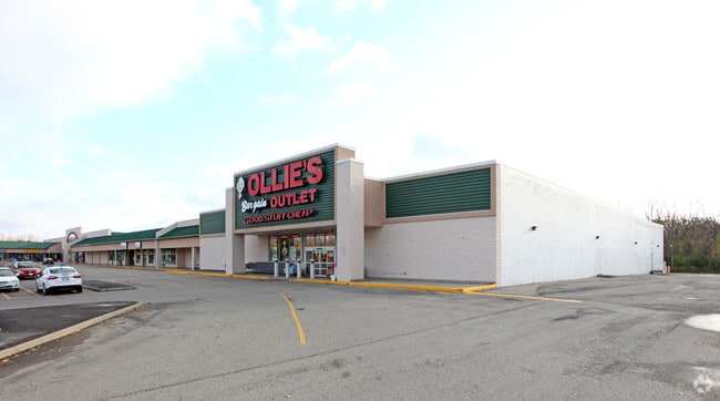
1500 Upper Valley Pike
05-00600-01200-0202
PT S W QR
Regionalshoppingcenterormallwithanchorstore
Clark
B-1
Ohio
AE The base floodplain where base flood elevations are provided. AE Zones are now used on new format FIRMs instead of A1-A30 Zones.
202
2024
13.53 AC
2025
Northeast Dayton
002502
Cincinnati/Dayton
160,572 SF
Springfield, OH
NEARBY LISTINGS FOR SALE OR LEASE
DEMOGRAPHICS near 1500 Upper Valley Pike
1 mile
3 mile
5 mile
2025 Total Population
871
31,720
80,816
2030 Population
882
31,974
81,117
Pop Growth 2025-2030
+ 1.26%
+ 0.80%
+ 0.37%
Average Age
43
40
41
2025 Total Households
397
12,909
33,547
HH Growth 2025-2030
+ 1.76%
+ 0.91%
+ 0.36%
Median Household Inc
$51,667
$51,746
$51,349
Avg Household Size
2.10
2.30
2.30
2025 Avg HH Vehicles
2.00
2.00
2.00
Median Home Value
$150,000
$170,996
$155,673
Median Year Built
1979
1954
1957
Nearby Places
Map Layers
Map Styles
 Street
 Aerial
Layers
 Traffic
 Biking
Places
Listings with unknown addresses are not visible on the map
- Restaurants
- Banks
- Shops
- Fitness
- Groceries
PUBLIC TRANSPORTATION
AIRPORT
James M Cox Dayton International
Drive
Walk
Distance
James M Cox Dayton International
34 min
25.5 mi
SALE & LEASE HISTORY
LISTING DATE
SALE/LEASE

Nov 21, 2024
For Lease
Jun 19, 2017
For Lease
Jan 12, 2017
For Lease
Aug 28, 2025
For Sale
Nearby Properties
Address
Land Use
TOTAL SIZE
Lot Size
Zoning
Address
Land Use
TOTAL SIZE
Lot Size
Zoning
1.20 AC
Address
Land Use
TOTAL SIZE
Lot Size
Zoning
479,515 SF
1.69 AC
Address
Land Use
TOTAL SIZE
Lot Size
Zoning
32.89 AC
Address
Land Use
TOTAL SIZE
Lot Size
Zoning
107.87 AC
Address
Land Use
TOTAL SIZE
Lot Size
Zoning
17,280 SF
14.32 AC
Address
Land Use
TOTAL SIZE
Lot Size
Zoning
Address
Land Use
TOTAL SIZE
Lot Size
Zoning
234,478 SF
59.28 AC
Address
Land Use
TOTAL SIZE
Lot Size
Zoning
103,458 SF
5.51 AC
Address
Land Use
TOTAL SIZE
Lot Size
Zoning
61,376 SF
3.95 AC
Address
Land Use
TOTAL SIZE
Lot Size
Zoning
160,352 SF
22.89 AC
Address
Land Use
TOTAL SIZE
Lot Size
Zoning
1,582 SF
42.13 AC
Address
Land Use
TOTAL SIZE
Lot Size
Zoning
47,929 SF
2.77 AC
Address
Land Use
TOTAL SIZE
Lot Size
Zoning
225,335 SF
22.73 AC
Address
Land Use
TOTAL SIZE
Lot Size
Zoning
103,589 SF
59.28 AC
Address
Land Use
TOTAL SIZE
Lot Size
Zoning
218,901 SF
19.15 AC
Address
Land Use
TOTAL SIZE
Lot Size
Zoning
136,700 SF
14.37 AC
Address
Land Use
TOTAL SIZE
Lot Size
Zoning
Address
Land Use
TOTAL SIZE
Lot Size
Zoning
Address
Land Use
TOTAL SIZE
Lot Size
Zoning
32,566 SF
1.90 AC
Address
Land Use
TOTAL SIZE
Lot Size
Zoning
79,187 SF
7.70 AC
Address
Land Use
TOTAL SIZE
Lot Size
Zoning
111,936 SF
7.04 AC
Address
Land Use
TOTAL SIZE
Lot Size
Zoning
1.05 AC
Address
Land Use
TOTAL SIZE
Lot Size
Zoning
141,891 SF
15.77 AC
R-4
Address
Land Use
TOTAL SIZE
Lot Size
Zoning
194,184 SF
24.01 AC
Address
Land Use
TOTAL SIZE
Lot Size
Zoning
812,844 SF
61.98 AC
Address
Land Use
TOTAL SIZE
Lot Size
Zoning
Address
Land Use
TOTAL SIZE
Lot Size
Zoning
Address
Land Use
TOTAL SIZE
Lot Size
Zoning
77,006 SF
1.39 AC
Address
Land Use
TOTAL SIZE
Lot Size
Zoning
74,122 SF
3.39 AC
Address
Land Use
TOTAL SIZE
Lot Size
Zoning
65,272 SF
2.33 AC
The World's #1 Commercial Real Estate Marketplace
Connect with us
© 2026 CoStar Group
The information above has been obtained from sources believed reliable. While we do not doubt its accuracy we have not verified it and make no guarantee, warranty or representation about it. It is your responsibility to independently confirm its accuracy and completeness. Any projections, opinions, assumptions, or estimates used are for example only and do not represent the current or future performance of the property. The value of this transaction to you depends on tax and other factors which should be evaluated by your tax, financial, and legal advisors. You and your advisors should conduct a careful, independent investigation of the property to determine to your satisfaction the suitability of the property for your needs.