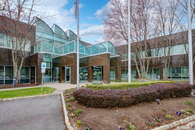
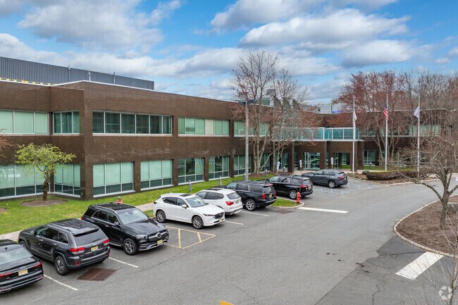
Property Record
1500 Valley Rd, Wayne, NJ 07470

Property Detail
1500 Valley Rd
14-03101-0000-00014
Passaic
Officebuilding
New Jersey
B and X Area of moderate flood hazard, usually the area between the limits of the 100-year and 500-year floods.
14
2024
10.52 AC
2025
Passaic Rt 46/23
246001
Northern New Jersey
101,667 SF
New York-Jersey City-White Plains, NY-NJ
NEARBY LISTINGS FOR SALE OR LEASE
DEMOGRAPHICS near 1500 Valley Rd
1 mile
3 mile
5 mile
2025 Total Population
7,032
77,165
308,043
2030 Population
7,257
80,236
314,939
Pop Growth 2025-2030
+ 3.20%
+ 3.98%
+ 2.24%
Average Age
44
43
40
2025 Total Households
3,185
26,363
104,765
HH Growth 2025-2030
+ 2.95%
+ 3.97%
+ 2.26%
Median Household Inc
$89,153
$134,743
$100,811
Avg Household Size
2.20
2.80
2.80
2025 Avg HH Vehicles
2.00
2.00
2.00
Median Home Value
$490,263
$695,005
$609,124
Median Year Built
1981
1968
1960
Nearby Places
Map Layers
Map Styles
 Street
 Aerial
Transit
 Traffic
 Biking
Places
Listings with unknown addresses are not visible on the map
- Restaurants
- Banks
- Shops
- Fitness
- Groceries
PUBLIC TRANSPORTATION
COMMUTER RAIL
Wayne/Route 23 Transit Center (Montclair-Boonton Line - NJ Transit Commuter Rail (NJ Transit))
Drive
Walk
Distance
Wayne/Route 23 Transit Center (Montclair-Boonton Line - NJ Transit Commuter Rail (NJ Transit))
12 min
5.5 mi
Mountain View (Montclair-Boonton Line - NJ Transit Commuter Rail (NJ Transit))
Drive
Walk
Distance
Mountain View (Montclair-Boonton Line - NJ Transit Commuter Rail (NJ Transit))
13 min
5.6 mi
AIRPORT
Newark Liberty International
Drive
Walk
Distance
Newark Liberty International
35 min
25.9 mi
LaGuardia
Drive
Walk
Distance
LaGuardia
47 min
29.4 mi
Westchester County
Drive
Walk
Distance
Westchester County
65 min
46.0 mi
Freight Ports
Maher Terminal
Drive
Walk
Distance
Maher Terminal
42 min
25.8 mi
Nearby Properties
Address
Land Use
TOTAL SIZE
Lot Size
Zoning
Address
Land Use
TOTAL SIZE
Lot Size
Zoning
45,000 SF
124.04 AC
R-A
Address
Land Use
TOTAL SIZE
Lot Size
Zoning
61.98 AC
Address
Land Use
TOTAL SIZE
Lot Size
Zoning
84.08 AC
Address
Land Use
TOTAL SIZE
Lot Size
Zoning
Address
Land Use
TOTAL SIZE
Lot Size
Zoning
19.20 AC
Address
Land Use
TOTAL SIZE
Lot Size
Zoning
1,482 SF
55.66 AC
R-B
Address
Land Use
TOTAL SIZE
Lot Size
Zoning
27.25 AC
Address
Land Use
TOTAL SIZE
Lot Size
Zoning
12.69 AC
A40
Address
Land Use
TOTAL SIZE
Lot Size
Zoning
334,755 SF
107.89 AC
Address
Land Use
TOTAL SIZE
Lot Size
Zoning
220,994 SF
16.48 AC
Address
Land Use
TOTAL SIZE
Lot Size
Zoning
21.82 AC
Address
Land Use
TOTAL SIZE
Lot Size
Zoning
186,299 SF
2.16 AC
R-A
Address
Land Use
TOTAL SIZE
Lot Size
Zoning
79,562 SF
10.33 AC
AHO3
Address
Land Use
TOTAL SIZE
Lot Size
Zoning
145,949 SF
50 AC
Address
Land Use
TOTAL SIZE
Lot Size
Zoning
277,661 SF
50.20 AC
Address
Land Use
TOTAL SIZE
Lot Size
Zoning
63,460 SF
10.72 AC
Address
Land Use
TOTAL SIZE
Lot Size
Zoning
259,919 SF
48.14 AC
Address
Land Use
TOTAL SIZE
Lot Size
Zoning
25.80 AC
Address
Land Use
TOTAL SIZE
Lot Size
Zoning
13.61 AC
Address
Land Use
TOTAL SIZE
Lot Size
Zoning
55,035 SF
34.48 AC
R-A
Address
Land Use
TOTAL SIZE
Lot Size
Zoning
8.87 AC
RA1
Address
Land Use
TOTAL SIZE
Lot Size
Zoning
4.72 AC
Address
Land Use
TOTAL SIZE
Lot Size
Zoning
7,398 SF
13.96 AC
Address
Land Use
TOTAL SIZE
Lot Size
Zoning
1,600 SF
11.60 AC
OB
Address
Land Use
TOTAL SIZE
Lot Size
Zoning
1,197.68 AC
Address
Land Use
TOTAL SIZE
Lot Size
Zoning
Address
Land Use
TOTAL SIZE
Lot Size
Zoning
36.30 AC
A40
Address
Land Use
TOTAL SIZE
Lot Size
Zoning
145,904 SF
14.20 AC
IP
Address
Land Use
TOTAL SIZE
Lot Size
Zoning
1.54 AC
Address
Land Use
TOTAL SIZE
Lot Size
Zoning
2,511 SF
17.63 AC
The World's #1 Commercial Real Estate Marketplace
Connect with us
© 2026 CoStar Group
The information above has been obtained from sources believed reliable. While we do not doubt its accuracy we have not verified it and make no guarantee, warranty or representation about it. It is your responsibility to independently confirm its accuracy and completeness. Any projections, opinions, assumptions, or estimates used are for example only and do not represent the current or future performance of the property. The value of this transaction to you depends on tax and other factors which should be evaluated by your tax, financial, and legal advisors. You and your advisors should conduct a careful, independent investigation of the property to determine to your satisfaction the suitability of the property for your needs.