Property Record
1500 W Airline Hwy, La Place, LA 70068


NEARBY LISTINGS FOR SALE OR LEASE
-
-
View all La Place listings for sale on LoopNet.com
Property Detail
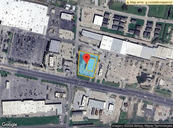
1500 W Airline Hwy
New Orleans-Metairie, LA
Carrollwood
0420009458
F GROUND COMMENCES AT N R/O/W LINE AIRLINE HWY & COB 352 / 666 E R/O/W LINE CARROLLWOOD AVENUE - THENCE 195.28' IN AN EASTERLY DIRECTION ALONG AIRLINE HWY R/O/W LINE TO A POINT - THENCE AT AN ANGLE OF 92 DEGREES 55.26' IN A NORTHERLY DIRECTION FROM A
Commercialnec
St John Baptist
X
Louisiana
22095C0230D
1.45 AC
2025
St John Baptist Parish
2024
New Orleans/Metairie/Kenner
070300
DEMOGRAPHICS near 1500 W Airline Hwy
1 Mile
3 Mile
5 Mile
2024 Total Population
10,091
30,050
38,036
2029 Population
9,460
28,240
35,807
Pop Growth 2024-2029
(6.25%)
(6.02%)
(5.86%)
Average Age
40
39
40
2024 Total Households
3,813
11,065
14,033
HH Growth 2024-2029
(5.95%)
(5.68%)
(5.59%)
Median Household Inc
$54,767
$63,849
$62,894
Avg Household Size
2.60
2.70
2.70
2024 Avg HH Vehicles
2.00
2.00
2.00
Median Home Value
$156,850
$168,967
$171,201
Median Year Built
1978
1984
1983
Nearby Places
Map Layers
Map Styles
 Street
 Aerial
- Restaurants
- Banks
- Shops
- Fitness
- Groceries
PUBLIC TRANSPORTATION
AIRPORT
Louis Armstrong New Orleans International
DRIVE
WALK
Distance
Louis Armstrong New Orleans International
25 min
17.4 mi
Freight Ports
Port of New Orleans
DRIVE
WALK
Distance
Port of New Orleans
46 min
32.0 mi
Nearby Properties
Address
Land Use
TOTAL SIZE
Lot Size
Zoning
Address
Land Use
TOTAL SIZE
Lot Size
Zoning
Address
Land Use
TOTAL SIZE
Lot Size
Zoning
705.13 AC
Address
Land Use
TOTAL SIZE
Lot Size
Zoning
Address
Land Use
TOTAL SIZE
Lot Size
Zoning
Address
Land Use
TOTAL SIZE
Lot Size
Zoning
Address
Land Use
TOTAL SIZE
Lot Size
Zoning
Address
Land Use
TOTAL SIZE
Lot Size
Zoning
Address
Land Use
TOTAL SIZE
Lot Size
Zoning
0.83 AC
Address
Land Use
TOTAL SIZE
Lot Size
Zoning
Address
Land Use
TOTAL SIZE
Lot Size
Zoning
2.45 AC
Address
Land Use
TOTAL SIZE
Lot Size
Zoning
Address
Land Use
TOTAL SIZE
Lot Size
Zoning
Address
Land Use
TOTAL SIZE
Lot Size
Zoning
Address
Land Use
TOTAL SIZE
Lot Size
Zoning
Address
Land Use
TOTAL SIZE
Lot Size
Zoning
Address
Land Use
TOTAL SIZE
Lot Size
Zoning
Address
Land Use
TOTAL SIZE
Lot Size
Zoning
Address
Land Use
TOTAL SIZE
Lot Size
Zoning
Address
Land Use
TOTAL SIZE
Lot Size
Zoning
Address
Land Use
TOTAL SIZE
Lot Size
Zoning
Address
Land Use
TOTAL SIZE
Lot Size
Zoning
Address
Land Use
TOTAL SIZE
Lot Size
Zoning
12.50 AC
Address
Land Use
TOTAL SIZE
Lot Size
Zoning
6.79 AC
Address
Land Use
TOTAL SIZE
Lot Size
Zoning
1.40 AC
Address
Land Use
TOTAL SIZE
Lot Size
Zoning
Address
Land Use
TOTAL SIZE
Lot Size
Zoning
Address
Land Use
TOTAL SIZE
Lot Size
Zoning
0.33 AC
The World's #1 Commercial Real Estate Marketplace
Connect with us
© 2026 CoStar Group
The information above has been obtained from sources believed reliable. While we do not doubt its accuracy we have not verified it and make no guarantee, warranty or representation about it. It is your responsibility to independently confirm its accuracy and completeness. Any projections, opinions, assumptions, or estimates used are for example only and do not represent the current or future performance of the property. The value of this transaction to you depends on tax and other factors which should be evaluated by your tax, financial, and legal advisors. You and your advisors should conduct a careful, independent investigation of the property to determine to your satisfaction the suitability of the property for your needs.