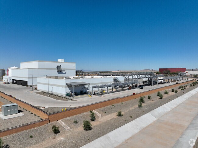
Property Record
1500 W Clayton Rd, Casa Grande, AZ 85193


NEARBY LISTINGS FOR SALE OR LEASE
Property Detail
1500 W Clayton Rd
Phoenix-Mesa-Scottsdale, AZ
A PORTION OF LAND WITHIN THE SOUTHEAST QUARTER OF SECTION 14, TOW NSHIP 06 SOUTH, RANGE 05 EAST, BEING MORE PARTICULARLY DESCRIBED AS FOLLOWS: BEGINNING AT THE SOUTHEAST CORNER OF SAID SECTION 14; THENCE WEST 1828.71 FEET ALONG THE SOUTH LINE OF SAID
503-35-006A
Pinal
Vacantlandnec
Arizona
2024
84.33 AC
2025
Pinal County
001500
Phoenix
DEMOGRAPHICS near 1500 W Clayton Rd
1 Mile
3 Mile
5 Mile
2024 Total Population
267
17,403
54,749
2029 Population
336
22,026
69,376
Pop Growth 2024-2029
+ 25.84%
+ 26.56%
+ 26.72%
Average Age
44
39
39
2024 Total Households
101
6,340
19,526
HH Growth 2024-2029
+ 23.76%
+ 26.03%
+ 26.26%
Median Household Inc
$48,823
$52,489
$61,345
Avg Household Size
2.70
2.70
2.70
2024 Avg HH Vehicles
2.00
2.00
2.00
Median Home Value
$96,249
$176,931
$232,684
Median Year Built
1976
1991
2000
Nearby Places
Map Layers
Map Styles
 Street
 Aerial
- Restaurants
- Banks
- Shops
- Fitness
- Groceries
PUBLIC TRANSPORTATION
AIRPORT
Phoenix-Mesa Gateway
DRIVE
WALK
Distance
Phoenix-Mesa Gateway
67 min
43.0 mi
Freight Ports
Port of San Diego
DRIVE
WALK
Distance
Port of San Diego
378 min
344.1 mi
Nearby Properties
Address
Land Use
TOTAL SIZE
Lot Size
Zoning
Address
Land Use
TOTAL SIZE
Lot Size
Zoning
3,431,931 SF
47.73 AC
Address
Land Use
TOTAL SIZE
Lot Size
Zoning
615,446 SF
88.25 AC
Address
Land Use
TOTAL SIZE
Lot Size
Zoning
877,742 SF
125.20 AC
UNDESIGNAT
Address
Land Use
TOTAL SIZE
Lot Size
Zoning
525,773 SF
27.24 AC
UNDESIGNAT
Address
Land Use
TOTAL SIZE
Lot Size
Zoning
223,443 SF
176.81 AC
Address
Land Use
TOTAL SIZE
Lot Size
Zoning
380,964 SF
36.62 AC
UNDESIGNAT
Address
Land Use
TOTAL SIZE
Lot Size
Zoning
286,759 SF
37.76 AC
UNDESIGNAT
Address
Land Use
TOTAL SIZE
Lot Size
Zoning
123,963 SF
15.43 AC
UNDESIGNAT
Address
Land Use
TOTAL SIZE
Lot Size
Zoning
172,746 SF
14.70 AC
UNDESIGNAT
Address
Land Use
TOTAL SIZE
Lot Size
Zoning
264,993 SF
26.48 AC
Address
Land Use
TOTAL SIZE
Lot Size
Zoning
93,477 SF
4.22 AC
UNDESIGNAT
Address
Land Use
TOTAL SIZE
Lot Size
Zoning
111,066 SF
5.04 AC
UNDESIGNAT
Address
Land Use
TOTAL SIZE
Lot Size
Zoning
100,149 SF
10.59 AC
Address
Land Use
TOTAL SIZE
Lot Size
Zoning
395,597 SF
13.81 AC
Address
Land Use
TOTAL SIZE
Lot Size
Zoning
33.70 AC
Address
Land Use
TOTAL SIZE
Lot Size
Zoning
67,163 SF
24.27 AC
UNDESIGNAT
Address
Land Use
TOTAL SIZE
Lot Size
Zoning
32 AC
UNDESIGNAT
Address
Land Use
TOTAL SIZE
Lot Size
Zoning
840 SF
80 AC
Address
Land Use
TOTAL SIZE
Lot Size
Zoning
51,866 SF
5.88 AC
UNDESIGNAT
Address
Land Use
TOTAL SIZE
Lot Size
Zoning
48,543 SF
3.04 AC
UNDESIGNAT
Address
Land Use
TOTAL SIZE
Lot Size
Zoning
15,122 SF
114.70 AC
UNDESIGNAT
Address
Land Use
TOTAL SIZE
Lot Size
Zoning
711 SF
67.24 AC
UNDESIGNAT
Address
Land Use
TOTAL SIZE
Lot Size
Zoning
53,952 SF
10 AC
Address
Land Use
TOTAL SIZE
Lot Size
Zoning
127,626 SF
19.13 AC
UNDESIGNAT
Address
Land Use
TOTAL SIZE
Lot Size
Zoning
Address
Land Use
TOTAL SIZE
Lot Size
Zoning
151 AC
UNDESIGNAT
Address
Land Use
TOTAL SIZE
Lot Size
Zoning
303,129 SF
4.03 AC
UNDESIGNAT
Address
Land Use
TOTAL SIZE
Lot Size
Zoning
31,252 SF
2.89 AC
The World's #1 Commercial Real Estate Marketplace
Connect with us
© 2026 CoStar Group
The information above has been obtained from sources believed reliable. While we do not doubt its accuracy we have not verified it and make no guarantee, warranty or representation about it. It is your responsibility to independently confirm its accuracy and completeness. Any projections, opinions, assumptions, or estimates used are for example only and do not represent the current or future performance of the property. The value of this transaction to you depends on tax and other factors which should be evaluated by your tax, financial, and legal advisors. You and your advisors should conduct a careful, independent investigation of the property to determine to your satisfaction the suitability of the property for your needs.