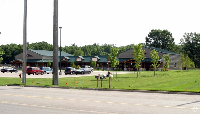
Property Record
1500 Whitehall Rd, Muskegon, MI 49445


NEARBY LISTINGS FOR SALE OR LEASE
Property Detail
1500 Whitehall Rd
10-006-300-0003-10
MUSKEGON CHARTER TOWNSHIP SEC 6 T10N R16W THAT PART OF SW FRAC 1/4, SW FRAC 1/4 DESC AS FOL: COMM AT SW COR OF SD SEC TH N
Commercialnec
Muskegon
X
Michigan
26121C0144E
3.06 AC
2024
Northern Muskegon County
2025
West Michigan
001800
Muskegon-Norton Shores, MI
13,500 SF
DEMOGRAPHICS near 1500 Whitehall Rd
1 Mile
3 Mile
5 Mile
2024 Total Population
2,884
14,019
61,143
2029 Population
2,893
14,057
61,647
Pop Growth 2024-2029
+ 0.31%
+ 0.27%
+ 0.82%
Average Age
42
42
40
2024 Total Households
1,166
5,513
23,887
HH Growth 2024-2029
+ 0.26%
+ 0.27%
+ 0.80%
Median Household Inc
$65,291
$68,587
$48,746
Avg Household Size
2.40
2.50
2.40
2024 Avg HH Vehicles
2.00
2.00
2.00
Median Home Value
$168,333
$177,287
$136,237
Median Year Built
1973
1971
1957
Nearby Places
Map Layers
Map Styles
 Street
 Aerial
- Restaurants
- Banks
- Shops
- Fitness
- Groceries
SALE & LEASE HISTORY
LISTING DATE
SALE/LEASE

Sep 24, 2016
For Lease
Jul 07, 2017
For Lease
Jul 07, 2017
For Sale
Dec 08, 2016
For Sale
Nearby Properties
Address
Land Use
TOTAL SIZE
Lot Size
Zoning
Address
Land Use
TOTAL SIZE
Lot Size
Zoning
Address
Land Use
TOTAL SIZE
Lot Size
Zoning
183,891 SF
391.21 AC
IP
Address
Land Use
TOTAL SIZE
Lot Size
Zoning
191,930 SF
37.12 AC
C2
Address
Land Use
TOTAL SIZE
Lot Size
Zoning
892,516 SF
57.88 AC
I
Address
Land Use
TOTAL SIZE
Lot Size
Zoning
59,396 SF
Address
Land Use
TOTAL SIZE
Lot Size
Zoning
79,321 SF
4.28 AC
B-3
Address
Land Use
TOTAL SIZE
Lot Size
Zoning
79,321 SF
5 AC
FBC-MS
Address
Land Use
TOTAL SIZE
Lot Size
Zoning
191,930 SF
35 AC
C2
Address
Land Use
TOTAL SIZE
Lot Size
Zoning
325,640 SF
49 AC
WM
Address
Land Use
TOTAL SIZE
Lot Size
Zoning
14,022 SF
13 AC
LI
Address
Land Use
TOTAL SIZE
Lot Size
Zoning
103,364 SF
4.35 AC
R-3HIGH
Address
Land Use
TOTAL SIZE
Lot Size
Zoning
79,321 SF
4.28 AC
B-3
Address
Land Use
TOTAL SIZE
Lot Size
Zoning
18,844 SF
99.10 AC
WI-PUD
Address
Land Use
TOTAL SIZE
Lot Size
Zoning
69,532 SF
4.38 AC
PUD
Address
Land Use
TOTAL SIZE
Lot Size
Zoning
37,872 SF
36.61 AC
RMH
Address
Land Use
TOTAL SIZE
Lot Size
Zoning
40,819 SF
6.80 AC
FBC-NC
Address
Land Use
TOTAL SIZE
Lot Size
Zoning
15,852 SF
1.77 AC
PUD
Address
Land Use
TOTAL SIZE
Lot Size
Zoning
41,845 SF
7.66 AC
M
Address
Land Use
TOTAL SIZE
Lot Size
Zoning
52.37 AC
WI-PUD
Address
Land Use
TOTAL SIZE
Lot Size
Zoning
84,160 SF
1.22 AC
PUD
Address
Land Use
TOTAL SIZE
Lot Size
Zoning
55,386 SF
5.72 AC
IND
Address
Land Use
TOTAL SIZE
Lot Size
Zoning
16,312 SF
15.99 AC
I-2
Address
Land Use
TOTAL SIZE
Lot Size
Zoning
11,033 SF
1.33 AC
PUD
Address
Land Use
TOTAL SIZE
Lot Size
Zoning
10,660 SF
1.09 AC
FBC-DT
Address
Land Use
TOTAL SIZE
Lot Size
Zoning
27,624 SF
1.70 AC
GC
Address
Land Use
TOTAL SIZE
Lot Size
Zoning
21,000 SF
0.51 AC
Address
Land Use
TOTAL SIZE
Lot Size
Zoning
39,232 SF
2.65 AC
PUD
Address
Land Use
TOTAL SIZE
Lot Size
Zoning
75,672 SF
5.15 AC
LI
Address
Land Use
TOTAL SIZE
Lot Size
Zoning
40,148 SF
5.26 AC
C1
Address
Land Use
TOTAL SIZE
Lot Size
Zoning
18,067 SF
1.70 AC
R-2-MED
The World's #1 Commercial Real Estate Marketplace
Connect with us
© 2026 CoStar Group
The information above has been obtained from sources believed reliable. While we do not doubt its accuracy we have not verified it and make no guarantee, warranty or representation about it. It is your responsibility to independently confirm its accuracy and completeness. Any projections, opinions, assumptions, or estimates used are for example only and do not represent the current or future performance of the property. The value of this transaction to you depends on tax and other factors which should be evaluated by your tax, financial, and legal advisors. You and your advisors should conduct a careful, independent investigation of the property to determine to your satisfaction the suitability of the property for your needs.