Property Record
15000 Minnetonka Blvd, Minnetonka, MN 55345

NEARBY LISTINGS FOR SALE OR LEASE
Property Detail
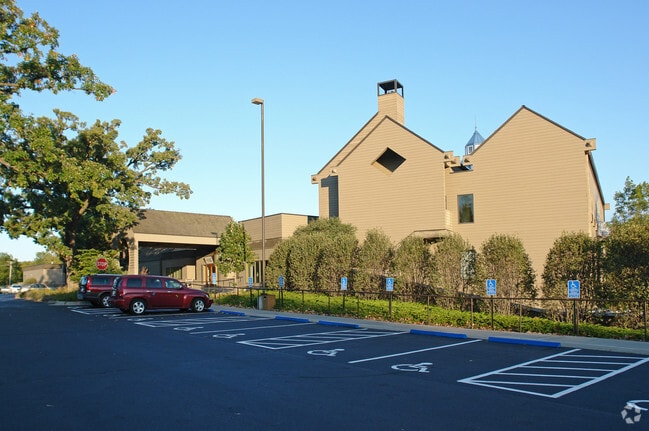
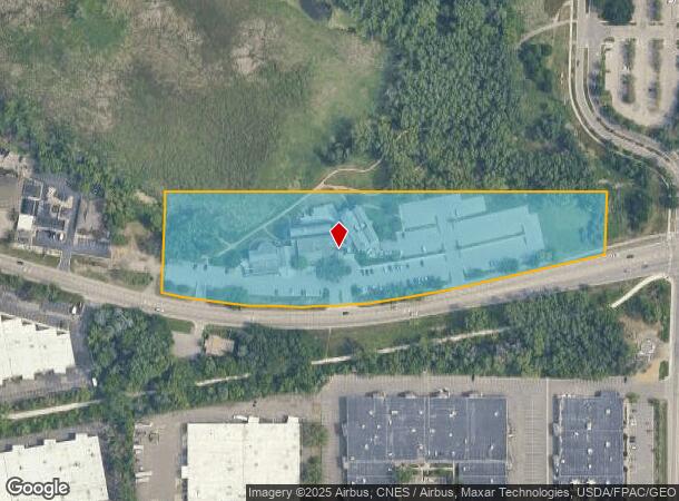
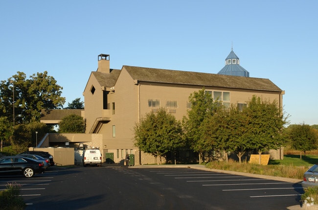
15000 Minnetonka Blvd
Minneapolis-St. Paul-Bloomington, MN-WI
Rosenthal Office Center
16-117-22-43-0023
LOT 001 BLOCK 001 B ROSENTHAL OFFICE CENTER LOT 1 BLK 1 AND LOT 1 BLK 2 ALSO OUTLOTS A B AND C ROSENTHAL OFFICE CENTER ALSO THAT PART OF S 100 FT OF NW 1/4 OF SE 1/4 LYING W OF E 208 FT T IRREGULAR
Commercialnec
Hennepin
AE
Minnesota
27053C0328F
1
0
6.27 AC
2024
Ridgedale
026302
Minneapolis/St Paul
20,000 SF
DEMOGRAPHICS near 15000 Minnetonka Blvd
1 Mile
3 Mile
5 Mile
2024 Total Population
3,922
48,632
148,089
2029 Population
3,824
48,011
146,057
Pop Growth 2024-2029
(2.50%)
(1.28%)
(1.37%)
Average Age
44
44
42
2024 Total Households
1,485
20,504
64,048
HH Growth 2024-2029
(2.69%)
(1.37%)
(1.48%)
Median Household Inc
$140,861
$116,817
$100,755
Avg Household Size
2.60
2.30
2.20
2024 Avg HH Vehicles
2.00
2.00
2.00
Median Home Value
$445,845
$446,257
$407,850
Median Year Built
1964
1976
1978
Nearby Places
Map Layers
Map Styles
 Street
 Aerial
- Restaurants
- Banks
- Shops
- Fitness
- Groceries
PUBLIC TRANSPORTATION
AIRPORT
Minneapolis-St Paul International/Wold-Chamberlain
DRIVE
WALK
Distance
Minneapolis-St Paul International/Wold-Chamberlain
26 min
18.3 mi
Freight Ports
Port Milwaukee
DRIVE
WALK
Distance
Port Milwaukee
392 min
351.2 mi
Nearby Properties
Address
Land Use
TOTAL SIZE
Lot Size
Zoning
Address
Land Use
TOTAL SIZE
Lot Size
Zoning
324,564 SF
32.54 AC
PID
Address
Land Use
TOTAL SIZE
Lot Size
Zoning
18.27 AC
Address
Land Use
TOTAL SIZE
Lot Size
Zoning
20,710 SF
7.69 AC
PID
Address
Land Use
TOTAL SIZE
Lot Size
Zoning
20,710 SF
7.69 AC
PID
Address
Land Use
TOTAL SIZE
Lot Size
Zoning
6.47 AC
Address
Land Use
TOTAL SIZE
Lot Size
Zoning
19.46 AC
PUD
Address
Land Use
TOTAL SIZE
Lot Size
Zoning
196,498 SF
13.13 AC
PID
Address
Land Use
TOTAL SIZE
Lot Size
Zoning
11.93 AC
PID
Address
Land Use
TOTAL SIZE
Lot Size
Zoning
2.38 AC
Address
Land Use
TOTAL SIZE
Lot Size
Zoning
171,900 SF
39.17 AC
B1
Address
Land Use
TOTAL SIZE
Lot Size
Zoning
2.18 AC
Address
Land Use
TOTAL SIZE
Lot Size
Zoning
94,155 SF
2.06 AC
PUD
Address
Land Use
TOTAL SIZE
Lot Size
Zoning
2.12 AC
Address
Land Use
TOTAL SIZE
Lot Size
Zoning
43,180 SF
10.28 AC
PID
Address
Land Use
TOTAL SIZE
Lot Size
Zoning
43,180 SF
10.94 AC
PID
Address
Land Use
TOTAL SIZE
Lot Size
Zoning
127,028 SF
9.04 AC
R4
Address
Land Use
TOTAL SIZE
Lot Size
Zoning
14,239 SF
4.44 AC
PID
Address
Land Use
TOTAL SIZE
Lot Size
Zoning
0.07 AC
Address
Land Use
TOTAL SIZE
Lot Size
Zoning
81,834 SF
16.20 AC
PID
Address
Land Use
TOTAL SIZE
Lot Size
Zoning
7.51 AC
Address
Land Use
TOTAL SIZE
Lot Size
Zoning
46,726 SF
2.65 AC
PUD
Address
Land Use
TOTAL SIZE
Lot Size
Zoning
0.48 AC
Address
Land Use
TOTAL SIZE
Lot Size
Zoning
123,774 SF
11.93 AC
PID
Address
Land Use
TOTAL SIZE
Lot Size
Zoning
2,676 SF
3.17 AC
PUD
Address
Land Use
TOTAL SIZE
Lot Size
Zoning
98,096 SF
4.38 AC
R4PURD
Address
Land Use
TOTAL SIZE
Lot Size
Zoning
7.06 AC
PUD
Address
Land Use
TOTAL SIZE
Lot Size
Zoning
49,925 SF
18.37 AC
B1
Address
Land Use
TOTAL SIZE
Lot Size
Zoning
129,168 SF
16.01 AC
PUD
Address
Land Use
TOTAL SIZE
Lot Size
Zoning
71,990 SF
5.85 AC
PID
Address
Land Use
TOTAL SIZE
Lot Size
Zoning
3,440 SF
3.52 AC
R-1
The World's #1 Commercial Real Estate Marketplace
Connect with us
© 2025 CoStar Group
The information above has been obtained from sources believed reliable. While we do not doubt its accuracy we have not verified it and make no guarantee, warranty or representation about it. It is your responsibility to independently confirm its accuracy and completeness. Any projections, opinions, assumptions, or estimates used are for example only and do not represent the current or future performance of the property. The value of this transaction to you depends on tax and other factors which should be evaluated by your tax, financial, and legal advisors. You and your advisors should conduct a careful, independent investigation of the property to determine to your satisfaction the suitability of the property for your needs.