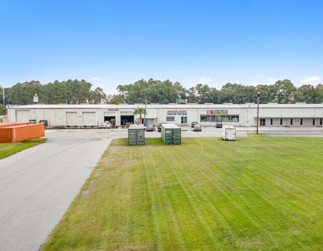
Property Record
15000 Abercorn St, Savannah, GA 31419


NEARBY LISTINGS FOR SALE OR LEASE
Property Detail
15000 Abercorn St
1100502001B
Georgetown Ind
Warehouse
A PORTION OF THE FORMER ZIPPERER TCT
X
Chatham
13051C0255G
Georgia
2023
5 AC
2025
Outlying Chatham County
010807
Savannah
27,760 SF
Savannah, GA
DEMOGRAPHICS near 15000 Abercorn St
1 Mile
3 Mile
5 Mile
2024 Total Population
5,169
26,951
51,008
2029 Population
5,283
27,849
52,921
Pop Growth 2024-2029
+ 2.21%
+ 3.33%
+ 3.75%
Average Age
38
37
38
2024 Total Households
2,288
10,861
20,055
HH Growth 2024-2029
+ 2.27%
+ 3.31%
+ 3.84%
Median Household Inc
$79,510
$67,176
$63,709
Avg Household Size
2.20
2.40
2.40
2024 Avg HH Vehicles
2.00
2.00
2.00
Median Home Value
$247,443
$212,395
$194,007
Median Year Built
1994
2000
1998
Nearby Places
Map Layers
Map Styles
 Street
 Aerial
- Restaurants
- Banks
- Shops
- Fitness
- Groceries
PUBLIC TRANSPORTATION
AIRPORT
Savannah/Hilton Head International
DRIVE
WALK
Distance
Savannah/Hilton Head International
24 min
12.2 mi
Freight Ports
Georgia Ports - Savannah
DRIVE
WALK
Distance
Georgia Ports - Savannah
26 min
15.2 mi
SALE & LEASE HISTORY
LISTING DATE
SALE/LEASE

Sep 24, 2021
For Sale
Nov 11, 2024
For Lease
Nearby Properties
Address
Land Use
TOTAL SIZE
Lot Size
Zoning
Address
Land Use
TOTAL SIZE
Lot Size
Zoning
34,980 SF
23.34 AC
PR3-16
Address
Land Use
TOTAL SIZE
Lot Size
Zoning
33,510 SF
22.30 AC
PRM16
Address
Land Use
TOTAL SIZE
Lot Size
Zoning
12,560 SF
14.82 AC
PUD
Address
Land Use
TOTAL SIZE
Lot Size
Zoning
21.13 AC
PUDC
Address
Land Use
TOTAL SIZE
Lot Size
Zoning
6,580 SF
42.03 AC
PUDM-12
Address
Land Use
TOTAL SIZE
Lot Size
Zoning
8,544 SF
22.40 AC
PBC
Address
Land Use
TOTAL SIZE
Lot Size
Zoning
8,784 SF
29.43 AC
PUDM10
Address
Land Use
TOTAL SIZE
Lot Size
Zoning
8,208 SF
48.30 AC
PUDC
Address
Land Use
TOTAL SIZE
Lot Size
Zoning
41,592 SF
20.47 AC
PUDC
Address
Land Use
TOTAL SIZE
Lot Size
Zoning
22,728 SF
15.81 AC
PUDC
Address
Land Use
TOTAL SIZE
Lot Size
Zoning
12,560 SF
22.94 AC
PUD
Address
Land Use
TOTAL SIZE
Lot Size
Zoning
27,168 SF
15.95 AC
PUDC
Address
Land Use
TOTAL SIZE
Lot Size
Zoning
16,138 SF
18.33 AC
PUDC
Address
Land Use
TOTAL SIZE
Lot Size
Zoning
6,278 SF
24.47 AC
RA
Address
Land Use
TOTAL SIZE
Lot Size
Zoning
27,408 SF
12.97 AC
PUDC
Address
Land Use
TOTAL SIZE
Lot Size
Zoning
12,432 SF
14.51 AC
PUDM
Address
Land Use
TOTAL SIZE
Lot Size
Zoning
94,808 SF
43.60 AC
RA
Address
Land Use
TOTAL SIZE
Lot Size
Zoning
8,544 SF
13.03 AC
PBC
Address
Land Use
TOTAL SIZE
Lot Size
Zoning
18,800 SF
8.71 AC
PUDC
Address
Land Use
TOTAL SIZE
Lot Size
Zoning
11,784 SF
9.79 AC
PUDC
Address
Land Use
TOTAL SIZE
Lot Size
Zoning
142,560 SF
6.67 AC
PUDCC
Address
Land Use
TOTAL SIZE
Lot Size
Zoning
221,171 SF
28.22 AC
PBC
Address
Land Use
TOTAL SIZE
Lot Size
Zoning
88,382 SF
23.16 AC
PUDC
Address
Land Use
TOTAL SIZE
Lot Size
Zoning
35,304 SF
6.40 AC
PUDC
Address
Land Use
TOTAL SIZE
Lot Size
Zoning
35,304 SF
6.86 AC
PUDC
Address
Land Use
TOTAL SIZE
Lot Size
Zoning
64,800 SF
2.83 AC
PUDC
Address
Land Use
TOTAL SIZE
Lot Size
Zoning
11,784 SF
9.37 AC
PUDC
Address
Land Use
TOTAL SIZE
Lot Size
Zoning
13,225 SF
18.59 AC
PUDCC
Address
Land Use
TOTAL SIZE
Lot Size
Zoning
9,170 SF
10 AC
PUDM6
Address
Land Use
TOTAL SIZE
Lot Size
Zoning
79,700 SF
4.67 AC
PUDCC
The World's #1 Commercial Real Estate Marketplace
Connect with us
© 2026 CoStar Group
The information above has been obtained from sources believed reliable. While we do not doubt its accuracy we have not verified it and make no guarantee, warranty or representation about it. It is your responsibility to independently confirm its accuracy and completeness. Any projections, opinions, assumptions, or estimates used are for example only and do not represent the current or future performance of the property. The value of this transaction to you depends on tax and other factors which should be evaluated by your tax, financial, and legal advisors. You and your advisors should conduct a careful, independent investigation of the property to determine to your satisfaction the suitability of the property for your needs.