Property Record
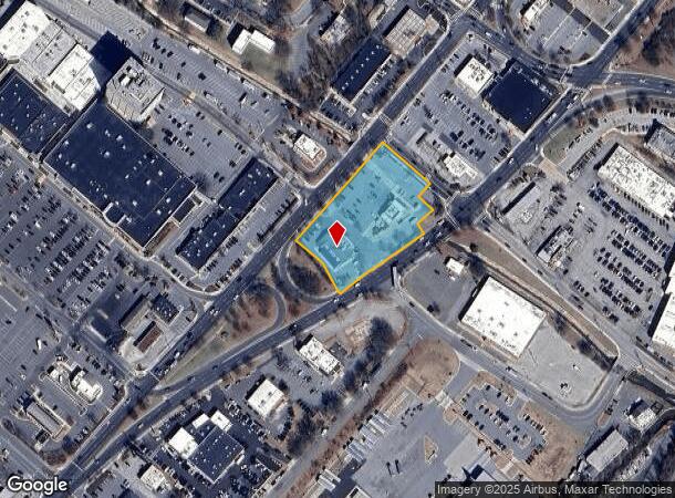
15004 Baltimore Ave, Laurel, MD 20707


NEARBY LISTINGS FOR SALE OR LEASE
Property Detail
15004 Baltimore Ave
10-0998930
BOSWELL TRACT ALL OF BLK 66
Restaurantbuilding
Prince George's
AO
Maryland
24033C0051E
1.75 AC
2024
Laurel
2025
Washington, DC
800213
Washington-Arlington-Alexandria, DC-VA-MD-WV
8,305 SF
DEMOGRAPHICS near 15004 Baltimore Ave
1 Mile
3 Mile
5 Mile
2024 Total Population
19,042
101,381
171,162
2029 Population
18,664
101,262
171,322
Pop Growth 2024-2029
(1.99%)
(0.12%)
+ 0.09%
Average Age
37
38
38
2024 Total Households
7,772
37,812
62,468
HH Growth 2024-2029
(2.17%)
(0.35%)
(0.05%)
Median Household Inc
$73,859
$96,153
$102,419
Avg Household Size
2.40
2.60
2.70
2024 Avg HH Vehicles
2.00
2.00
2.00
Median Home Value
$339,989
$387,761
$404,742
Median Year Built
1979
1985
1986
Nearby Places
Map Layers
Map Styles
 Street
 Aerial
- Restaurants
- Banks
- Shops
- Fitness
- Groceries
PUBLIC TRANSPORTATION
TRANSIT/SUBWAY
Laurel (Camden Line - Maryland Area Regional Commuter Trains (The MARC))
DRIVE
WALK
Distance
Laurel (Camden Line - Maryland Area Regional Commuter Trains (The MARC))
2 min
15 min
0.8 mi
COMMUTER RAIL
Laurel (Camden Line - Maryland Area Regional Commuter Trains (The MARC))
DRIVE
WALK
Distance
Laurel (Camden Line - Maryland Area Regional Commuter Trains (The MARC))
2 min
15 min
0.8 mi
Laurel Racetrack (Camden Line - Maryland Area Regional Commuter Trains (The MARC))
DRIVE
WALK
Distance
Laurel Racetrack (Camden Line - Maryland Area Regional Commuter Trains (The MARC))
6 min
1.9 mi
AIRPORT
Baltimore/Washington International Thurgood Marshall
DRIVE
WALK
Distance
Baltimore/Washington International Thurgood Marshall
25 min
14.7 mi
Ronald Reagan Washington Ntl
DRIVE
WALK
Distance
Ronald Reagan Washington Ntl
40 min
24.7 mi
Washington Dulles International
DRIVE
WALK
Distance
Washington Dulles International
64 min
41.4 mi
Freight Ports
Port of Baltimore
DRIVE
WALK
Distance
Port of Baltimore
31 min
21.1 mi
Nearby Properties
Address
Land Use
TOTAL SIZE
Lot Size
Zoning
Address
Land Use
TOTAL SIZE
Lot Size
Zoning
393,970 SF
44 AC
RR
Address
Land Use
TOTAL SIZE
Lot Size
Zoning
218,406 SF
26.80 AC
LAUR
Address
Land Use
TOTAL SIZE
Lot Size
Zoning
399,715 SF
23.04 AC
LAUR
Address
Land Use
TOTAL SIZE
Lot Size
Zoning
791,089 SF
10.69 AC
LAUR
Address
Land Use
TOTAL SIZE
Lot Size
Zoning
657,100 SF
7.39 AC
LAUR
Address
Land Use
TOTAL SIZE
Lot Size
Zoning
514,064 SF
7.37 AC
NAC
Address
Land Use
TOTAL SIZE
Lot Size
Zoning
279,320 SF
15.25 AC
R15
Address
Land Use
TOTAL SIZE
Lot Size
Zoning
390,986 SF
16.87 AC
LAUR
Address
Land Use
TOTAL SIZE
Lot Size
Zoning
564,165 SF
35.85 AC
RMF12
Address
Land Use
TOTAL SIZE
Lot Size
Zoning
559,944 SF
11.89 AC
IE
Address
Land Use
TOTAL SIZE
Lot Size
Zoning
104,067 SF
25.29 AC
RMF20
Address
Land Use
TOTAL SIZE
Lot Size
Zoning
14.84 AC
R-15
Address
Land Use
TOTAL SIZE
Lot Size
Zoning
165,236 SF
5.24 AC
LAUR
Address
Land Use
TOTAL SIZE
Lot Size
Zoning
379,264 SF
23.08 AC
LAUR
Address
Land Use
TOTAL SIZE
Lot Size
Zoning
539,758 SF
48.32 AC
M1
Address
Land Use
TOTAL SIZE
Lot Size
Zoning
158,316 SF
20.30 AC
LAUR
Address
Land Use
TOTAL SIZE
Lot Size
Zoning
16,016 SF
19.95 AC
RA15
Address
Land Use
TOTAL SIZE
Lot Size
Zoning
12,936 SF
19.50 AC
RA15
Address
Land Use
TOTAL SIZE
Lot Size
Zoning
302,887 SF
24.96 AC
LAUR
Address
Land Use
TOTAL SIZE
Lot Size
Zoning
364,609 SF
8.57 AC
R22
Address
Land Use
TOTAL SIZE
Lot Size
Zoning
418,818 SF
48.07 AC
C3
Address
Land Use
TOTAL SIZE
Lot Size
Zoning
16.36 AC
RMF20
Address
Land Use
TOTAL SIZE
Lot Size
Zoning
291,250 SF
30.09 AC
CECLI
Address
Land Use
TOTAL SIZE
Lot Size
Zoning
149,990 SF
10.41 AC
PEC
Address
Land Use
TOTAL SIZE
Lot Size
Zoning
149,990 SF
9.70 AC
PEC
Address
Land Use
TOTAL SIZE
Lot Size
Zoning
304,575 SF
33.71 AC
TOD
Address
Land Use
TOTAL SIZE
Lot Size
Zoning
15.70 AC
RMF20
Address
Land Use
TOTAL SIZE
Lot Size
Zoning
13,624 SF
17.08 AC
RA15
Address
Land Use
TOTAL SIZE
Lot Size
Zoning
155,446 SF
10.76 AC
PEC
Address
Land Use
TOTAL SIZE
Lot Size
Zoning
56,148 SF
8.24 AC
PEC
The World's #1 Commercial Real Estate Marketplace
Connect with us
© 2026 CoStar Group
The information above has been obtained from sources believed reliable. While we do not doubt its accuracy we have not verified it and make no guarantee, warranty or representation about it. It is your responsibility to independently confirm its accuracy and completeness. Any projections, opinions, assumptions, or estimates used are for example only and do not represent the current or future performance of the property. The value of this transaction to you depends on tax and other factors which should be evaluated by your tax, financial, and legal advisors. You and your advisors should conduct a careful, independent investigation of the property to determine to your satisfaction the suitability of the property for your needs.