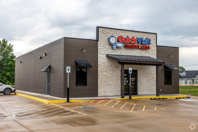
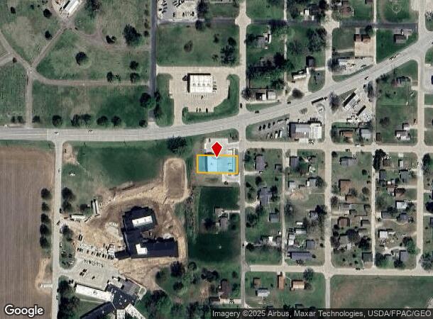
Property Record
1501 39Th St, Fort Madison, IA 52627

NEARBY LISTINGS FOR SALE OR LEASE
-
-
View all Fort Madison listings for sale on LoopNet.com
Property Detail
1501 39Th St
Fort Madison-Keokuk, IA-IL-MO
Oakland Add
02-47-15-07-201-0010
#4451 1501 39TH OAKLAND ADD BLK 6 LOTS 1,2,3
Commercialnec
Lee
X
Iowa
19111C0351D
1-3
2024
0.24 AC
2025
Iowa Southeast Area
490200
Other Market Areas
3,840 SF
DEMOGRAPHICS near 1501 39Th St
1 Mile
3 Mile
5 Mile
2024 Total Population
2,827
10,394
12,649
2029 Population
2,781
10,245
12,439
Pop Growth 2024-2029
(1.63%)
(1.43%)
(1.66%)
Average Age
46
43
43
2024 Total Households
1,346
4,446
5,272
HH Growth 2024-2029
(1.71%)
(1.51%)
(1.71%)
Median Household Inc
$46,250
$49,210
$52,717
Avg Household Size
2.00
2.20
2.20
2024 Avg HH Vehicles
2.00
2.00
2.00
Median Home Value
$80,085
$90,555
$100,935
Median Year Built
1960
1953
1954
Nearby Places
Map Layers
Map Styles
 Street
 Aerial
- Restaurants
- Banks
- Shops
- Fitness
- Groceries
PUBLIC TRANSPORTATION
COMMUTER RAIL
Fort Madison (Southwest Chief - Amtrak)
DRIVE
WALK
Distance
Fort Madison (Southwest Chief - Amtrak)
5 min
2.9 mi
Freight Ports
Port Milwaukee
DRIVE
WALK
Distance
Port Milwaukee
349 min
304.9 mi
SALE & LEASE HISTORY
LISTING DATE
SALE/LEASE

Sep 27, 2022
For Sale
Sep 23, 2016
For Sale
May 06, 2021
For Sale
Nearby Properties
Address
Land Use
TOTAL SIZE
Lot Size
Zoning
Address
Land Use
TOTAL SIZE
Lot Size
Zoning
4,850 SF
121.16 AC
Address
Land Use
TOTAL SIZE
Lot Size
Zoning
35,019 SF
11.11 AC
Address
Land Use
TOTAL SIZE
Lot Size
Zoning
12,852 SF
Address
Land Use
TOTAL SIZE
Lot Size
Zoning
1,960 SF
27 AC
Address
Land Use
TOTAL SIZE
Lot Size
Zoning
40,664 SF
3.98 AC
Address
Land Use
TOTAL SIZE
Lot Size
Zoning
12.15 AC
Address
Land Use
TOTAL SIZE
Lot Size
Zoning
17,168 SF
3.07 AC
Address
Land Use
TOTAL SIZE
Lot Size
Zoning
26,541 SF
77.40 AC
Address
Land Use
TOTAL SIZE
Lot Size
Zoning
2,600 SF
21.30 AC
Address
Land Use
TOTAL SIZE
Lot Size
Zoning
38,947 SF
8.26 AC
Address
Land Use
TOTAL SIZE
Lot Size
Zoning
26,468 SF
3.38 AC
Address
Land Use
TOTAL SIZE
Lot Size
Zoning
225,000 SF
9.39 AC
Address
Land Use
TOTAL SIZE
Lot Size
Zoning
7.24 AC
Address
Land Use
TOTAL SIZE
Lot Size
Zoning
8.27 AC
Address
Land Use
TOTAL SIZE
Lot Size
Zoning
24,194 SF
1.94 AC
Address
Land Use
TOTAL SIZE
Lot Size
Zoning
18,952 SF
2.93 AC
Address
Land Use
TOTAL SIZE
Lot Size
Zoning
38,110 SF
4.93 AC
Address
Land Use
TOTAL SIZE
Lot Size
Zoning
Address
Land Use
TOTAL SIZE
Lot Size
Zoning
113,400 SF
33.33 AC
Address
Land Use
TOTAL SIZE
Lot Size
Zoning
7,846 SF
4.91 AC
Address
Land Use
TOTAL SIZE
Lot Size
Zoning
71,029 SF
3.02 AC
Address
Land Use
TOTAL SIZE
Lot Size
Zoning
14,736 SF
1.39 AC
Address
Land Use
TOTAL SIZE
Lot Size
Zoning
527 SF
3.35 AC
Address
Land Use
TOTAL SIZE
Lot Size
Zoning
3.79 AC
Address
Land Use
TOTAL SIZE
Lot Size
Zoning
15,451 SF
0.97 AC
Address
Land Use
TOTAL SIZE
Lot Size
Zoning
9,600 SF
3.81 AC
Address
Land Use
TOTAL SIZE
Lot Size
Zoning
8,872 SF
6.49 AC
Address
Land Use
TOTAL SIZE
Lot Size
Zoning
65,760 SF
5.52 AC
Address
Land Use
TOTAL SIZE
Lot Size
Zoning
102,024 SF
4.58 AC
Address
Land Use
TOTAL SIZE
Lot Size
Zoning
147.96 AC
The World's #1 Commercial Real Estate Marketplace
Connect with us
© 2025 CoStar Group
The information above has been obtained from sources believed reliable. While we do not doubt its accuracy we have not verified it and make no guarantee, warranty or representation about it. It is your responsibility to independently confirm its accuracy and completeness. Any projections, opinions, assumptions, or estimates used are for example only and do not represent the current or future performance of the property. The value of this transaction to you depends on tax and other factors which should be evaluated by your tax, financial, and legal advisors. You and your advisors should conduct a careful, independent investigation of the property to determine to your satisfaction the suitability of the property for your needs.