Property Record
1501 82Nd St, Lubbock, TX 79423


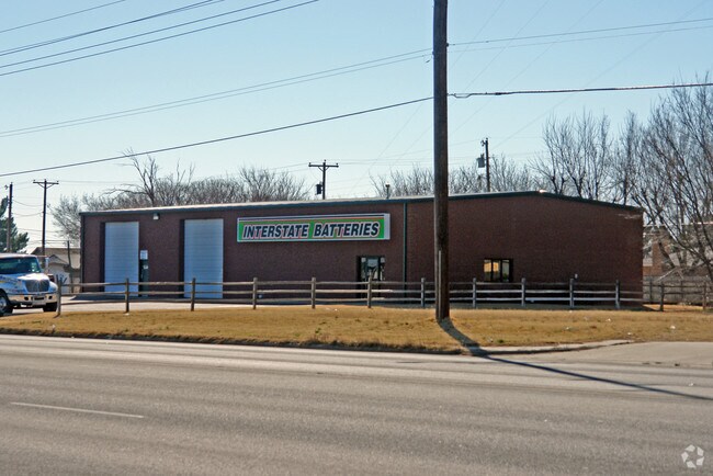
Property Detail
1501 82Nd St
Lubbock, TX
RHOADES HTS BLK 4 L 1 & 2 LESS S25
R116182
Lubbock
Storebuilding
Texas
B and X Area of moderate flood hazard, usually the area between the limits of the 100-year and 500-year floods.
2
2024
0.33 AC
2025
Outlying Lubbock County
010506
Lubbock
5,000 SF
NEARBY LISTINGS FOR SALE OR LEASE
DEMOGRAPHICS near 1501 82Nd St
1 mile
3 mile
5 mile
2025 Total Population
9,038
62,921
160,903
2030 Population
9,423
65,392
168,070
Pop Growth 2025-2030
+ 4.26%
+ 3.93%
+ 4.45%
Average Age
34
37
36
2025 Total Households
3,549
24,354
61,496
HH Growth 2025-2030
+ 4.42%
+ 4.11%
+ 4.82%
Median Household Inc
$57,947
$58,610
$57,388
Avg Household Size
2.50
2.50
2.40
2025 Avg HH Vehicles
2.00
2.00
2.00
Median Home Value
$160,161
$182,903
$211,612
Median Year Built
1994
1979
1980
Nearby Places
Map Layers
Map Styles
 Street
 Aerial
Transit
 Traffic
 Biking
Places
Listings with unknown addresses are not visible on the map
- Restaurants
- Banks
- Shops
- Fitness
- Groceries
PUBLIC TRANSPORTATION
AIRPORT
Lubbock Preston Smith International
Drive
Walk
Distance
Lubbock Preston Smith International
27 min
15.9 mi
Nearby Properties
Address
Land Use
TOTAL SIZE
Lot Size
Zoning
Address
Land Use
TOTAL SIZE
Lot Size
Zoning
709,350 SF
98.60 AC
Address
Land Use
TOTAL SIZE
Lot Size
Zoning
176,165 SF
36.61 AC
Address
Land Use
TOTAL SIZE
Lot Size
Zoning
219,352 SF
21.90 AC
Address
Land Use
TOTAL SIZE
Lot Size
Zoning
172,263 SF
11.01 AC
Address
Land Use
TOTAL SIZE
Lot Size
Zoning
167,208 SF
10.09 AC
Address
Land Use
TOTAL SIZE
Lot Size
Zoning
169,139 SF
12.07 AC
Address
Land Use
TOTAL SIZE
Lot Size
Zoning
157,644 SF
9.69 AC
Address
Land Use
TOTAL SIZE
Lot Size
Zoning
76,680 SF
4.95 AC
Address
Land Use
TOTAL SIZE
Lot Size
Zoning
88,998 SF
7.56 AC
Address
Land Use
TOTAL SIZE
Lot Size
Zoning
65,798 SF
4.11 AC
Address
Land Use
TOTAL SIZE
Lot Size
Zoning
421,200 SF
43.22 AC
Address
Land Use
TOTAL SIZE
Lot Size
Zoning
38,414 SF
3.33 AC
Address
Land Use
TOTAL SIZE
Lot Size
Zoning
95,000 SF
12.33 AC
Address
Land Use
TOTAL SIZE
Lot Size
Zoning
247,475 SF
53 AC
Address
Land Use
TOTAL SIZE
Lot Size
Zoning
88,417 SF
8.01 AC
Address
Land Use
TOTAL SIZE
Lot Size
Zoning
202,036 SF
17.12 AC
Address
Land Use
TOTAL SIZE
Lot Size
Zoning
205,150 SF
23.43 AC
Address
Land Use
TOTAL SIZE
Lot Size
Zoning
133,795 SF
6.37 AC
Address
Land Use
TOTAL SIZE
Lot Size
Zoning
71,329 SF
14 AC
Address
Land Use
TOTAL SIZE
Lot Size
Zoning
71,413 SF
5.42 AC
Address
Land Use
TOTAL SIZE
Lot Size
Zoning
105,908 SF
9.78 AC
Address
Land Use
TOTAL SIZE
Lot Size
Zoning
24,084 SF
2.44 AC
Address
Land Use
TOTAL SIZE
Lot Size
Zoning
192,128 SF
9.87 AC
Address
Land Use
TOTAL SIZE
Lot Size
Zoning
43,155 SF
1.76 AC
Address
Land Use
TOTAL SIZE
Lot Size
Zoning
121,899 SF
7.70 AC
Address
Land Use
TOTAL SIZE
Lot Size
Zoning
53,816 SF
1.32 AC
Address
Land Use
TOTAL SIZE
Lot Size
Zoning
131,497 SF
4.61 AC
Address
Land Use
TOTAL SIZE
Lot Size
Zoning
189,737 SF
31 AC
Address
Land Use
TOTAL SIZE
Lot Size
Zoning
88,310 SF
9.95 AC
Address
Land Use
TOTAL SIZE
Lot Size
Zoning
367,283 SF
36.77 AC
The World's #1 Commercial Real Estate Marketplace
Connect with us
© 2026 CoStar Group
The information above has been obtained from sources believed reliable. While we do not doubt its accuracy we have not verified it and make no guarantee, warranty or representation about it. It is your responsibility to independently confirm its accuracy and completeness. Any projections, opinions, assumptions, or estimates used are for example only and do not represent the current or future performance of the property. The value of this transaction to you depends on tax and other factors which should be evaluated by your tax, financial, and legal advisors. You and your advisors should conduct a careful, independent investigation of the property to determine to your satisfaction the suitability of the property for your needs.