Property Record
1501 E Expressway 83, Penitas, TX 78576

Save to a Folder
{{folder.Name}}
{{folder.ListingIds.length}} Properties
{{folder.ListingIds.length}} Property
Create a New Folder
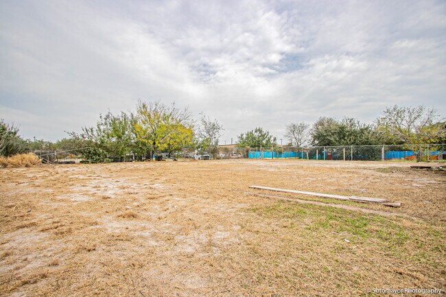
Property Detail
1501 E Expressway 83
McAllen-Edinburg-Mission, TX
ANADAL LOT 3
A4930-00-000-0003-00
Hidalgo
Vehiclerentalsvehiclesales
Texas
CO
3
2025
0.51 AC
2025
Outlying Hidalgo County
024208
McAllen/Edinburg/Pharr
480 SF
NEARBY LISTINGS FOR SALE OR LEASE
DEMOGRAPHICS near 1501 E Expressway 83
1 mile
3 mile
5 mile
2025 Total Population
2,310
17,796
43,801
2030 Population
2,398
18,689
46,314
Pop Growth 2025-2030
+ 3.81%
+ 5.02%
+ 5.74%
Average Age
36
38
37
2025 Total Households
658
5,608
12,962
HH Growth 2025-2030
+ 3.65%
+ 5.53%
+ 6.44%
Median Household Inc
$44,131
$46,227
$47,169
Avg Household Size
3.50
3.20
3.30
2025 Avg HH Vehicles
2.00
2.00
2.00
Median Home Value
$153,720
$150,378
$139,547
Median Year Built
2000
2002
2000
Nearby Places
Map Layers
Map Styles
 Street
 Aerial
Layers
 Traffic
 Biking
Places
Listings with unknown addresses are not visible on the map
- Restaurants
- Banks
- Shops
- Fitness
- Groceries
PUBLIC TRANSPORTATION
AIRPORT
McAllen International
Drive
Walk
Distance
McAllen International
20 min
15.4 mi
SALE & LEASE HISTORY
LISTING DATE
SALE/LEASE

Feb 11, 2020
For Sale
Nearby Properties
Address
Land Use
TOTAL SIZE
Lot Size
Zoning
Address
Land Use
TOTAL SIZE
Lot Size
Zoning
1 SF
20.81 AC
Address
Land Use
TOTAL SIZE
Lot Size
Zoning
185,304 SF
25.97 AC
Address
Land Use
TOTAL SIZE
Lot Size
Zoning
4 SF
34.32 AC
GT
Address
Land Use
TOTAL SIZE
Lot Size
Zoning
36.56 AC
Address
Land Use
TOTAL SIZE
Lot Size
Zoning
78,975 SF
8.72 AC
Address
Land Use
TOTAL SIZE
Lot Size
Zoning
36,325 SF
29.22 AC
Address
Land Use
TOTAL SIZE
Lot Size
Zoning
106,821 SF
Address
Land Use
TOTAL SIZE
Lot Size
Zoning
107,311 SF
10.39 AC
Address
Land Use
TOTAL SIZE
Lot Size
Zoning
50,784 SF
5.09 AC
Address
Land Use
TOTAL SIZE
Lot Size
Zoning
112.99 AC
Address
Land Use
TOTAL SIZE
Lot Size
Zoning
30,942 SF
3.82 AC
Address
Land Use
TOTAL SIZE
Lot Size
Zoning
14,364 SF
3.51 AC
RS
Address
Land Use
TOTAL SIZE
Lot Size
Zoning
41,860 SF
3.82 AC
Address
Land Use
TOTAL SIZE
Lot Size
Zoning
96,337 SF
16.96 AC
Address
Land Use
TOTAL SIZE
Lot Size
Zoning
11,211 SF
13.99 AC
Address
Land Use
TOTAL SIZE
Lot Size
Zoning
20,980 SF
2.11 AC
Address
Land Use
TOTAL SIZE
Lot Size
Zoning
32,573 SF
4.36 AC
CO
Address
Land Use
TOTAL SIZE
Lot Size
Zoning
12,373 SF
35.16 AC
M3
Address
Land Use
TOTAL SIZE
Lot Size
Zoning
2,300 SF
20.20 AC
Address
Land Use
TOTAL SIZE
Lot Size
Zoning
22,980 SF
2.04 AC
CO
Address
Land Use
TOTAL SIZE
Lot Size
Zoning
20,720 SF
6.32 AC
CO
Address
Land Use
TOTAL SIZE
Lot Size
Zoning
23,607 SF
20 AC
Address
Land Use
TOTAL SIZE
Lot Size
Zoning
39,369 SF
5.02 AC
Address
Land Use
TOTAL SIZE
Lot Size
Zoning
33,979 SF
1.98 AC
CO
Address
Land Use
TOTAL SIZE
Lot Size
Zoning
7,858 SF
2.68 AC
CO
Address
Land Use
TOTAL SIZE
Lot Size
Zoning
13,500 SF
2.61 AC
Address
Land Use
TOTAL SIZE
Lot Size
Zoning
3,788 SF
1.51 AC
Address
Land Use
TOTAL SIZE
Lot Size
Zoning
5,264 SF
1.40 AC
Address
Land Use
TOTAL SIZE
Lot Size
Zoning
4,500 SF
1.57 AC
Address
Land Use
TOTAL SIZE
Lot Size
Zoning
13,984 SF
1.50 AC
The World's #1 Commercial Real Estate Marketplace
Connect with us
© 2026 CoStar Group
The information above has been obtained from sources believed reliable. While we do not doubt its accuracy we have not verified it and make no guarantee, warranty or representation about it. It is your responsibility to independently confirm its accuracy and completeness. Any projections, opinions, assumptions, or estimates used are for example only and do not represent the current or future performance of the property. The value of this transaction to you depends on tax and other factors which should be evaluated by your tax, financial, and legal advisors. You and your advisors should conduct a careful, independent investigation of the property to determine to your satisfaction the suitability of the property for your needs.