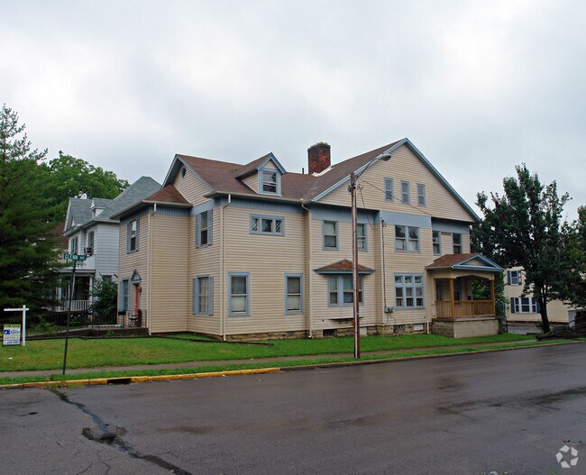
Property Record
1501 E High St, Springfield, OH 45505
NEARBY LISTINGS FOR SALE OR LEASE
Property Detail
1501 E High St
Springfield, OH
Brain Hrs
34-00700-02820-4001
Clark
Duplex
Ohio
X
0.17 AC
39023C0191E
Northeast Dayton
4,058 SF
Cincinnati/Dayton
DEMOGRAPHICS near 1501 E High St
1 Mile
3 Mile
5 Mile
2024 Total Population
12,326
63,184
82,048
2029 Population
12,362
63,315
81,924
Pop Growth 2024-2029
+ 0.29%
+ 0.21%
(0.15%)
Average Age
38
39
41
2024 Total Households
5,138
25,727
33,988
HH Growth 2024-2029
+ 0.25%
+ 0.12%
(0.25%)
Median Household Inc
$46,177
$45,474
$50,868
Avg Household Size
2.30
2.30
2.30
2024 Avg HH Vehicles
2.00
2.00
2.00
Median Home Value
$68,564
$102,721
$131,101
Median Year Built
1947
1951
1957
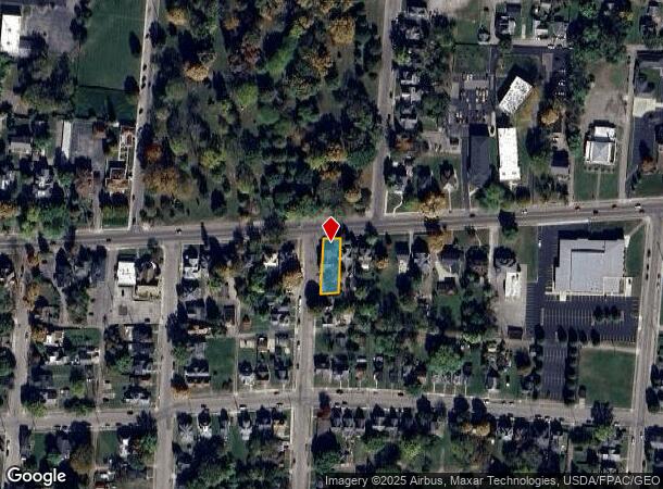
Nearby Places
Map Layers
Map Styles
 Street
 Aerial
- Restaurants
- Banks
- Shops
- Fitness
- Groceries
PUBLIC TRANSPORTATION
AIRPORT
James M Cox Dayton International
DRIVE
WALK
Distance
James M Cox Dayton International
36 min
28.0 mi
SALE & LEASE HISTORY
LISTING DATE
SALE/LEASE

May 07, 2019
For Sale
Nearby Properties
Address
Land Use
TOTAL SIZE
Lot Size
Zoning
Address
Land Use
TOTAL SIZE
Lot Size
Zoning
1.20 AC
Address
Land Use
TOTAL SIZE
Lot Size
Zoning
479,515 SF
1.69 AC
Address
Land Use
TOTAL SIZE
Lot Size
Zoning
32.89 AC
Address
Land Use
TOTAL SIZE
Lot Size
Zoning
107.87 AC
Address
Land Use
TOTAL SIZE
Lot Size
Zoning
Address
Land Use
TOTAL SIZE
Lot Size
Zoning
44.85 AC
Address
Land Use
TOTAL SIZE
Lot Size
Zoning
103,458 SF
5.51 AC
Address
Land Use
TOTAL SIZE
Lot Size
Zoning
399,308 SF
11.06 AC
Address
Land Use
TOTAL SIZE
Lot Size
Zoning
8,316 SF
34.41 AC
R-1
Address
Land Use
TOTAL SIZE
Lot Size
Zoning
61,376 SF
3.95 AC
Address
Land Use
TOTAL SIZE
Lot Size
Zoning
25.44 AC
Address
Land Use
TOTAL SIZE
Lot Size
Zoning
28,105 SF
1.40 AC
Address
Land Use
TOTAL SIZE
Lot Size
Zoning
218,901 SF
19.15 AC
Address
Land Use
TOTAL SIZE
Lot Size
Zoning
225,335 SF
22.73 AC
Address
Land Use
TOTAL SIZE
Lot Size
Zoning
Address
Land Use
TOTAL SIZE
Lot Size
Zoning
Address
Land Use
TOTAL SIZE
Lot Size
Zoning
Address
Land Use
TOTAL SIZE
Lot Size
Zoning
Address
Land Use
TOTAL SIZE
Lot Size
Zoning
211,877 SF
24.01 AC
Address
Land Use
TOTAL SIZE
Lot Size
Zoning
6,521 SF
94.30 AC
Address
Land Use
TOTAL SIZE
Lot Size
Zoning
1.05 AC
Address
Land Use
TOTAL SIZE
Lot Size
Zoning
217,626 SF
17.85 AC
Address
Land Use
TOTAL SIZE
Lot Size
Zoning
56,381 SF
0.22 AC
Address
Land Use
TOTAL SIZE
Lot Size
Zoning
32,566 SF
1.90 AC
Address
Land Use
TOTAL SIZE
Lot Size
Zoning
Address
Land Use
TOTAL SIZE
Lot Size
Zoning
Address
Land Use
TOTAL SIZE
Lot Size
Zoning
Address
Land Use
TOTAL SIZE
Lot Size
Zoning
Address
Land Use
TOTAL SIZE
Lot Size
Zoning
Address
Land Use
TOTAL SIZE
Lot Size
Zoning
26.78 AC
The World's #1 Commercial Real Estate Marketplace
Connect with us
© 2025 CoStar Group
The information above has been obtained from sources believed reliable. While we do not doubt its accuracy we have not verified it and make no guarantee, warranty or representation about it. It is your responsibility to independently confirm its accuracy and completeness. Any projections, opinions, assumptions, or estimates used are for example only and do not represent the current or future performance of the property. The value of this transaction to you depends on tax and other factors which should be evaluated by your tax, financial, and legal advisors. You and your advisors should conduct a careful, independent investigation of the property to determine to your satisfaction the suitability of the property for your needs.