Property Record
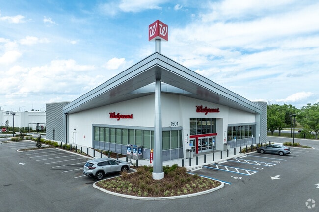
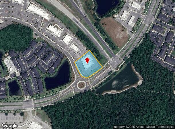
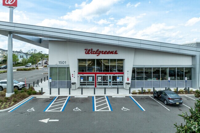
1501 Future Way, Kissimmee, FL 34747
NEARBY LISTINGS FOR SALE OR LEASE
Property Detail
1501 Future Way
Orlando
Celebration Pointe
Orlando-Kissimmee-Sanford, FL
CELEBRATION POINTE PB 33 PGS 95-100 LOT 1
24-25-27-3567-0001-0010
Osceola
Storebuilding
Florida
2024
1
2025
1.46 AC
040808
Osceola Outlying
14,758 SF
DEMOGRAPHICS near 1501 Future Way
1 Mile
3 Mile
5 Mile
2024 Total Population
4,204
26,792
68,822
2029 Population
5,165
33,445
85,833
Pop Growth 2024-2029
+ 22.86%
+ 24.83%
+ 24.72%
Average Age
41
40
38
2024 Total Households
1,745
10,445
26,124
HH Growth 2024-2029
+ 22.81%
+ 24.51%
+ 24.51%
Median Household Inc
$95,352
$82,238
$68,491
Avg Household Size
2.40
2.50
2.60
2024 Avg HH Vehicles
2.00
2.00
2.00
Median Home Value
$575,539
$406,810
$313,539
Median Year Built
2008
2005
2005
Nearby Places
Map Layers
Map Styles
 Street
 Aerial
- Restaurants
- Banks
- Shops
- Fitness
- Groceries
PUBLIC TRANSPORTATION
AIRPORT
Orlando International
DRIVE
WALK
Distance
Orlando International
32 min
22.4 mi
Nearby Properties
Address
Land Use
TOTAL SIZE
Lot Size
Zoning
Address
Land Use
TOTAL SIZE
Lot Size
Zoning
571,384 SF
249.40 AC
RCID
Address
Land Use
TOTAL SIZE
Lot Size
Zoning
1,446,052 SF
64.06 AC
OPUD
Address
Land Use
TOTAL SIZE
Lot Size
Zoning
533,192 SF
70.52 AC
OPUD
Address
Land Use
TOTAL SIZE
Lot Size
Zoning
439,638 SF
28.93 AC
OPUD
Address
Land Use
TOTAL SIZE
Lot Size
Zoning
597,078 SF
51.33 AC
Address
Land Use
TOTAL SIZE
Lot Size
Zoning
412,934 SF
11.96 AC
Address
Land Use
TOTAL SIZE
Lot Size
Zoning
355,791 SF
28.19 AC
OPD
Address
Land Use
TOTAL SIZE
Lot Size
Zoning
358,576 SF
27.34 AC
OPD
Address
Land Use
TOTAL SIZE
Lot Size
Zoning
315,823 SF
14.41 AC
OPD
Address
Land Use
TOTAL SIZE
Lot Size
Zoning
333,554 SF
19.22 AC
Address
Land Use
TOTAL SIZE
Lot Size
Zoning
307,953 SF
16.20 AC
Address
Land Use
TOTAL SIZE
Lot Size
Zoning
360,801 SF
8.24 AC
Address
Land Use
TOTAL SIZE
Lot Size
Zoning
348,661 SF
8.20 AC
Address
Land Use
TOTAL SIZE
Lot Size
Zoning
200,413 SF
8.90 AC
OPUD
Address
Land Use
TOTAL SIZE
Lot Size
Zoning
177,998 SF
8.98 AC
OPUD
Address
Land Use
TOTAL SIZE
Lot Size
Zoning
104,391 SF
3.97 AC
OPUD
Address
Land Use
TOTAL SIZE
Lot Size
Zoning
166,556 SF
12.62 AC
OPUD
Address
Land Use
TOTAL SIZE
Lot Size
Zoning
340,225 SF
21.29 AC
OPD
Address
Land Use
TOTAL SIZE
Lot Size
Zoning
92,561 SF
1.70 AC
OPUD
Address
Land Use
TOTAL SIZE
Lot Size
Zoning
121,203 SF
7.41 AC
OAC
Address
Land Use
TOTAL SIZE
Lot Size
Zoning
128,745 SF
9.46 AC
OPUD
Address
Land Use
TOTAL SIZE
Lot Size
Zoning
584,513 SF
73.53 AC
OPD
Address
Land Use
TOTAL SIZE
Lot Size
Zoning
85,821 SF
2.96 AC
Address
Land Use
TOTAL SIZE
Lot Size
Zoning
272,593 SF
16.16 AC
OPD
Address
Land Use
TOTAL SIZE
Lot Size
Zoning
104,482 SF
9.02 AC
OPUD
Address
Land Use
TOTAL SIZE
Lot Size
Zoning
210,404 SF
45.84 AC
OPUD
Address
Land Use
TOTAL SIZE
Lot Size
Zoning
73,666 SF
2.34 AC
OPD
Address
Land Use
TOTAL SIZE
Lot Size
Zoning
100,032 SF
9.64 AC
OPUD
Address
Land Use
TOTAL SIZE
Lot Size
Zoning
60,647 SF
2.82 AC
OPUD
Address
Land Use
TOTAL SIZE
Lot Size
Zoning
250,489 SF
20.02 AC
OTSC
The World's #1 Commercial Real Estate Marketplace
Connect with us
© 2026 CoStar Group
The information above has been obtained from sources believed reliable. While we do not doubt its accuracy we have not verified it and make no guarantee, warranty or representation about it. It is your responsibility to independently confirm its accuracy and completeness. Any projections, opinions, assumptions, or estimates used are for example only and do not represent the current or future performance of the property. The value of this transaction to you depends on tax and other factors which should be evaluated by your tax, financial, and legal advisors. You and your advisors should conduct a careful, independent investigation of the property to determine to your satisfaction the suitability of the property for your needs.