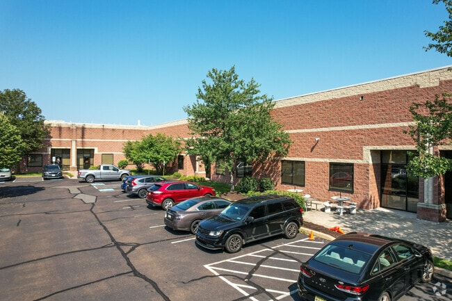
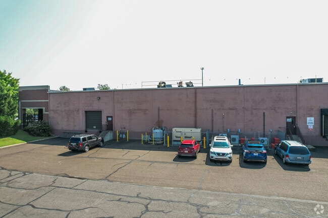
Property Record
1501 Grundys Ln, Croydon, PA 19021


Current Lease Availabilities
Property Detail
1501 Grundys Ln
05-006-003
13.6306AC KKEYSTONE PARK SEC III LOTS 5-6-7-8 1142 ON GRUNDYS LA
Warehouse
BUCKS
PI
Pennsylvania
C and X Area of minimal flood hazard, usually depicted on FIRMs as above the 500-year flood level.
5-6
2024
13.63 AC
2025
Bucks
100304
Philadelphia
178,638 SF
Philadelphia-Camden-Wilmington, PA-NJ-DE-MD
NEARBY LISTINGS FOR SALE OR LEASE
DEMOGRAPHICS near 1501 Grundys Ln
1 mile
3 mile
5 mile
2025 Total Population
11,933
83,154
248,971
2030 Population
11,926
83,547
250,533
Pop Growth 2025-2030
(0.06%)
+ 0.47%
+ 0.63%
Average Age
42
42
42
2025 Total Households
4,552
31,905
94,115
HH Growth 2025-2030
(0.13%)
+ 0.45%
+ 0.62%
Median Household Inc
$64,215
$78,188
$85,520
Avg Household Size
2.60
2.50
2.60
2025 Avg HH Vehicles
2.00
2.00
2.00
Median Home Value
$292,045
$325,083
$324,924
Median Year Built
1969
1968
1965
Nearby Places
Map Layers
Map Styles
 Street
 Aerial
Layers
 Traffic
 Biking
Places
Listings with unknown addresses are not visible on the map
- Restaurants
- Banks
- Shops
- Fitness
- Groceries
PUBLIC TRANSPORTATION
COMMUTER RAIL
Croydon (R7 - Southeastern Pennsylvania Transportation Authority Regional Rail (SEPTA Regional Rail))
Drive
Walk
Distance
Croydon (R7 - Southeastern Pennsylvania Transportation Authority Regional Rail (SEPTA Regional Rail))
3 min
1.2 mi
Bristol (R7 - Southeastern Pennsylvania Transportation Authority Regional Rail (SEPTA Regional Rail))
Drive
Walk
Distance
Bristol (R7 - Southeastern Pennsylvania Transportation Authority Regional Rail (SEPTA Regional Rail))
9 min
3.7 mi
AIRPORT
Trenton Mercer
Drive
Walk
Distance
Trenton Mercer
25 min
15.4 mi
Philadelphia International
Drive
Walk
Distance
Philadelphia International
46 min
29.2 mi
Freight Ports
Port of Philadelphia
Drive
Walk
Distance
Port of Philadelphia
26 min
15.5 mi
Nearby Properties
Address
Land Use
TOTAL SIZE
Lot Size
Zoning
Address
Land Use
TOTAL SIZE
Lot Size
Zoning
15.09 AC
I-1
Address
Land Use
TOTAL SIZE
Lot Size
Zoning
8.60 AC
R-1
Address
Land Use
TOTAL SIZE
Lot Size
Zoning
2.43 AC
W-1
Address
Land Use
TOTAL SIZE
Lot Size
Zoning
242 AC
OS-1
Address
Land Use
TOTAL SIZE
Lot Size
Zoning
Address
Land Use
TOTAL SIZE
Lot Size
Zoning
3,456 SF
4.88 AC
TRN
Address
Land Use
TOTAL SIZE
Lot Size
Zoning
32,912 SF
42.06 AC
AO
Address
Land Use
TOTAL SIZE
Lot Size
Zoning
11,280 SF
26.16 AC
R3
Address
Land Use
TOTAL SIZE
Lot Size
Zoning
Address
Land Use
TOTAL SIZE
Lot Size
Zoning
66.09 AC
I-2
Address
Land Use
TOTAL SIZE
Lot Size
Zoning
34,920 SF
38 AC
CD
Address
Land Use
TOTAL SIZE
Lot Size
Zoning
31,497 SF
21.50 AC
1-2
Address
Land Use
TOTAL SIZE
Lot Size
Zoning
30.79 AC
I-2
Address
Land Use
TOTAL SIZE
Lot Size
Zoning
150,000 SF
21.46 AC
R3
Address
Land Use
TOTAL SIZE
Lot Size
Zoning
8.19 AC
I-P
Address
Land Use
TOTAL SIZE
Lot Size
Zoning
4.49 AC
I-P
Address
Land Use
TOTAL SIZE
Lot Size
Zoning
10,025 SF
19.11 AC
CD
Address
Land Use
TOTAL SIZE
Lot Size
Zoning
1.30 AC
TC-2
Address
Land Use
TOTAL SIZE
Lot Size
Zoning
19.95 AC
CD
Address
Land Use
TOTAL SIZE
Lot Size
Zoning
242,550 SF
24.32 AC
PI
Address
Land Use
TOTAL SIZE
Lot Size
Zoning
3.11 AC
Address
Land Use
TOTAL SIZE
Lot Size
Zoning
0.40 AC
TRN
Address
Land Use
TOTAL SIZE
Lot Size
Zoning
10,779 SF
19.07 AC
CD
Address
Land Use
TOTAL SIZE
Lot Size
Zoning
242,550 SF
24.18 AC
PI
Address
Land Use
TOTAL SIZE
Lot Size
Zoning
125,307 SF
31.79 AC
VC
Address
Land Use
TOTAL SIZE
Lot Size
Zoning
2,800 SF
1.29 AC
R7.5
Address
Land Use
TOTAL SIZE
Lot Size
Zoning
179,920 SF
23.92 AC
CS
Address
Land Use
TOTAL SIZE
Lot Size
Zoning
171,918 SF
17.70 AC
AO
Address
Land Use
TOTAL SIZE
Lot Size
Zoning
2,240 SF
19.29 AC
I-P
Address
Land Use
TOTAL SIZE
Lot Size
Zoning
555,218 SF
24.94 AC
M2
The World's #1 Commercial Real Estate Marketplace
Connect with us
© 2026 CoStar Group
The information above has been obtained from sources believed reliable. While we do not doubt its accuracy we have not verified it and make no guarantee, warranty or representation about it. It is your responsibility to independently confirm its accuracy and completeness. Any projections, opinions, assumptions, or estimates used are for example only and do not represent the current or future performance of the property. The value of this transaction to you depends on tax and other factors which should be evaluated by your tax, financial, and legal advisors. You and your advisors should conduct a careful, independent investigation of the property to determine to your satisfaction the suitability of the property for your needs.