Property Record
1501 Highway 78 W, Jasper, AL 35501


NEARBY LISTINGS FOR SALE OR LEASE
Property Detail
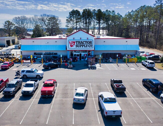
1501 Highway 78 W
17-03-08-1-000-003-0020
PO NWNE 8/14/7 COM @ NW COR RUN S 17 TO S ROW HWY 78 & POB CONT S 640 E 345 N 10 W 230 N 100 E 200 NLY 325 E 64.15 TO S ROW
Storebuilding
Walker
X
Alabama
01127C0306E
4 AC
2025
Walker County
2024
Birmingham
020400
Birmingham-Hoover, AL
22,364 SF
DEMOGRAPHICS near 1501 Highway 78 W
1 Mile
3 Mile
5 Mile
2024 Total Population
2,082
11,841
19,492
2029 Population
2,047
11,562
19,055
Pop Growth 2024-2029
(1.68%)
(2.36%)
(2.24%)
Average Age
41
42
42
2024 Total Households
769
4,713
7,666
HH Growth 2024-2029
(1.56%)
(2.31%)
(2.18%)
Median Household Inc
$56,769
$47,482
$49,708
Avg Household Size
2.30
2.30
2.40
2024 Avg HH Vehicles
2.00
2.00
2.00
Median Home Value
$173,529
$177,516
$173,875
Median Year Built
1975
1976
1979
Nearby Places
Map Layers
Map Styles
 Street
 Aerial
- Restaurants
- Banks
- Shops
- Fitness
- Groceries
SALE & LEASE HISTORY
LISTING DATE
SALE/LEASE

Feb 16, 2021
For Sale
Dec 06, 2018
For Sale
Nearby Properties
Address
Land Use
TOTAL SIZE
Lot Size
Zoning
Address
Land Use
TOTAL SIZE
Lot Size
Zoning
86,928 SF
19 AC
OT
Address
Land Use
TOTAL SIZE
Lot Size
Zoning
55,188 SF
4.80 AC
OT
Address
Land Use
TOTAL SIZE
Lot Size
Zoning
8,932 SF
7.50 AC
CO
Address
Land Use
TOTAL SIZE
Lot Size
Zoning
60,200 SF
5.60 AC
OT
Address
Land Use
TOTAL SIZE
Lot Size
Zoning
38,770 SF
180 AC
CO
Address
Land Use
TOTAL SIZE
Lot Size
Zoning
26,446 SF
43 AC
CO
Address
Land Use
TOTAL SIZE
Lot Size
Zoning
4,830 SF
6.10 AC
OT
Address
Land Use
TOTAL SIZE
Lot Size
Zoning
30,981 SF
3.90 AC
S
Address
Land Use
TOTAL SIZE
Lot Size
Zoning
19,040 SF
2 AC
OT
Address
Land Use
TOTAL SIZE
Lot Size
Zoning
54,905 SF
3 AC
C
Address
Land Use
TOTAL SIZE
Lot Size
Zoning
13,578 SF
1.60 AC
O
Address
Land Use
TOTAL SIZE
Lot Size
Zoning
23,353 SF
1.16 AC
C
Address
Land Use
TOTAL SIZE
Lot Size
Zoning
6,000 SF
3.40 AC
OT
The World's #1 Commercial Real Estate Marketplace
Connect with us
© 2026 CoStar Group
The information above has been obtained from sources believed reliable. While we do not doubt its accuracy we have not verified it and make no guarantee, warranty or representation about it. It is your responsibility to independently confirm its accuracy and completeness. Any projections, opinions, assumptions, or estimates used are for example only and do not represent the current or future performance of the property. The value of this transaction to you depends on tax and other factors which should be evaluated by your tax, financial, and legal advisors. You and your advisors should conduct a careful, independent investigation of the property to determine to your satisfaction the suitability of the property for your needs.