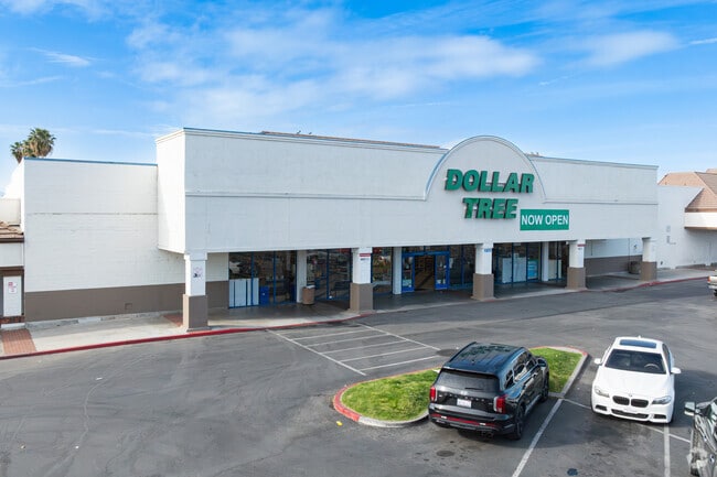
Property Record
1501 White Ln, Bakersfield, CA 93307
NEARBY LISTINGS FOR SALE OR LEASE
Property Detail
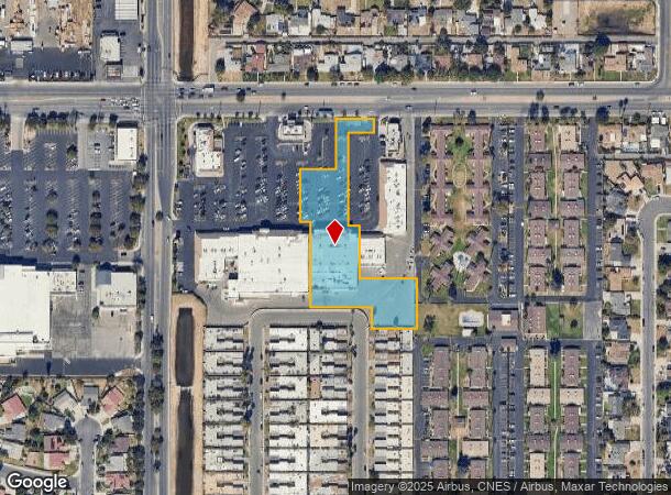
1501 White Ln
Bakersfield, CA
Parcel Map 7087
171-010-64-00-6
PARCEL MAP 7087 , LOT 6
Storebuilding
Kern
X
California
06029C2300E
6
2024
1.99 AC
2025
South Bakersfield
003126
Bakersfield
22,880 SF
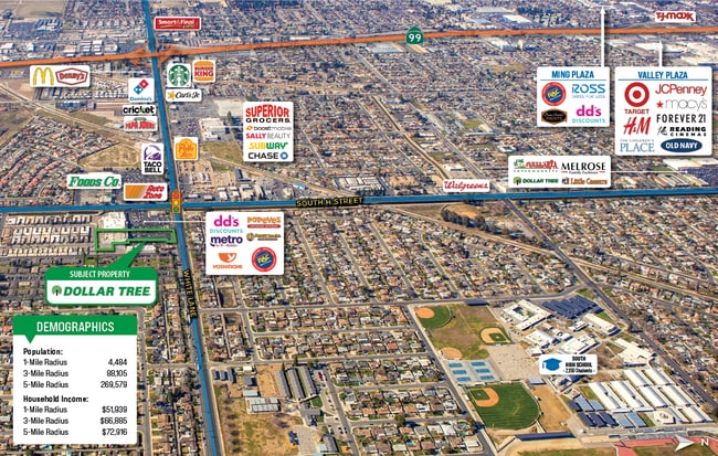
DEMOGRAPHICS near 1501 White Ln
1 Mile
3 Mile
5 Mile
2024 Total Population
26,404
145,105
280,172
2029 Population
26,399
144,840
279,938
Pop Growth 2024-2029
(0.02%)
(0.18%)
(0.08%)
Average Age
33
33
34
2024 Total Households
7,495
42,374
86,127
HH Growth 2024-2029
+ 0.01%
(0.23%)
(0.12%)
Median Household Inc
$51,454
$51,928
$54,707
Avg Household Size
3.40
3.30
3.20
2024 Avg HH Vehicles
2.00
2.00
2.00
Median Home Value
$206,735
$237,160
$260,623
Median Year Built
1977
1977
1979
Nearby Places
- Restaurants
- Banks
- Shops
- Fitness
- Groceries
PUBLIC TRANSPORTATION
COMMUTER RAIL
Bakersfield (San Joaquins - Amtrak)
DRIVE
WALK
Distance
Bakersfield (San Joaquins - Amtrak)
11 min
5.5 mi
AIRPORT
Meadows Field
DRIVE
WALK
Distance
Meadows Field
20 min
10.3 mi
Freight Ports
The Port of Hueneme
DRIVE
WALK
Distance
The Port of Hueneme
149 min
119.1 mi
SALE & LEASE HISTORY
LISTING DATE
SALE/LEASE

Sep 15, 2025
For Sale
Feb 05, 2025
For Sale
Nearby Properties
Address
Land Use
TOTAL SIZE
Lot Size
Zoning
Address
Land Use
TOTAL SIZE
Lot Size
Zoning
23,615 SF
39.38 AC
C2
Address
Land Use
TOTAL SIZE
Lot Size
Zoning
114,500 SF
12.02 AC
C-2
Address
Land Use
TOTAL SIZE
Lot Size
Zoning
185,181 SF
14.67 AC
C2
Address
Land Use
TOTAL SIZE
Lot Size
Zoning
269,429 SF
12.71 AC
R-2
Address
Land Use
TOTAL SIZE
Lot Size
Zoning
218,345 SF
19.54 AC
PCD
Address
Land Use
TOTAL SIZE
Lot Size
Zoning
66,849 SF
5.32 AC
CO
Address
Land Use
TOTAL SIZE
Lot Size
Zoning
62,941 SF
8.79 AC
M-1
Address
Land Use
TOTAL SIZE
Lot Size
Zoning
79,325 SF
7.77 AC
C-2
Address
Land Use
TOTAL SIZE
Lot Size
Zoning
127,308 SF
8.25 AC
R-2
Address
Land Use
TOTAL SIZE
Lot Size
Zoning
11,780 SF
11.25 AC
C1
Address
Land Use
TOTAL SIZE
Lot Size
Zoning
79,987 SF
3.22 AC
SP
Address
Land Use
TOTAL SIZE
Lot Size
Zoning
5,756 SF
9.70 AC
C-2-D
Address
Land Use
TOTAL SIZE
Lot Size
Zoning
147,451 SF
9.55 AC
C2
Address
Land Use
TOTAL SIZE
Lot Size
Zoning
69,414 SF
4.47 AC
M1
Address
Land Use
TOTAL SIZE
Lot Size
Zoning
123,844 SF
7.49 AC
R-3
Address
Land Use
TOTAL SIZE
Lot Size
Zoning
149,499 SF
13.20 AC
GC
Address
Land Use
TOTAL SIZE
Lot Size
Zoning
30,854 SF
12.17 AC
M1
Address
Land Use
TOTAL SIZE
Lot Size
Zoning
92,469 SF
7.15 AC
R-3
Address
Land Use
TOTAL SIZE
Lot Size
Zoning
41,507 SF
10.37 AC
C2
Address
Land Use
TOTAL SIZE
Lot Size
Zoning
10,073 SF
15.48 AC
PCD
Address
Land Use
TOTAL SIZE
Lot Size
Zoning
75,800 SF
7.18 AC
C-2
Address
Land Use
TOTAL SIZE
Lot Size
Zoning
1,100 SF
6.28 AC
R-3
Address
Land Use
TOTAL SIZE
Lot Size
Zoning
74,890 SF
3.61 AC
SP
Address
Land Use
TOTAL SIZE
Lot Size
Zoning
149,187 SF
7.14 AC
Address
Land Use
TOTAL SIZE
Lot Size
Zoning
154,581 SF
2.11 AC
C-2
Address
Land Use
TOTAL SIZE
Lot Size
Zoning
74,890 SF
3.75 AC
SP
Address
Land Use
TOTAL SIZE
Lot Size
Zoning
81,682 SF
12.27 AC
M-2
Address
Land Use
TOTAL SIZE
Lot Size
Zoning
34,306 SF
12.39 AC
R-2
Address
Land Use
TOTAL SIZE
Lot Size
Zoning
36,720 SF
3.29 AC
C2
Address
Land Use
TOTAL SIZE
Lot Size
Zoning
94,240 SF
4.95 AC
C-2
The World's #1 Commercial Real Estate Marketplace
Connect with us
© 2025 CoStar Group
The information above has been obtained from sources believed reliable. While we do not doubt its accuracy we have not verified it and make no guarantee, warranty or representation about it. It is your responsibility to independently confirm its accuracy and completeness. Any projections, opinions, assumptions, or estimates used are for example only and do not represent the current or future performance of the property. The value of this transaction to you depends on tax and other factors which should be evaluated by your tax, financial, and legal advisors. You and your advisors should conduct a careful, independent investigation of the property to determine to your satisfaction the suitability of the property for your needs.