Property Record
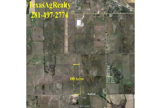
15019 Mound Rd, Hockley, TX 77447
NEARBY LISTINGS FOR SALE OR LEASE
-
-
View all Hockley listings for sale on LoopNet.com
Property Detail
15019 Mound Rd
0461320000003
Abst 850 W Wade & Pt Trs 1 Thru 6 A1227
Farms
PT TR 1 & (HOMESITE) PT TR 2 ABST 850 W WADE & PT TRS 1 THRU 6 A1227 HT & BRR CO SEC 2 ABST 1030 HT&BRR CO SEC 2
AE
Harris
48201C0360M
Texas
2024
1 AC
2025
Northwest Outlier
543100
Houston
3,728 SF
Houston-The Woodlands-Sugar Land, TX
DEMOGRAPHICS near 15019 Mound Rd
1 Mile
3 Mile
5 Mile
2024 Total Population
258
1,454
4,383
2029 Population
278
1,633
4,914
Pop Growth 2024-2029
+ 7.75%
+ 12.31%
+ 12.11%
Average Age
33
36
37
2024 Total Households
74
446
1,398
HH Growth 2024-2029
+ 8.11%
+ 12.78%
+ 12.52%
Median Household Inc
$99,038
$84,626
$78,480
Avg Household Size
3.20
3.10
3.00
2024 Avg HH Vehicles
3.00
3.00
3.00
Median Home Value
$250,000
$245,600
$256,488
Median Year Built
2010
2008
2002
Nearby Places
Map Layers
Map Styles
 Street
 Aerial
- Restaurants
- Banks
- Shops
- Fitness
- Groceries
Nearby Properties
Address
Land Use
TOTAL SIZE
Lot Size
Zoning
Address
Land Use
TOTAL SIZE
Lot Size
Zoning
1,812.90 AC
Address
Land Use
TOTAL SIZE
Lot Size
Zoning
585.97 AC
Address
Land Use
TOTAL SIZE
Lot Size
Zoning
Address
Land Use
TOTAL SIZE
Lot Size
Zoning
649.45 AC
Address
Land Use
TOTAL SIZE
Lot Size
Zoning
580 AC
Address
Land Use
TOTAL SIZE
Lot Size
Zoning
Address
Land Use
TOTAL SIZE
Lot Size
Zoning
Address
Land Use
TOTAL SIZE
Lot Size
Zoning
628.42 AC
Address
Land Use
TOTAL SIZE
Lot Size
Zoning
621.57 AC
Address
Land Use
TOTAL SIZE
Lot Size
Zoning
527.61 AC
Address
Land Use
TOTAL SIZE
Lot Size
Zoning
444.47 AC
Address
Land Use
TOTAL SIZE
Lot Size
Zoning
Address
Land Use
TOTAL SIZE
Lot Size
Zoning
5,194 SF
200 AC
Address
Land Use
TOTAL SIZE
Lot Size
Zoning
190.41 AC
Address
Land Use
TOTAL SIZE
Lot Size
Zoning
16,588 SF
54.93 AC
Address
Land Use
TOTAL SIZE
Lot Size
Zoning
318 AC
Address
Land Use
TOTAL SIZE
Lot Size
Zoning
17,576 SF
153.08 AC
Address
Land Use
TOTAL SIZE
Lot Size
Zoning
212.07 AC
Address
Land Use
TOTAL SIZE
Lot Size
Zoning
103.64 AC
Address
Land Use
TOTAL SIZE
Lot Size
Zoning
97.14 AC
Address
Land Use
TOTAL SIZE
Lot Size
Zoning
80.89 AC
Address
Land Use
TOTAL SIZE
Lot Size
Zoning
288.77 AC
Address
Land Use
TOTAL SIZE
Lot Size
Zoning
61.60 AC
Address
Land Use
TOTAL SIZE
Lot Size
Zoning
140 AC
Address
Land Use
TOTAL SIZE
Lot Size
Zoning
3,704 SF
14.71 AC
Address
Land Use
TOTAL SIZE
Lot Size
Zoning
1,600 SF
296.58 AC
Address
Land Use
TOTAL SIZE
Lot Size
Zoning
Address
Land Use
TOTAL SIZE
Lot Size
Zoning
50 AC
Address
Land Use
TOTAL SIZE
Lot Size
Zoning
95 AC
Address
Land Use
TOTAL SIZE
Lot Size
Zoning
98.37 AC
The World's #1 Commercial Real Estate Marketplace
Connect with us
© 2026 CoStar Group
The information above has been obtained from sources believed reliable. While we do not doubt its accuracy we have not verified it and make no guarantee, warranty or representation about it. It is your responsibility to independently confirm its accuracy and completeness. Any projections, opinions, assumptions, or estimates used are for example only and do not represent the current or future performance of the property. The value of this transaction to you depends on tax and other factors which should be evaluated by your tax, financial, and legal advisors. You and your advisors should conduct a careful, independent investigation of the property to determine to your satisfaction the suitability of the property for your needs.