Property Record
1506 S Main St, Lindale, TX 75771
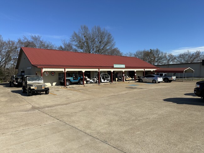


Property Detail
1506 S Main St
Tyler, TX
WILSON BUSINESS PARK LOT 2
1-88340-0000-00-002000
SMITH
Storebuilding
Texas
B and X Area of moderate flood hazard, usually the area between the limits of the 100-year and 500-year floods.
2
2025
0.91 AC
2025
Lindale
001407
Other Market Areas
4,590 SF
NEARBY LISTINGS FOR SALE OR LEASE
DEMOGRAPHICS near 1506 S Main St
1 mile
3 mile
5 mile
2025 Total Population
4,125
14,399
22,703
2030 Population
4,403
15,364
24,224
Pop Growth 2025-2030
+ 6.74%
+ 6.70%
+ 6.70%
Average Age
39
40
41
2025 Total Households
1,480
5,225
8,389
HH Growth 2025-2030
+ 6.35%
+ 6.22%
+ 6.21%
Median Household Inc
$79,332
$94,705
$93,693
Avg Household Size
2.70
2.70
2.60
2025 Avg HH Vehicles
2.00
2.00
2.00
Median Home Value
$258,104
$299,062
$316,784
Median Year Built
1991
1995
1994
Nearby Places
Map Layers
Map Styles
 Street
 Aerial
Transit
 Traffic
 Biking
Places
Listings with unknown addresses are not visible on the map
- Restaurants
- Banks
- Shops
- Fitness
- Groceries
PUBLIC TRANSPORTATION
AIRPORT
Tyler Pounds Regional
Drive
Walk
Distance
Tyler Pounds Regional
22 min
15.0 mi
SALE & LEASE HISTORY
LISTING DATE
SALE/LEASE

Oct 03, 2024
For Sale
Feb 19, 2024
For Sale
Apr 29, 2024
For Lease
Nearby Properties
Address
Land Use
TOTAL SIZE
Lot Size
Zoning
Address
Land Use
TOTAL SIZE
Lot Size
Zoning
1,680,000 SF
145.53 AC
Address
Land Use
TOTAL SIZE
Lot Size
Zoning
87,195 SF
5.44 AC
Address
Land Use
TOTAL SIZE
Lot Size
Zoning
72,185 SF
17.53 AC
Address
Land Use
TOTAL SIZE
Lot Size
Zoning
2,094 SF
6.94 AC
Address
Land Use
TOTAL SIZE
Lot Size
Zoning
15,436 SF
7.66 AC
Address
Land Use
TOTAL SIZE
Lot Size
Zoning
163,900 SF
27.35 AC
Address
Land Use
TOTAL SIZE
Lot Size
Zoning
32,238 SF
10.61 AC
Address
Land Use
TOTAL SIZE
Lot Size
Zoning
156,758 SF
21.96 AC
Address
Land Use
TOTAL SIZE
Lot Size
Zoning
17,597 SF
9.36 AC
Address
Land Use
TOTAL SIZE
Lot Size
Zoning
26.50 AC
Address
Land Use
TOTAL SIZE
Lot Size
Zoning
58,400 SF
2.56 AC
Address
Land Use
TOTAL SIZE
Lot Size
Zoning
104,953 SF
6.37 AC
Address
Land Use
TOTAL SIZE
Lot Size
Zoning
13.26 AC
Address
Land Use
TOTAL SIZE
Lot Size
Zoning
3,063 SF
8.25 AC
Address
Land Use
TOTAL SIZE
Lot Size
Zoning
995 SF
7.93 AC
Address
Land Use
TOTAL SIZE
Lot Size
Zoning
136,846 SF
15.10 AC
Address
Land Use
TOTAL SIZE
Lot Size
Zoning
29,024 SF
1.27 AC
Address
Land Use
TOTAL SIZE
Lot Size
Zoning
4.31 AC
Address
Land Use
TOTAL SIZE
Lot Size
Zoning
95,278 SF
4.60 AC
Address
Land Use
TOTAL SIZE
Lot Size
Zoning
3,200 SF
3.47 AC
Address
Land Use
TOTAL SIZE
Lot Size
Zoning
16,625 SF
5.82 AC
Address
Land Use
TOTAL SIZE
Lot Size
Zoning
2,400 SF
3.21 AC
Address
Land Use
TOTAL SIZE
Lot Size
Zoning
36,519 SF
3.18 AC
Address
Land Use
TOTAL SIZE
Lot Size
Zoning
7,822 SF
7.59 AC
Address
Land Use
TOTAL SIZE
Lot Size
Zoning
11,532 SF
2.24 AC
Address
Land Use
TOTAL SIZE
Lot Size
Zoning
16,950 SF
10.48 AC
Address
Land Use
TOTAL SIZE
Lot Size
Zoning
1,036 SF
5.53 AC
Address
Land Use
TOTAL SIZE
Lot Size
Zoning
18,510 SF
3.19 AC
Address
Land Use
TOTAL SIZE
Lot Size
Zoning
15,292 SF
2 AC
Address
Land Use
TOTAL SIZE
Lot Size
Zoning
3.18 AC
The World's #1 Commercial Real Estate Marketplace
Connect with us
© 2026 CoStar Group
The information above has been obtained from sources believed reliable. While we do not doubt its accuracy we have not verified it and make no guarantee, warranty or representation about it. It is your responsibility to independently confirm its accuracy and completeness. Any projections, opinions, assumptions, or estimates used are for example only and do not represent the current or future performance of the property. The value of this transaction to you depends on tax and other factors which should be evaluated by your tax, financial, and legal advisors. You and your advisors should conduct a careful, independent investigation of the property to determine to your satisfaction the suitability of the property for your needs.