Property Record
15029 Us Highway 19 S, Thomasville, GA 31792
NEARBY LISTINGS FOR SALE OR LEASE
Property Detail
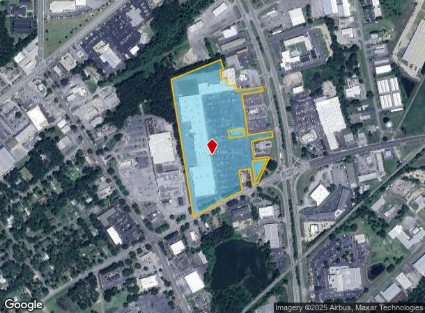
15029 Us Highway 19 S
045ETH-049
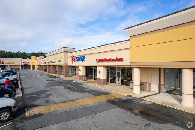
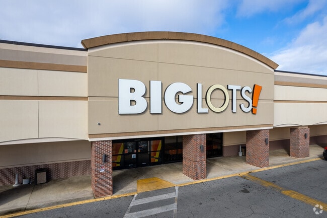
15029 US HWY 19 S/GATEWAY SHOPPING CENTER
Commercialnec
Thomas
X
Georgia
13275C0227D
84
2024
18.52 AC
2024
Albany/Southwest
960502
Other Market Areas
188,831 SF
Thomasville, GA
DEMOGRAPHICS near 15029 Us Highway 19 S
1 Mile
3 Mile
5 Mile
2024 Total Population
3,341
22,339
31,712
2029 Population
3,315
22,286
31,770
Pop Growth 2024-2029
(0.78%)
(0.24%)
+ 0.18%
Average Age
42
40
40
2024 Total Households
1,482
9,221
12,878
HH Growth 2024-2029
(0.94%)
(0.27%)
+ 0.19%
Median Household Inc
$54,464
$53,648
$53,718
Avg Household Size
2.20
2.30
2.40
2024 Avg HH Vehicles
2.00
2.00
2.00
Median Home Value
$212,281
$179,145
$180,973
Median Year Built
1989
1982
1984
Nearby Places
Map Layers
Map Styles
 Street
 Aerial
- Restaurants
- Banks
- Shops
- Fitness
- Groceries
SALE & LEASE HISTORY
LISTING DATE
SALE/LEASE

Sep 25, 2016
For Lease
Jan 22, 2018
For Lease
Aug 23, 2017
For Lease
Nearby Properties
Address
Land Use
TOTAL SIZE
Lot Size
Zoning
Address
Land Use
TOTAL SIZE
Lot Size
Zoning
178,227 SF
16.73 AC
C-1
Address
Land Use
TOTAL SIZE
Lot Size
Zoning
327,147 SF
106.07 AC
AG
Address
Land Use
TOTAL SIZE
Lot Size
Zoning
271,000 SF
95.80 AC
R1
Address
Land Use
TOTAL SIZE
Lot Size
Zoning
43,476 SF
18.60 AC
RM11
Address
Land Use
TOTAL SIZE
Lot Size
Zoning
117,638 SF
1.89 AC
C-2
Address
Land Use
TOTAL SIZE
Lot Size
Zoning
72,404 SF
3.79 AC
C-2
Address
Land Use
TOTAL SIZE
Lot Size
Zoning
6,087 SF
34.01 AC
R1
Address
Land Use
TOTAL SIZE
Lot Size
Zoning
145,231 SF
13.95 AC
M
Address
Land Use
TOTAL SIZE
Lot Size
Zoning
37,211 SF
4.55 AC
C-1-LU
Address
Land Use
TOTAL SIZE
Lot Size
Zoning
83,919 SF
24.59 AC
R-1A
Address
Land Use
TOTAL SIZE
Lot Size
Zoning
67,454 SF
31.60 AC
R-2
Address
Land Use
TOTAL SIZE
Lot Size
Zoning
145,230 SF
17.23 AC
C-1
Address
Land Use
TOTAL SIZE
Lot Size
Zoning
69,050 SF
47.74 AC
AG
Address
Land Use
TOTAL SIZE
Lot Size
Zoning
63,280 SF
9.85 AC
C-1
Address
Land Use
TOTAL SIZE
Lot Size
Zoning
45,196 SF
3.31 AC
C2-CU
Address
Land Use
TOTAL SIZE
Lot Size
Zoning
44,801 SF
3.97 AC
C-2
Address
Land Use
TOTAL SIZE
Lot Size
Zoning
169,359 SF
21.31 AC
C-2
Address
Land Use
TOTAL SIZE
Lot Size
Zoning
57,600 SF
8.30 AC
R-TH
Address
Land Use
TOTAL SIZE
Lot Size
Zoning
6,138 SF
18.04 AC
R-TH
Address
Land Use
TOTAL SIZE
Lot Size
Zoning
22,048 SF
8.32 AC
M
Address
Land Use
TOTAL SIZE
Lot Size
Zoning
37,512 SF
7.53 AC
R-2
Address
Land Use
TOTAL SIZE
Lot Size
Zoning
40,600 SF
6.46 AC
R-TH
Address
Land Use
TOTAL SIZE
Lot Size
Zoning
33,138 SF
11.40 AC
002
Address
Land Use
TOTAL SIZE
Lot Size
Zoning
36,396 SF
2 AC
C1
Address
Land Use
TOTAL SIZE
Lot Size
Zoning
68,850 SF
2.38 AC
C-2
Address
Land Use
TOTAL SIZE
Lot Size
Zoning
64,768 SF
4.70 AC
M/C-1-LU
Address
Land Use
TOTAL SIZE
Lot Size
Zoning
110,795 SF
8.50 AC
M
Address
Land Use
TOTAL SIZE
Lot Size
Zoning
286,150 SF
25.48 AC
C-2
Address
Land Use
TOTAL SIZE
Lot Size
Zoning
21,233 SF
1.11 AC
C-2
The World's #1 Commercial Real Estate Marketplace
Connect with us
© 2026 CoStar Group
The information above has been obtained from sources believed reliable. While we do not doubt its accuracy we have not verified it and make no guarantee, warranty or representation about it. It is your responsibility to independently confirm its accuracy and completeness. Any projections, opinions, assumptions, or estimates used are for example only and do not represent the current or future performance of the property. The value of this transaction to you depends on tax and other factors which should be evaluated by your tax, financial, and legal advisors. You and your advisors should conduct a careful, independent investigation of the property to determine to your satisfaction the suitability of the property for your needs.