Property Record
1501 Blackjack St, Lockhart, TX 78644


Property Detail
1501 Blackjack St
17634
A009 GEORGE, JAMES, ACRES 15.171
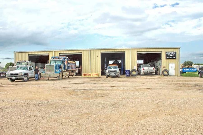
Commercialnec
CALDWELL
B and X Area of moderate flood hazard, usually the area between the limits of the 100-year and 500-year floods.
Texas
2025
15.17 AC
2025
Caldwell County
960200
Austin
7,587 SF
Austin-Round Rock-San Marcos, TX
NEARBY LISTINGS FOR SALE OR LEASE
DEMOGRAPHICS near 1501 Blackjack St
1 mile
3 mile
5 mile
2025 Total Population
3,386
17,906
20,847
2030 Population
3,868
20,501
23,871
Pop Growth 2025-2030
+ 14.24%
+ 14.49%
+ 14.51%
Average Age
38
39
39
2025 Total Households
959
6,110
7,104
HH Growth 2025-2030
+ 16.06%
+ 15.79%
+ 15.78%
Median Household Inc
$36,847
$66,831
$68,025
Avg Household Size
2.80
2.60
2.70
2025 Avg HH Vehicles
2.00
2.00
2.00
Median Home Value
$181,064
$237,708
$243,207
Median Year Built
1982
1989
1990
Nearby Places
Map Layers
Map Styles
 Street
 Aerial
Transit
 Traffic
 Biking
Places
Listings with unknown addresses are not visible on the map
- Restaurants
- Banks
- Shops
- Fitness
- Groceries
PUBLIC TRANSPORTATION
AIRPORT
Austin-Bergstrom International
Drive
Walk
Distance
Austin-Bergstrom International
35 min
25.6 mi
SALE & LEASE HISTORY
LISTING DATE
SALE/LEASE

Oct 01, 2018
For Sale
May 03, 2019
For Sale
Aug 06, 2019
For Sale
Nearby Properties
Address
Land Use
TOTAL SIZE
Lot Size
Zoning
Address
Land Use
TOTAL SIZE
Lot Size
Zoning
46,884 SF
31.13 AC
Address
Land Use
TOTAL SIZE
Lot Size
Zoning
3,307 SF
16.31 AC
Address
Land Use
TOTAL SIZE
Lot Size
Zoning
115,669 SF
21.70 AC
Address
Land Use
TOTAL SIZE
Lot Size
Zoning
152,063 SF
73.48 AC
Address
Land Use
TOTAL SIZE
Lot Size
Zoning
175,590 SF
30.47 AC
Address
Land Use
TOTAL SIZE
Lot Size
Zoning
83,362 SF
10.87 AC
Address
Land Use
TOTAL SIZE
Lot Size
Zoning
2,226 SF
8.61 AC
Address
Land Use
TOTAL SIZE
Lot Size
Zoning
7,000 SF
8.81 AC
Address
Land Use
TOTAL SIZE
Lot Size
Zoning
58,369 SF
20.20 AC
Address
Land Use
TOTAL SIZE
Lot Size
Zoning
49,000 SF
24.58 AC
Address
Land Use
TOTAL SIZE
Lot Size
Zoning
271.12 AC
Address
Land Use
TOTAL SIZE
Lot Size
Zoning
43,248 SF
5.85 AC
Address
Land Use
TOTAL SIZE
Lot Size
Zoning
2,700 SF
29.22 AC
Address
Land Use
TOTAL SIZE
Lot Size
Zoning
69,127 SF
14.23 AC
Address
Land Use
TOTAL SIZE
Lot Size
Zoning
55,946 SF
7.86 AC
Address
Land Use
TOTAL SIZE
Lot Size
Zoning
19,005 SF
7.54 AC
Address
Land Use
TOTAL SIZE
Lot Size
Zoning
38,420 SF
4.37 AC
Address
Land Use
TOTAL SIZE
Lot Size
Zoning
25,742 SF
7.36 AC
Address
Land Use
TOTAL SIZE
Lot Size
Zoning
40,514 SF
5 AC
Address
Land Use
TOTAL SIZE
Lot Size
Zoning
1,950 SF
6 AC
Address
Land Use
TOTAL SIZE
Lot Size
Zoning
8,417 SF
7.62 AC
Address
Land Use
TOTAL SIZE
Lot Size
Zoning
55,860 SF
19.80 AC
Address
Land Use
TOTAL SIZE
Lot Size
Zoning
15,758 SF
1.20 AC
Address
Land Use
TOTAL SIZE
Lot Size
Zoning
37,210 SF
5.85 AC
Address
Land Use
TOTAL SIZE
Lot Size
Zoning
28,671 SF
3.23 AC
Address
Land Use
TOTAL SIZE
Lot Size
Zoning
16,983 SF
1.47 AC
Address
Land Use
TOTAL SIZE
Lot Size
Zoning
27,543 SF
1.71 AC
Address
Land Use
TOTAL SIZE
Lot Size
Zoning
49,044 SF
7.03 AC
Address
Land Use
TOTAL SIZE
Lot Size
Zoning
29,674 SF
5.53 AC
Address
Land Use
TOTAL SIZE
Lot Size
Zoning
18,750 SF
4.16 AC
The World's #1 Commercial Real Estate Marketplace
Connect with us
© 2026 CoStar Group
The information above has been obtained from sources believed reliable. While we do not doubt its accuracy we have not verified it and make no guarantee, warranty or representation about it. It is your responsibility to independently confirm its accuracy and completeness. Any projections, opinions, assumptions, or estimates used are for example only and do not represent the current or future performance of the property. The value of this transaction to you depends on tax and other factors which should be evaluated by your tax, financial, and legal advisors. You and your advisors should conduct a careful, independent investigation of the property to determine to your satisfaction the suitability of the property for your needs.