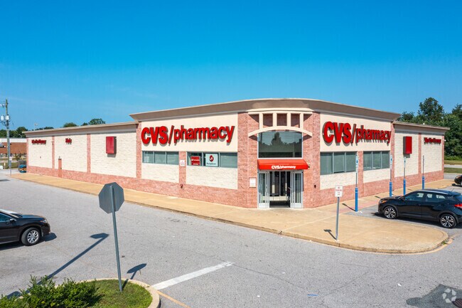
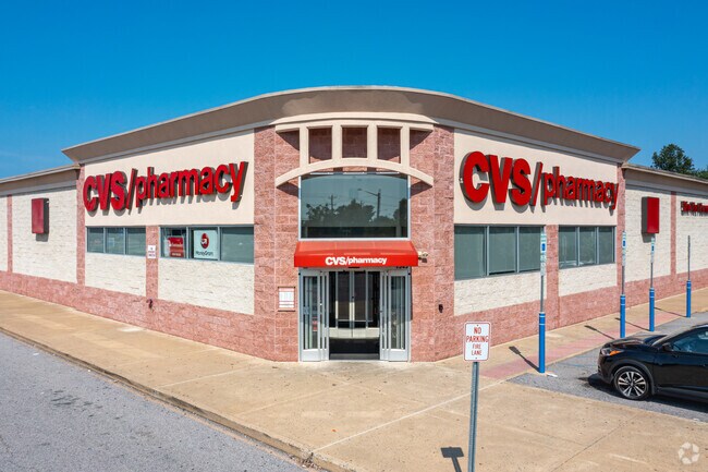
Property Record
1503 Pulaski Hwy, Bear, DE 19701

Property Detail
1503 Pulaski Hwy
10-043.30-315
NEW CASTLE
Storebuilding
Delaware
CR
3
B and X Area of moderate flood hazard, usually the area between the limits of the 100-year and 500-year floods.
2.28 AC
2025
South New Castle County
2025
Philadelphia
014809
Philadelphia-Camden-Wilmington, PA-NJ-DE-MD
13,234 SF
NEARBY LISTINGS FOR SALE OR LEASE
DEMOGRAPHICS near 1503 Pulaski Hwy
1 mile
3 mile
5 mile
2025 Total Population
14,745
67,547
160,639
2030 Population
15,127
68,991
166,067
Pop Growth 2025-2030
+ 2.59%
+ 2.14%
+ 3.38%
Average Age
39
40
40
2025 Total Households
5,414
25,567
60,784
HH Growth 2025-2030
+ 2.77%
+ 2.28%
+ 3.66%
Median Household Inc
$83,800
$89,304
$85,623
Avg Household Size
2.60
2.60
2.50
2025 Avg HH Vehicles
2.00
2.00
2.00
Median Home Value
$310,010
$330,107
$334,598
Median Year Built
1995
1991
1988
Nearby Places
Map Layers
Map Styles
 Street
 Aerial
Layers
 Traffic
 Biking
Places
Listings with unknown addresses are not visible on the map
- Restaurants
- Banks
- Shops
- Fitness
- Groceries
PUBLIC TRANSPORTATION
COMMUTER RAIL
Churchmans Crossing (R2 - Southeastern Pennsylvania Transportation Authority Regional Rail (SEPTA Regional Rail))
Drive
Walk
Distance
Churchmans Crossing (R2 - Southeastern Pennsylvania Transportation Authority Regional Rail (SEPTA Regional Rail))
13 min
7.8 mi
Newark (R2 - Southeastern Pennsylvania Transportation Authority Regional Rail (SEPTA Regional Rail))
Drive
Walk
Distance
Newark (R2 - Southeastern Pennsylvania Transportation Authority Regional Rail (SEPTA Regional Rail))
13 min
8.0 mi
AIRPORT
Philadelphia International
Drive
Walk
Distance
Philadelphia International
47 min
34.2 mi
Freight Ports
Port of Wilmington, RI
Drive
Walk
Distance
Port of Wilmington, RI
21 min
14.1 mi
SALE & LEASE HISTORY
LISTING DATE
SALE/LEASE

Sep 24, 2016
For Sale
Mar 31, 2017
For Sale
Nearby Properties
Address
Land Use
TOTAL SIZE
Lot Size
Zoning
Address
Land Use
TOTAL SIZE
Lot Size
Zoning
326,520 SF
125.02 AC
EX
Address
Land Use
TOTAL SIZE
Lot Size
Zoning
Address
Land Use
TOTAL SIZE
Lot Size
Zoning
Address
Land Use
TOTAL SIZE
Lot Size
Zoning
735,703 SF
49.15 AC
NCAP
Address
Land Use
TOTAL SIZE
Lot Size
Zoning
4,676 SF
42.81 AC
NCAP
Address
Land Use
TOTAL SIZE
Lot Size
Zoning
259,722 SF
20.72 AC
NCAP
Address
Land Use
TOTAL SIZE
Lot Size
Zoning
33,790 SF
45.17 AC
S
Address
Land Use
TOTAL SIZE
Lot Size
Zoning
59.70 AC
BP
Address
Land Use
TOTAL SIZE
Lot Size
Zoning
343,216 SF
27.10 AC
ST
Address
Land Use
TOTAL SIZE
Lot Size
Zoning
594,720 SF
33.32 AC
HI
Address
Land Use
TOTAL SIZE
Lot Size
Zoning
333,334 SF
20.57 AC
NCPUD
Address
Land Use
TOTAL SIZE
Lot Size
Zoning
135,764 SF
18.59 AC
NCAP
Address
Land Use
TOTAL SIZE
Lot Size
Zoning
385,350 SF
43.51 AC
OR
Address
Land Use
TOTAL SIZE
Lot Size
Zoning
Address
Land Use
TOTAL SIZE
Lot Size
Zoning
234,941 SF
19.54 AC
NCPUD
Address
Land Use
TOTAL SIZE
Lot Size
Zoning
Address
Land Use
TOTAL SIZE
Lot Size
Zoning
293,376 SF
149.74 AC
I
Address
Land Use
TOTAL SIZE
Lot Size
Zoning
18,476 SF
18 AC
NCAP
Address
Land Use
TOTAL SIZE
Lot Size
Zoning
152,860 SF
49.01 AC
CR
Address
Land Use
TOTAL SIZE
Lot Size
Zoning
62,498 SF
132.23 AC
I
Address
Land Use
TOTAL SIZE
Lot Size
Zoning
305,422 SF
22.35 AC
NCPUD
Address
Land Use
TOTAL SIZE
Lot Size
Zoning
152,075 SF
35.66 AC
CR
Address
Land Use
TOTAL SIZE
Lot Size
Zoning
2,040 SF
15.38 AC
NCAP
Address
Land Use
TOTAL SIZE
Lot Size
Zoning
Address
Land Use
TOTAL SIZE
Lot Size
Zoning
18,101 SF
8.91 AC
NCAP
Address
Land Use
TOTAL SIZE
Lot Size
Zoning
91,473 SF
59.44 AC
S
Address
Land Use
TOTAL SIZE
Lot Size
Zoning
11,362 SF
36.39 AC
I
Address
Land Use
TOTAL SIZE
Lot Size
Zoning
218,883 SF
42.56 AC
HI
Address
Land Use
TOTAL SIZE
Lot Size
Zoning
94,417 SF
28.89 AC
CR
Address
Land Use
TOTAL SIZE
Lot Size
Zoning
62,054 SF
37.38 AC
S
The World's #1 Commercial Real Estate Marketplace
Connect with us
© 2026 CoStar Group
The information above has been obtained from sources believed reliable. While we do not doubt its accuracy we have not verified it and make no guarantee, warranty or representation about it. It is your responsibility to independently confirm its accuracy and completeness. Any projections, opinions, assumptions, or estimates used are for example only and do not represent the current or future performance of the property. The value of this transaction to you depends on tax and other factors which should be evaluated by your tax, financial, and legal advisors. You and your advisors should conduct a careful, independent investigation of the property to determine to your satisfaction the suitability of the property for your needs.