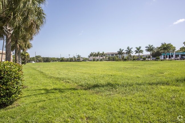
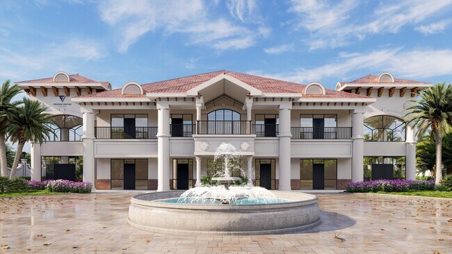
Property Record
15031 Mcgregor Blvd, Fort Myers, FL 33908


NEARBY LISTINGS FOR SALE OR LEASE
Property Detail
15031 Mcgregor Blvd
Cape Coral-Fort Myers, FL
Mcgregor / Summerlin
31-45-24-00-00007.3050
PARL IN NE 1/4 DESC INST#2006-12011
Commercialacreage
Lee
AE
Florida
12071C0418G
305
2024
1.67 AC
2025
S Ft Myers/San Carlos
001917
Southwest Florida
DEMOGRAPHICS near 15031 Mcgregor Blvd
1 Mile
3 Mile
5 Mile
2024 Total Population
8,292
58,758
134,584
2029 Population
9,978
70,358
160,433
Pop Growth 2024-2029
+ 20.33%
+ 19.74%
+ 19.21%
Average Age
51
55
53
2024 Total Households
3,845
29,812
66,139
HH Growth 2024-2029
+ 20.29%
+ 19.45%
+ 18.92%
Median Household Inc
$62,180
$60,343
$61,072
Avg Household Size
2.00
1.90
2.00
2024 Avg HH Vehicles
1.00
1.00
2.00
Median Home Value
$369,373
$277,437
$290,761
Median Year Built
1999
1991
1987
Nearby Places
Map Layers
Map Styles
 Street
 Aerial
- Restaurants
- Banks
- Shops
- Fitness
- Groceries
PUBLIC TRANSPORTATION
AIRPORT
Southwest Florida International
DRIVE
WALK
Distance
Southwest Florida International
23 min
13.0 mi
Punta Gorda
DRIVE
WALK
Distance
Punta Gorda
52 min
32.6 mi
Freight Ports
Port Manatee
DRIVE
WALK
Distance
Port Manatee
131 min
104.3 mi
SALE & LEASE HISTORY
LISTING DATE
SALE/LEASE

Sep 07, 2017
For Sale
Mar 24, 2025
For Sale
Jan 10, 2018
For Sale
Dec 14, 2017
For Lease
Nearby Properties
Address
Land Use
TOTAL SIZE
Lot Size
Zoning
Address
Land Use
TOTAL SIZE
Lot Size
Zoning
1,116,051 SF
35.44 AC
CPD
Address
Land Use
TOTAL SIZE
Lot Size
Zoning
Address
Land Use
TOTAL SIZE
Lot Size
Zoning
539,207 SF
61.09 AC
AG-2
Address
Land Use
TOTAL SIZE
Lot Size
Zoning
446,205 SF
28.90 AC
CC
Address
Land Use
TOTAL SIZE
Lot Size
Zoning
564,663 SF
33.53 AC
CPD
Address
Land Use
TOTAL SIZE
Lot Size
Zoning
334,148 SF
48.67 AC
RM-2
Address
Land Use
TOTAL SIZE
Lot Size
Zoning
423,044 SF
37.11 AC
C-1
Address
Land Use
TOTAL SIZE
Lot Size
Zoning
335,660 SF
15.42 AC
MPD
Address
Land Use
TOTAL SIZE
Lot Size
Zoning
209,483 SF
15.03 AC
CF-2
Address
Land Use
TOTAL SIZE
Lot Size
Zoning
261,136 SF
11.68 AC
AG-2
Address
Land Use
TOTAL SIZE
Lot Size
Zoning
153,907 SF
22.03 AC
TFC2
Address
Land Use
TOTAL SIZE
Lot Size
Zoning
96,448 SF
3.85 AC
CPD
Address
Land Use
TOTAL SIZE
Lot Size
Zoning
235,691 SF
30.01 AC
RM-6
Address
Land Use
TOTAL SIZE
Lot Size
Zoning
469,746 SF
89.45 AC
RPD
Address
Land Use
TOTAL SIZE
Lot Size
Zoning
65,051 SF
4.89 AC
CFPD
Address
Land Use
TOTAL SIZE
Lot Size
Zoning
301,212 SF
5.28 AC
Address
Land Use
TOTAL SIZE
Lot Size
Zoning
15.22 AC
CF-3
Address
Land Use
TOTAL SIZE
Lot Size
Zoning
84,147 SF
10.60 AC
CPD
Address
Land Use
TOTAL SIZE
Lot Size
Zoning
89,321 SF
11.40 AC
CPD
Address
Land Use
TOTAL SIZE
Lot Size
Zoning
5,654 SF
49.94 AC
MH-2
Address
Land Use
TOTAL SIZE
Lot Size
Zoning
13.65 AC
CPD
Address
Land Use
TOTAL SIZE
Lot Size
Zoning
11.29 AC
CPD
Address
Land Use
TOTAL SIZE
Lot Size
Zoning
132,456 SF
7.86 AC
IPD
Address
Land Use
TOTAL SIZE
Lot Size
Zoning
38,928 SF
4.88 AC
CT
Address
Land Use
TOTAL SIZE
Lot Size
Zoning
34,157 SF
2.54 AC
CPD
Address
Land Use
TOTAL SIZE
Lot Size
Zoning
26,337 SF
11.54 AC
C-1
Address
Land Use
TOTAL SIZE
Lot Size
Zoning
44.05 AC
RPD
Address
Land Use
TOTAL SIZE
Lot Size
Zoning
85,815 SF
3.48 AC
CT
Address
Land Use
TOTAL SIZE
Lot Size
Zoning
185,986 SF
13.40 AC
CPD
Address
Land Use
TOTAL SIZE
Lot Size
Zoning
82,450 SF
4.11 AC
CPD
The World's #1 Commercial Real Estate Marketplace
Connect with us
© 2025 CoStar Group
The information above has been obtained from sources believed reliable. While we do not doubt its accuracy we have not verified it and make no guarantee, warranty or representation about it. It is your responsibility to independently confirm its accuracy and completeness. Any projections, opinions, assumptions, or estimates used are for example only and do not represent the current or future performance of the property. The value of this transaction to you depends on tax and other factors which should be evaluated by your tax, financial, and legal advisors. You and your advisors should conduct a careful, independent investigation of the property to determine to your satisfaction the suitability of the property for your needs.