Property Record
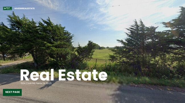
1504 Cook Rd, Ferris, TX 75125
This Property Is For Sale
NEARBY LISTINGS FOR SALE OR LEASE
Property Detail
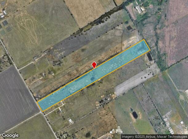
1504 Cook Rd
65127673510360000
Ann Stokes
Privatepreserveopenspacevacantlandforestlandconservation
ANN STOKES ABST 1276 PG 735 ACS 15.00 VOL2003063/6538 DD03252003 CO-DC 1276735103600 28712767351
X
Dallas
48113C0660K
Texas
2024
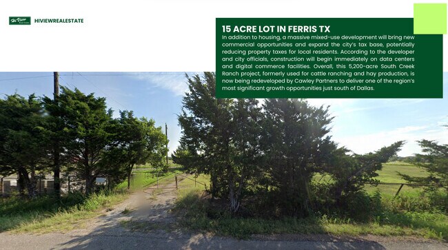
15 AC
2025
Mesquite/Forney/Terrell
060104
Dallas/Ft Worth
2,700 SF
Dallas-Fort Worth-Arlington, TX
DEMOGRAPHICS near 1504 Cook Rd
1 mile
3 mile
5 mile
2024 Total Population
213
3,272
14,028
2029 Population
230
3,504
15,562
Pop Growth 2024-2029
+ 7.98%
+ 7.09%
+ 10.94%
Average Age
33
33
36
2024 Total Households
64
982
4,397
HH Growth 2024-2029
+ 7.81%
+ 7.13%
+ 11.28%
Median Household Inc
$67,159
$63,562
$63,859
Avg Household Size
3.30
3.30
3.10
2024 Avg HH Vehicles
2.00
2.00
2.00
Median Home Value
$152,941
$146,410
$195,454
Median Year Built
2001
1998
1993
Nearby Places
Map Layers
Map Styles
 Street
 Aerial
Transit
 Traffic
 Biking
Places
Listings with unknown addresses are not visible on the map
- Restaurants
- Banks
- Shops
- Fitness
- Groceries
PUBLIC TRANSPORTATION
AIRPORT
Dallas Love Field
Drive
Walk
Distance
Dallas Love Field
37 min
25.7 mi
Freight Ports
Port of Shreveport
Drive
Walk
Distance
Port of Shreveport
213 min
190.5 mi
Nearby Properties
Address
Land Use
TOTAL SIZE
Lot Size
Zoning
Address
Land Use
TOTAL SIZE
Lot Size
Zoning
62.41 AC
Z31
Address
Land Use
TOTAL SIZE
Lot Size
Zoning
36.33 AC
Z31
Address
Land Use
TOTAL SIZE
Lot Size
Zoning
1,409,184 SF
75.72 AC
Z31
Address
Land Use
TOTAL SIZE
Lot Size
Zoning
1,021,601 SF
79.42 AC
Z268
Address
Land Use
TOTAL SIZE
Lot Size
Zoning
1,020,000 SF
56.30 AC
Z31
Address
Land Use
TOTAL SIZE
Lot Size
Zoning
660,000 SF
39.24 AC
Z31
Address
Land Use
TOTAL SIZE
Lot Size
Zoning
750,000 SF
37.12 AC
Z31
Address
Land Use
TOTAL SIZE
Lot Size
Zoning
565,259 SF
38.69 AC
Z123
Address
Land Use
TOTAL SIZE
Lot Size
Zoning
481,520 SF
26.82 AC
Z31
Address
Land Use
TOTAL SIZE
Lot Size
Zoning
431,190 SF
46.46 AC
Z251
Address
Land Use
TOTAL SIZE
Lot Size
Zoning
202,439 SF
12.48 AC
Z31
Address
Land Use
TOTAL SIZE
Lot Size
Zoning
392,066 SF
23.52 AC
Address
Land Use
TOTAL SIZE
Lot Size
Zoning
370,139 SF
15.42 AC
Z268
Address
Land Use
TOTAL SIZE
Lot Size
Zoning
376,368 SF
19.42 AC
Z31
Address
Land Use
TOTAL SIZE
Lot Size
Zoning
80,980 SF
15.18 AC
AG
Address
Land Use
TOTAL SIZE
Lot Size
Zoning
174,802 SF
8.67 AC
Address
Land Use
TOTAL SIZE
Lot Size
Zoning
235,368 SF
21.03 AC
Z05
Address
Land Use
TOTAL SIZE
Lot Size
Zoning
143,771 SF
130.33 AC
Z123
Address
Land Use
TOTAL SIZE
Lot Size
Zoning
174,802 SF
8.67 AC
Z05
Address
Land Use
TOTAL SIZE
Lot Size
Zoning
97,372 SF
42.82 AC
Z31
Address
Land Use
TOTAL SIZE
Lot Size
Zoning
12,444 SF
5 AC
Address
Land Use
TOTAL SIZE
Lot Size
Zoning
84.71 AC
Z268
Address
Land Use
TOTAL SIZE
Lot Size
Zoning
1,400 SF
75.81 AC
Z05
Address
Land Use
TOTAL SIZE
Lot Size
Zoning
53,610 SF
15 AC
Z31
Address
Land Use
TOTAL SIZE
Lot Size
Zoning
110 SF
12.35 AC
Z31
Address
Land Use
TOTAL SIZE
Lot Size
Zoning
27,152 SF
71.21 AC
Z268
Address
Land Use
TOTAL SIZE
Lot Size
Zoning
53,536 SF
2.06 AC
Z160
Address
Land Use
TOTAL SIZE
Lot Size
Zoning
2,688 SF
27.97 AC
Z123
Address
Land Use
TOTAL SIZE
Lot Size
Zoning
13,000 SF
4.99 AC
Address
Land Use
TOTAL SIZE
Lot Size
Zoning
20.01 AC
Z05
The World's #1 Commercial Real Estate Marketplace
Connect with us
© 2026 CoStar Group
The information above has been obtained from sources believed reliable. While we do not doubt its accuracy we have not verified it and make no guarantee, warranty or representation about it. It is your responsibility to independently confirm its accuracy and completeness. Any projections, opinions, assumptions, or estimates used are for example only and do not represent the current or future performance of the property. The value of this transaction to you depends on tax and other factors which should be evaluated by your tax, financial, and legal advisors. You and your advisors should conduct a careful, independent investigation of the property to determine to your satisfaction the suitability of the property for your needs.