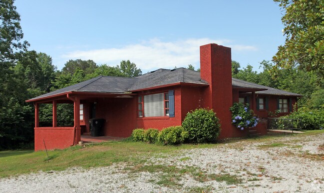
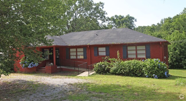
Property Record
1504 E Rutherford St, Landrum, SC 29356
NEARBY LISTINGS FOR SALE OR LEASE
-
-
View all Landrum listings for sale on LoopNet.com
Property Detail
1504 E Rutherford St
Spartanburg, SC
Greenwood Sub
1-08-03-002.00
Spartanburg
Sfr
South Carolina
X
1.61 AC
45083C0016D
Upper Spartanburg County
1,830 SF
Greenville/Spartanburg
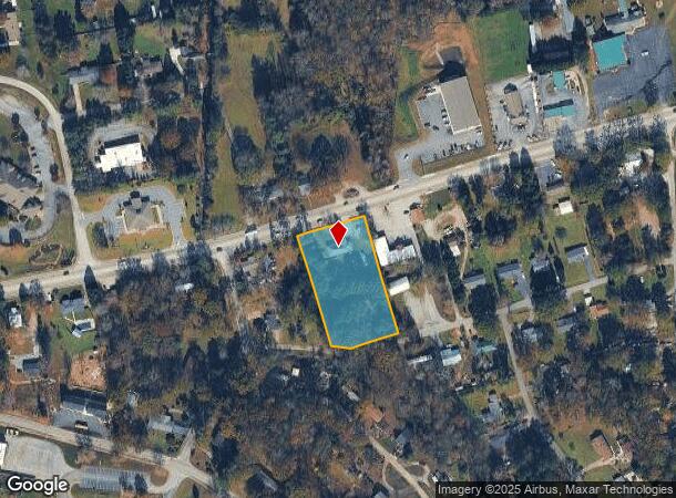
DEMOGRAPHICS near 1504 E Rutherford St
1 Mile
3 Mile
5 Mile
2024 Total Population
1,828
5,823
15,535
2029 Population
2,064
6,578
17,359
Pop Growth 2024-2029
+ 12.91%
+ 12.97%
+ 11.74%
Average Age
45
45
47
2024 Total Households
830
2,513
6,776
HH Growth 2024-2029
+ 13.13%
+ 13.13%
+ 11.79%
Median Household Inc
$41,718
$52,309
$54,560
Avg Household Size
2.20
2.30
2.20
2024 Avg HH Vehicles
2.00
2.00
2.00
Median Home Value
$188,122
$237,139
$266,124
Median Year Built
1971
1977
1982
Nearby Places
Map Layers
Map Styles
 Street
 Aerial
- Restaurants
- Banks
- Shops
- Fitness
- Groceries
PUBLIC TRANSPORTATION
AIRPORT
Greenville Spartanburg International
DRIVE
WALK
Distance
Greenville Spartanburg International
42 min
32.6 mi
Asheville Regional
DRIVE
WALK
Distance
Asheville Regional
40 min
33.0 mi
Freight Ports
North Charleston Terminal
DRIVE
WALK
Distance
North Charleston Terminal
237 min
213.4 mi
SALE & LEASE HISTORY
LISTING DATE
SALE/LEASE

Dec 14, 2017
For Sale
Nearby Properties
Address
Land Use
TOTAL SIZE
Lot Size
Zoning
Address
Land Use
TOTAL SIZE
Lot Size
Zoning
166.74 AC
RE5
Address
Land Use
TOTAL SIZE
Lot Size
Zoning
7,703 SF
190.87 AC
RE5
Address
Land Use
TOTAL SIZE
Lot Size
Zoning
332.64 AC
Address
Land Use
TOTAL SIZE
Lot Size
Zoning
2,290 SF
23.19 AC
RE5
Address
Land Use
TOTAL SIZE
Lot Size
Zoning
2,812 SF
3.26 AC
RE5
Address
Land Use
TOTAL SIZE
Lot Size
Zoning
13.05 AC
Address
Land Use
TOTAL SIZE
Lot Size
Zoning
2.43 AC
MX
Address
Land Use
TOTAL SIZE
Lot Size
Zoning
15.18 AC
Address
Land Use
TOTAL SIZE
Lot Size
Zoning
4.61 AC
RE5
Address
Land Use
TOTAL SIZE
Lot Size
Zoning
2.59 AC
Address
Land Use
TOTAL SIZE
Lot Size
Zoning
2.20 AC
MX
Address
Land Use
TOTAL SIZE
Lot Size
Zoning
21.61 AC
RE5
Address
Land Use
TOTAL SIZE
Lot Size
Zoning
1,410 SF
31.21 AC
RE5
Address
Land Use
TOTAL SIZE
Lot Size
Zoning
1,065 SF
32.46 AC
RE5
Address
Land Use
TOTAL SIZE
Lot Size
Zoning
Address
Land Use
TOTAL SIZE
Lot Size
Zoning
1,584 SF
8.79 AC
RE5
Address
Land Use
TOTAL SIZE
Lot Size
Zoning
19.25 AC
RE5
Address
Land Use
TOTAL SIZE
Lot Size
Zoning
2.70 AC
MX
Address
Land Use
TOTAL SIZE
Lot Size
Zoning
22.88 AC
RE5
Address
Land Use
TOTAL SIZE
Lot Size
Zoning
5.24 AC
RE5
Address
Land Use
TOTAL SIZE
Lot Size
Zoning
8.57 AC
RE5
Address
Land Use
TOTAL SIZE
Lot Size
Zoning
1,991 SF
2.10 AC
MX
Address
Land Use
TOTAL SIZE
Lot Size
Zoning
3.64 AC
MX
Address
Land Use
TOTAL SIZE
Lot Size
Zoning
4,264 SF
1.13 AC
MX
Address
Land Use
TOTAL SIZE
Lot Size
Zoning
69.07 AC
RE5
Address
Land Use
TOTAL SIZE
Lot Size
Zoning
51.65 AC
Address
Land Use
TOTAL SIZE
Lot Size
Zoning
38.03 AC
RE5
Address
Land Use
TOTAL SIZE
Lot Size
Zoning
1,953 SF
7.48 AC
RE5
Address
Land Use
TOTAL SIZE
Lot Size
Zoning
2,624 SF
2 AC
RE5
Address
Land Use
TOTAL SIZE
Lot Size
Zoning
48.33 AC
RE5
The World's #1 Commercial Real Estate Marketplace
Connect with us
© 2025 CoStar Group
The information above has been obtained from sources believed reliable. While we do not doubt its accuracy we have not verified it and make no guarantee, warranty or representation about it. It is your responsibility to independently confirm its accuracy and completeness. Any projections, opinions, assumptions, or estimates used are for example only and do not represent the current or future performance of the property. The value of this transaction to you depends on tax and other factors which should be evaluated by your tax, financial, and legal advisors. You and your advisors should conduct a careful, independent investigation of the property to determine to your satisfaction the suitability of the property for your needs.